
Orroroo, SA
Orroroo is a farming town on the southern edge of the Flinders Ranges, about 275 km north of Adelaide and 100 km south-east of Port Augusta. It sits at a crossroads, with roads leading to Broken Hill, the Flinders and the Clare Valley, and it is close to Goyder’s Line, the boundary that separates reliable cropping country from the arid interior.
Known For
- A giant river red gum
- Goyder’s Line
- A very wide main street
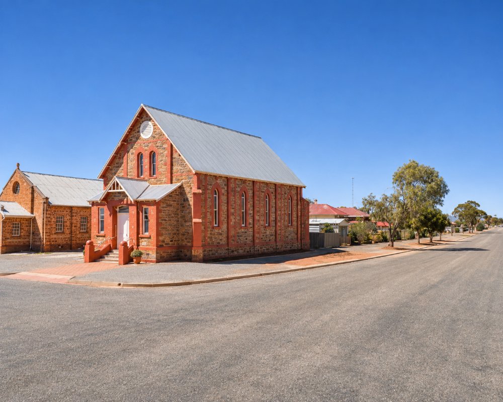
The main street is broad enough to have a tree-lined park down the middle, with stone shops and hotels from the 1880s on either side. About 520 people live here, serving a district of wheat and sheep farms that gives way quickly to saltbush plains to the north and east.
Things To Do
Giant Gum Tree
On the edge of town stands a river red gum estimated to be more than 500 years old, with a trunk over ten metres around.
Pekina Creek Walk
A walking trail follows the creek past rock engravings made by the Ngadjuri people and to a rock face into which a local man carved two poems in 1896 and 1901. The trail continues to the Pekina reservoir.
Tank Hill Lookout
A short drive leads to a lookout over the town, the Pekina Creek valley and the surrounding plains.
Early Settler’s Cottage
A restored pug-and-pine cottage shows how the first farming families lived, and the town’s historical collection includes a notable display of period costume.
Magnetic Hill
About 17 km south of town, beyond Pekina, a signposted stretch of gravel road creates the illusion that a car in neutral rolls uphill. It is part of a signposted loop drive of 44 km.
Goyder’s Line
A monument a few kilometres out of town marks the line drawn by Surveyor-General George Goyder in 1865 to show the limit of safe farming. Settlers who ignored it in the wet years of the 1870s were ruined when drought returned.
History
Orroroo is in the country of the Ngadjuri people. The origin of its name is disputed.
Pekina Station was established in the 1840s. The town was surveyed in 1875 and named by Goyder as land was thrown open to wheat farmers. The railway arrived in 1881, and the town became the centre of a district that has swung between good seasons and hard droughts ever since.
Where To Stay
Orroroo has a caravan park and two hotels, one with motel rooms.
The Orroroo Caravan Park, on Second Street, has powered and unpowered sites that take big rigs, cabins, a camp kitchen and a dump point, and is a short walk from the main street. A rest area about eight kilometres west of town on the Wilmington road allows free overnight stops; it has no toilets or water.
Farm stays are available in the district.
The Orroroo Caravan Park overlooks the golf course and Pekina Creek. It has standard and ensuite cabins, lawn and gravel sites with drive-through bays for long rigs, a laundry and a fire pit in the cooler months, and it takes pets by arrangement. In the main street, the Orroroo Hotel at 6 Second Street has pub rooms, and the Commercial Hotel Motel at 30 Second Street has motel units as well as rooms in the hotel. Black Jack Get-a-way’s Magpies Nest, on School Terrace at the edge of town, is a self-contained cottage above Pekina Creek with a wood fire and beds for six.
Out of town, Bendleby Ranges is a 15,000-hectare station with more than 200 km of 4WD and mountain-bike tracks. You can stay in the old Crotta Homestead, two cottages or the shearers’ quarters, at creek-side bush camps with firewood, or on powered sites near the camp kitchen and hot showers. Coonatto Station, on the Wilmington road near Hammond, rents out its shearers’ quarters for groups of up to 10. Almerta Station, near Carrieton about 40 km north, has creek-side camping and shearers’ quarters. Station tracks can close after rain, so ring ahead before towing a van in.
Eat & Drink
The pubs serve meals, and there are cafes, a bakery and a supermarket in the main street.
Nearly everything is on Second Street, the wide main street. The Orroroo Hotel is a classic country pub with counter meals and a front bar where farmers and travellers mix. The Commercial Hotel Motel offers hearty pub meals and cold beer. Check meal days at both before you go. Two Farmers Daughters, at 9 Second Street, is a small coffee shop serving light meals, salads and home-made sweet treats. It also sells fresh fruit and vegetables, and produce orders are ready to collect on Thursdays.
The 5431 Collective is a not-for-profit shop run by locals, with ever-changing displays of goods by district makers and designers. Orroroo Kangaroo, in the main street, is an award-winning maker of kangaroo meat and smallgoods, good for stocking the barbecue at the caravan park. The Orroroo Main Street Market brings stalls, produce and themed family activities to the main street on Sunday mornings several times a year. The visitor centre at 17 Second Street has the dates.
The supermarket, the butcher and the pharmacy are all in the main street. Orroroo’s only fuel station stopped selling fuel in mid-2025. Check whether fuel is back before you rely on it, or fill up at Peterborough, about 40 km south-east, or Booleroo Centre, about 35 km south-west.
Getting There
Orroroo is about three and a quarter hours from Adelaide via Clare and Jamestown. It is on the RM Williams Way to Hawker and at the start of the road east to the Barrier Highway.
Experiences
- Caravan and Camping
- Historic/Heritage
- Rural/Country
- Self-Drive
Popular Activities
- Bush Walking
- Caravan and Camping
- Cycling
- Driving
- Sightseeing
About Orroroo
- Locality: Urban locality
- Orroroo Postcode: 5431
- State: South Australia
- Region: Flinders Ranges and Outback
- Latitude: -32.73427
- Longitude: 138.61365
- Elevation: 433m
- Timezone: Australia/Adelaide
Accommodation In Orroroo
Discover some of the accommodation in and around Orroroo
