
Derwent Bridge, TAS
Surrounded by the rugged beauty of Tasmania’s Central Highlands, Derwent Bridge is more than just a stopover. Positioned strategically along the Lyell Highway, it’s 174 km northwest of Hobart—a scenic drive that takes about 2.5 hours through winding roads and breathtaking landscapes. For those traveling from Devonport or Launceston, Derwent Bridge offers a halfway point to immerse yourself in pristine wilderness and cultural landmarks.
Known For
- Lake St Clair: Australia’s deepest freshwater lake
- The Wall in the Wilderness: Renowned wood-carved art installation
- Cradle Mountain-Lake St Clair National Park
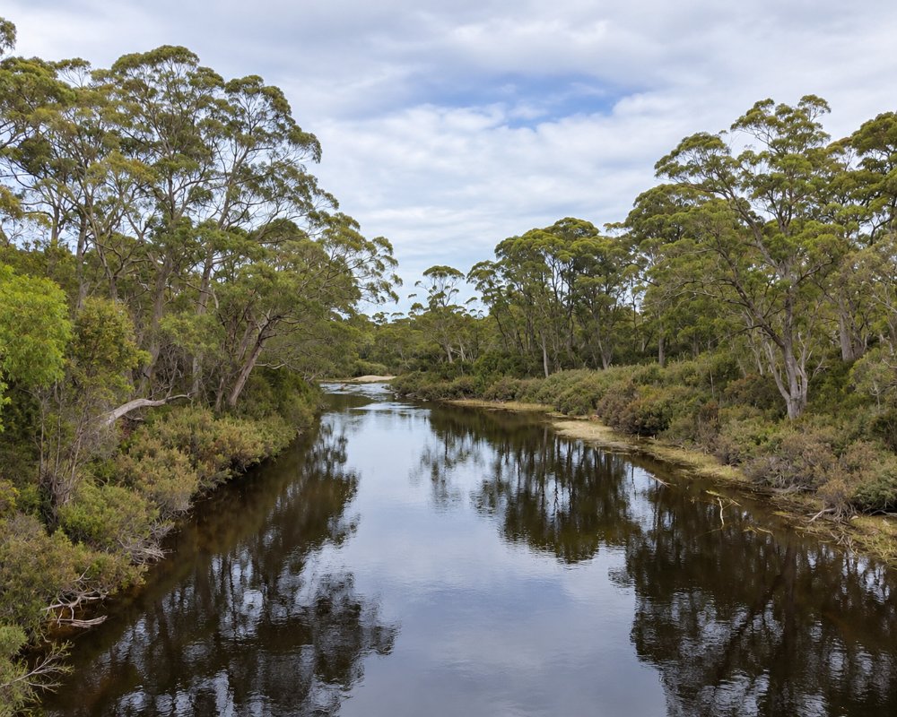
Derwent Bridge provides an ideal entry point to some of Tasmania’s most celebrated natural sites. Just 5 kilometers north lies Lake St Clair, the southern boundary of the World Heritage-listed Cradle Mountain-Lake St Clair National Park. Known as Australia’s deepest lake, this tranquil waterbody invites adventurers for kayaking, fishing, or simply soaking in the serenity.
The area’s extensive network of hiking trails caters to all levels, from leisurely lakeside strolls to challenging backcountry routes like the Overland Track. Wildlife enthusiasts may spot wombats, wallabies, or even a shy Tasmanian devil amid the wilderness.
No trip to Derwent Bridge is complete without visiting The Wall in the Wilderness. This awe-inspiring art installation, created by Greg Duncan, spans over 100 meters and tells the story of Tasmania’s pioneers through intricately carved wooden panels. Each panel reflects a piece of the island’s rich history, from its logging roots to its natural beauty.
This unique attraction not only celebrates craftsmanship but also fosters a deeper connection to the land’s cultural and environmental significance.
Things To Do in Derwent Bridge
Visiting the Wall in the Wilderness
Greg Duncan began carving the Wall on 1 March 2005, and the finished work runs more than 100 metres along a purpose-built gallery, three metres high and carved from Huon pine. It stands beside the Lyell Highway at Derwent Bridge. The gallery closes for winter from June to August and opens again on 1 September, its cafe has closed for good, and visits are booked through its website, so book ahead in busy months.
Lake St Clair and Cynthia Bay
Turn off at Derwent Bridge onto Lake St Clair Road for 5.5 km to the visitor centre at Cynthia Bay, where short walks such as Watersmeet and Platypus Bay start behind the building. The ferry cruises up the lake and drops walkers at Echo Point or Narcissus Bay. A national parks pass is needed.
Franklin-Gordon Wild Rivers stops
West of Derwent Bridge the Lyell Highway crosses King William Saddle into the Franklin-Gordon Wild Rivers National Park. The Franklin River Nature Trail, about 26 km west, is an easy, wheelchair-friendly 25-minute return walk by the river with toilets and picnic tables, and Donaghys Hill, about 34 km west, is a 40-minute return walk to a rocky lookout over the Franklin River valley and the surrounding ranges.
Trout fishing
Lake St Clair holds brown and rainbow trout, and the Bronte lakes, Lake King William and the other Hydro storages are within an hour’s drive. Inland angling licences are sold at the Derwent Bridge Chalets.
Where To Stay
For those looking to stay overnight, Derwent Bridge offers options that blend comfort with proximity to nature.
The Lake St Clair Lodge provides cozy cabins with stunning lake views, ideal for unwinding after a day of exploration. Nearby, Pumphouse Point offers a more luxurious retreat, perched dramatically over the water with boutique-style accommodations and communal dining experiences.
For travelers seeking something more budget-friendly, there are also guesthouses and campgrounds that provide a closer connection to the outdoors.
Derwent Bridge Chalets & Studios has ten self-contained units looking onto snow gum forest: six chalets, two of them spa chalets for couples, and four smaller studios named after local rivers. It sells fishing licences and is about 700 metres from the hotel. Lake St Clair Lodge at Cynthia Bay, about 6 km north-west, has studio cabins, one-bedroom suites with kitchenettes, two-bedroom loft cottages, bungalows for up to six and a two-bedroom house. Pumphouse Point is for adults only, with rooms in the old pumphouse out on the lake and the shorehouse, plus two new Retreats, and meals are included in the stay.
For caravans, the nearest park is the Highlander Caravan Park at Tarraleah, about 43 km east, with 15 powered sites, or self-contained campers can use the free lakeshore area at Bronte Lagoon, about 30 km east, which has no facilities. Derwent Bridge has a dump point, worth using if you are heading west, as there are few services before Queenstown, about 86 km west. Snow can close the Lyell Highway and Lake St Clair Road for short periods in winter.
Eat & Drink
Derwent Bridge has its share of culinary delights, perfect for refueling after a day of adventure. The Derwent Bridge Wilderness Hotel is a favorite, offering hearty meals prepared with fresh Tasmanian ingredients. Visitors can enjoy everything from warming soups to locally caught trout, accompanied by Tasmanian wines or craft beers.
For those passing through, a roadside café serves light snacks and excellent coffee, ensuring travelers are well-prepared for their journey.
The Derwent Bridge Wilderness Hotel is a lodge-style pub with a big open fire, a bar and pool tables, serving lunch and dinner seven days. The menu leans on Tasmanian produce, with seafood chowder, porterhouse steaks, slow-braised lamb and West Coast salmon, and it takes coach groups by arrangement; check opening hours before you go. The Hungry Wombat Cafe on the highway is the settlement’s fuel stop, with coffee and snacks.
At Cynthia Bay, about 6 km away, Lake St Clair Lodge runs a restaurant with an organic menu, a cafe known for its Overland Burger with hand-cut chips and house-made pizzas, and the Trapper & Miggins bar for Tasmanian beer, wine and gin. Meals at Pumphouse Point are for staying guests only. The next pub is the Highlander Arms at Tarraleah, about 43 km east, for dinner. There is no supermarket, so bring supplies; the nearest are at Ouse, about 80 km east, and Queenstown. Fuel is at the Hungry Wombat Cafe.
History
Derwent Bridge lies on the western edge of the Big River nation’s country, where palawa people hunted the buttongrass plains around Lake St Clair, known as leeawuleena. The settlement takes its name from the highway bridge over the young River Derwent, which flows out of the lake just upstream. The Linda Track, cut in 1887 to the western mining fields, was the forerunner of the Lyell Highway, which opened in 1932. The post office opened in February 1937, the same year the Hydro dammed the Derwent below the lake to feed Tarraleah, and later works at Butlers Gorge created Lake King William. The post office closed in 1980, and the 2021 census counted 40 residents.
Getting There
Getting to Derwent Bridge is part of the adventure. The Lyell Highway provides a scenic route through some of Tasmania’s most picturesque landscapes. Whether you’re traveling by car from Hobart, Launceston, or Devonport, the journey showcases mountain vistas, dense forests, and tranquil lakes.
For those without a car, limited public transport options are available, but hiring a vehicle offers the most flexibility to explore the area fully.
Experiences
- Caravan and Camping
- Nature based
- Remote
- Self-Drive
Popular Activities
- Bush Walking
- Caravan and Camping
- Fishing
- National Park
About Derwent Bridge
- Locality: Rural locality
- Derwent Bridge Postcode: 7140
- State: Tasmania
- Region: Hobart and South
- Latitude: -42.1372
- Longitude: 146.2291
- Timezone: Australia/Tasmania
