
Berrigan, NSW
Berrigan is a town of about 1,300 people on the Riverina Highway, 24 km east of Finley and 32 km north of Cobram on the Murray. It is a traditional country town in mixed farming and irrigation country.
Known For
- A heritage main street
- Country racing
- A quiet stop near the Murray
Things To Do in Berrigan
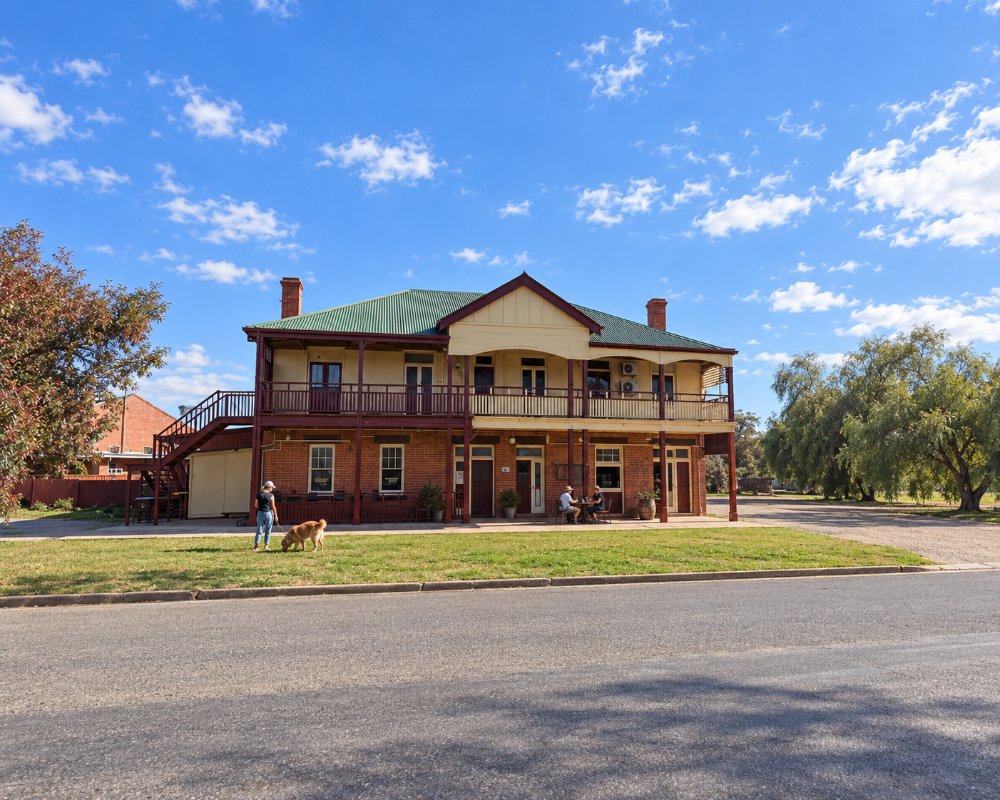
Chanter Street has shops, banks and hotels from the 1890s. Hayes Park, in the middle of town, is a good place for a break. The racecourse is one of the oldest in the district and holds a gold cup meeting each year, and the town has a golf course.
Berrigan Nature Reserve
On the eastern side of town, the regenerated reserve known as the Tank Paddock has a walking trail through wetlands, with bird hides and signs. It is best early or late in the day.
The Drop
About halfway between Berrigan and Barooga, the Mulwala Canal falls into the Berrigan Channel at a structure called The Drop, where a small power station was Australia’s first hydro-electric plant on an irrigation canal.
Heritage Walk, Museum and Bookshop
The Berrigan Heritage Walk links 20 places, including the old post office, the Federal Hotel and the Memorial Hall. The Berrigan and District Heritage Museum on Jerilderie Street has Federation material and fire brigade memorabilia, but opens for short hours, so ring ahead. In an old bakery building on Chanter Street, the Berrigan Bookshop fills 11 themed rooms with more than 100,000 second-hand books.
Where To Stay
Berrigan Caravan Park, on Jerilderie Street, has cabins, drive-through sites and a camp kitchen and allows pets. There is a dump point at Hayes Park next door.
The town also has two old hotels, and the Federal has had motel units and pub rooms, so ring ahead to check.
Barooga and Cobram, 32 km south, have the biggest choice of motels and parks, and Barooga has free NPWS beach campgrounds in the Murray Valley Regional Park, booked online for $6. Finley, 24 km west, has motels on the Newell Highway.
Eat & Drink
The Royal Hotel and the Federal Hotel are the town’s two old pubs, but check they are open before planning a meal around them, and small cafes line Chanter Street.
The Berrigan Community Golf and Bowls Club has an 18-hole course and bowling greens and is the local social hub. The sandhills around town grow the country’s largest planting of Sumo mandarins. Finley and Cobram have bigger supermarkets.
The golf and bowls club, also known as the Community Sports Club, has a popular Chinese restaurant. The Sumo mandarins come from Mowbray Farms, the largest planting in Australia, and the district is on the Murray Farm Gate Trail; phone ahead, as the stops are working farms. Barooga, about 25 minutes south, has Sporties Barooga and the Barooga Hotel.
History
Berrigan Shire acknowledges the Bangerang people. Robert Rand’s Momalong station took up the area in 1849, and the town grew where the Corowa mail run met the Jerilderie road. The post office opened in 1884, the town was proclaimed in 1890, and in 1896 the line from Jerilderie arrived, the first pioneer light railway in New South Wales. Berrigan’s branch of the Australian Natives’ Association suggested the Federation League meeting held at Corowa in 1893.
Getting to Berrigan
Berrigan is on the Riverina Highway. Barooga and Tocumwal on the Murray are half an hour south.
From Sydney it is about 710 km via the Hume and Sturt highways to Narrandera, the Newell to Finley and the Riverina Highway east. From Melbourne it is about 294 km via Shepparton and Cobram. All roads are sealed and suit caravans.
Experiences
- Historic/Heritage
- Rural/Country
- Self-Drive
Popular Activities
- Bird Watching
- Caravan and Camping
- Driving
- Golfing
- Shopping
- Sightseeing
About Berrigan
- Locality: Urban locality
- Berrigan Postcode: 2712
- State: New South Wales
- Region: Country NSW
- Latitude: -35.65743
- Longitude: 145.81264
- Elevation: 121m
- Population: 1260
- Median Income: $25948
- Area (Sq/km): 720.012
- Timezone: Australia/Sydney
