
Goolhi, NSW
Back-road drives
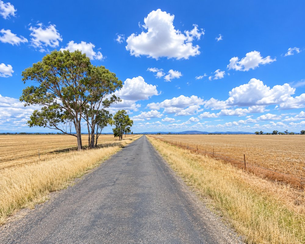
The local roads north of the highway cross open wheat and sorghum country with views to the Nandewar Range in the north-east and the Warrumbungles in the west. They are partly gravel, so they suit a car better than a caravan after rain, and there is no fuel until Mullaley or Coonabarabran.
Goolhi is a farming district of fewer than 100 people on the plains north of the Oxley Highway, about 50 km east of Coonabarabran and nearer to Mullaley and Gunnedah.
Known For
- Cropping and grazing country
- Back roads off the Oxley Highway
- Views to the Nandewar and Warrumbungle ranges
Things To Do in Goolhi
There is nothing here for visitors. Graves from the early days of Goolhi station survive on private land. The nearest pub and roadhouse are at Mullaley, on the highway.
Mullaley
The nearest village, about 20 to 25 km east, sits where the Black Stump Way leaves the Oxley Highway. Its Post Office Hotel combines the pub, post office, service station and a small caravan park, and the roadhouse serves takeaway meals.
The Warrumbungles
Warrumbungle National Park, with its volcanic spires, Siding Spring Observatory and dark-sky camping, is beyond Coonabarabran, about an hour west.
Where To Stay
There is nowhere to stay. Mullaley, much closer, has the Post Office Hotel and Caravan Park, and Gunnedah and Coonabarabran have more.
The Royal Hotel at Tambar Springs, south-east of Mullaley, also has rooms. In Gunnedah, about 65 km east, Gunnedah Tourist Caravan Park, at 51 Henry Street, has powered and unpowered sites, cabins, a pool and a dump point, and the CMCA RV Park at 107 Chandos Street takes fully self-contained rigs for up to 14 nights, and Coonabarabran, about 50 km west, is the base for the national park’s campgrounds.
Eat & Drink
There are no services.
The Post Office Hotel at Mullaley serves pub meals and the Mullaley Road House does takeaway; this is also the nearest fuel. Gunnedah and Coonabarabran have supermarkets.
History
Goolhi is Kamilaroi country, and the name is said to mean a log bridge. It comes from a pastoral run: a 1910 land plan shows Goolhi held by the New South Wales Land and Agency Company. The district is still mainly wheat, sorghum and cattle country, with no village centre, and it lies in Warrumbungle Shire.
Getting to Goolhi
Local roads are partly unsealed and slippery when wet.
From Gunnedah, take the Oxley Highway west through Mullaley, then local roads north. The highway is sealed.
Experiences
- Remote
- Rural/Country
- Self-Drive
Popular Activities
- Driving
- Sightseeing
About Goolhi
- Locality: Rural locality
- Goolhi Postcode: 2379
- State: New South Wales
- Region: Country NSW
- Latitude: -31.06754
- Longitude: 149.71205
- Elevation: 358m
- Population: 88
- Median Income: $33124
- Area (Sq/km): 453.817
- Timezone: Australia/Sydney
