
Bolong, NSW
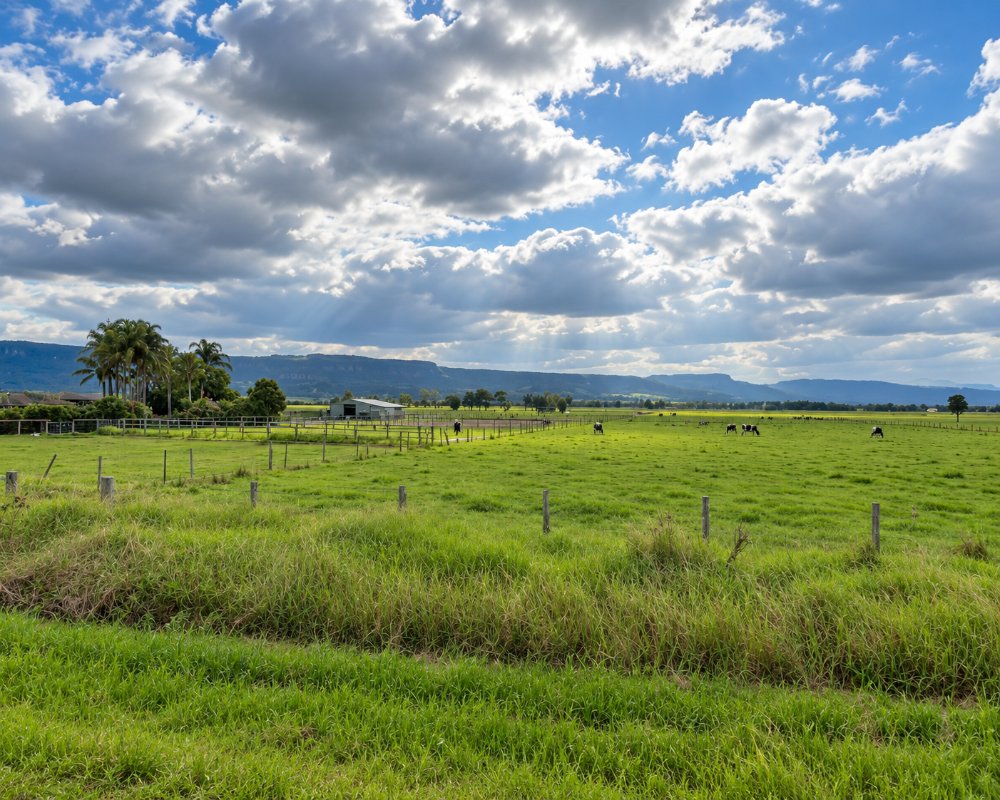
Bolong is a stretch of flat dairy country on the northern side of the Shoalhaven River, along Bolong Road between Bomaderry and Shoalhaven Heads. There is no township, only farms, a hall and a large grain-processing plant near the river.
Known For
- Open river-flat farmland
- A quiet back road to Shoalhaven Heads
- Views to Mount Coolangatta
Things To Do at Bolong
There is nothing here for visitors to stop for, and it would be wrong to suggest otherwise. Bolong Road is, however, the direct way from Nowra to Shoalhaven Heads, Seven Mile Beach and the historic estate at Coolangatta, and it is a pleasant drive across the flats.
The drive across the flats
Dairy paddocks line the road, with Mount Coolangatta, Cullunghutti to the Aboriginal people, rising ahead and the river off to the south. Trucks use the western end near the starch plant, but the rest of the road is quiet.
Coolangatta Estate
At the eastern end of the road, the 1822 headquarters of Alexander Berry’s estate has a cellar door open daily from 11am, with platters, picnic hampers and rooms in the restored convict-built buildings.
Where To Stay
The nearest accommodation is at Shoalhaven Heads and Nowra.
Bolong itself is farms and an industrial site, with nowhere to stay or pull over for the night.
In Nowra and Bomaderry, about 10 km south-west, North Nowra Riverfront Caravan Park on Rock Hill Road has powered and unpowered sites by the river, and Shoalhaven Caravan Village at Terara has powered sites and cabins. The council’s Nowra Showground Campground takes caravans and campervans only and has a dump point. To the east, Holiday Haven Shoalhaven Heads is a council park between the river and Seven Mile Beach, with powered riverfront sites and cabins, and it takes dogs. On the way, Coolangatta Estate has 26 rooms in its heritage buildings. Bolong Road is sealed and flat and suits caravans.
Eat & Drink
Bolong has no shops, cafes or fuel. At the eastern end, Coolangatta Estate serves cheese boards and platters with tastings at its cellar door from 11am daily. Shoalhaven Heads has the Heads Hotel, with Hedy’s Bistro on the river, the bowling club bistro, a general store and a takeaway. Bomaderry, at the western end, has a supermarket, fuel and takeaways, and Nowra across the bridge has the main pubs, clubs and cafes of the Shoalhaven. Buy fuel before heading east.
History
Bolong is on Yuin country, and the lower Shoalhaven around the river mouth is Jerrinja land. The flats were part of the 10,000-acre grant made in 1822 to Alexander Berry and Edward Wollstonecraft, run from Coolangatta, and were later let to tenant dairy farmers. A public school opened in November 1861 and ran until December 1963; until about 1900 it was spelt Boolong. The grain-processing plant at the Bomaderry end is the Shoalhaven Starches works of the Manildra Group.
Getting to Bolong
From Bomaderry, follow Bolong Road east.
From Sydney, follow the M1 and the Princes Highway to Bomaderry, about 155 km, then turn east into Bolong Road; Shoalhaven Heads is about 15 km from the highway. The road is sealed but low-lying, and it can go under in major floods. The nearest railway station is Bomaderry, the end of the South Coast Line.
Experiences
- Rural/Country
- Self-Drive
Popular Activities
- Driving
- Fishing
- Sightseeing
About Bolong
- Locality: Rural locality
- Bolong Postcode: 2540
- State: New South Wales
- Region: South Coast
- Latitude: -34.84701
- Longitude: 150.64957
- Elevation: 3m
- Population: 104
- Median Income: $35932
- Area (Sq/km): 16.413
- Timezone: Australia/Sydney
