
Bellata, NSW
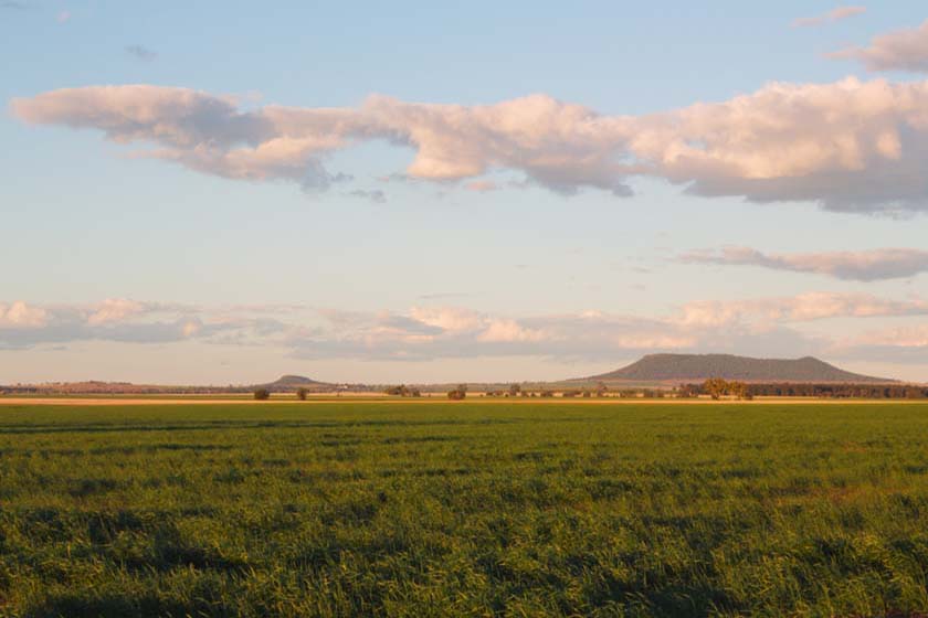
Bellata is a village of about 270 people on the Newell Highway, about 47 km north of Narrabri and 54 km south of Moree. It lies on gently rolling black-soil country that produces some of the best prime hard wheat in Australia, and its big silos are the landmark.
Known For
- A halfway stop between Narrabri and Moree
- Prime wheat country
- Petrified wood and agate
Things To Do in Bellata
The district is known among fossickers for petrified and opalised wood and agate. The village has a school, churches, a hall, tennis courts and a nine-hole sand-green golf course. To the east the Nandewar Range and Mount Kaputar are in view.
Fossicking
There is no public fossicking reserve at the village and the paddocks are private, so ask landholders before searching. The Narrabri visitor centre can suggest where to look.
Mount Kaputar from the north
Bellata gives a side-on view of the Nandewar Range. The Killarney Gap Road to Sawn Rocks and Waa Gorge leaves the Newell 3 km north of Narrabri, and the Sawn Rocks car park takes caravans.
Where To Stay
Free camping is offered at Bellata Golf Club; ask locally about facilities. Narrabri and Moree have full caravan parks.
Narrabri, about 47 km south, has Big Sky Caravan Park on the creek, with powered and unpowered sites, villas, a camp kitchen and a dump point, and takes dogs, Narrabri Motel and Caravan Park, the showground and plenty of motels. Moree, 54 km north, has several caravan parks and motels, and the Newell is sealed with recent overtaking lanes near Bellata.
Eat & Drink
The roadhouse on the highway is open 24 hours for fuel and meals. The village pub burnt down in 2006 and was not rebuilt.
The roadhouse is the only fuel on the 100 km between Narrabri and Moree. For a pub meal, the Namoi Hotel and the Crossroads Hotel in Narrabri serve dinner, and both Narrabri and Moree have supermarkets.
History
Bellata is on Gamilaraay country, and the name is said to mean home of the belar trees. The railway north from Narrabri opened in 1897 with a station here called Woolabra, and both station and post office were renamed Bellata in 1909. The two-storey Nandewar Inn, built in 1902, was a landmark until a fire destroyed it in April 2006.
Getting to Bellata
Bellata is on the Newell Highway, half an hour from Narrabri.
NSW TrainLink’s daily Sydney to Moree Xplorer can stop at the Bellata platform on request; check the timetable and book ahead.
Experiences
- Rural/Country
- Self-Drive
Popular Activities
- Caravan and Camping
- Driving
- Golfing
- Sightseeing
About Bellata
- Locality: Rural locality
- Bellata Postcode: 2397
- State: New South Wales
- Region: Country NSW
- Latitude: -29.91962
- Longitude: 149.79098
- Elevation: 234m
- Population: 350
- Median Income: $36088
- Area (Sq/km): 1021.64
- Timezone: Australia/Sydney
