
Bailup, WA
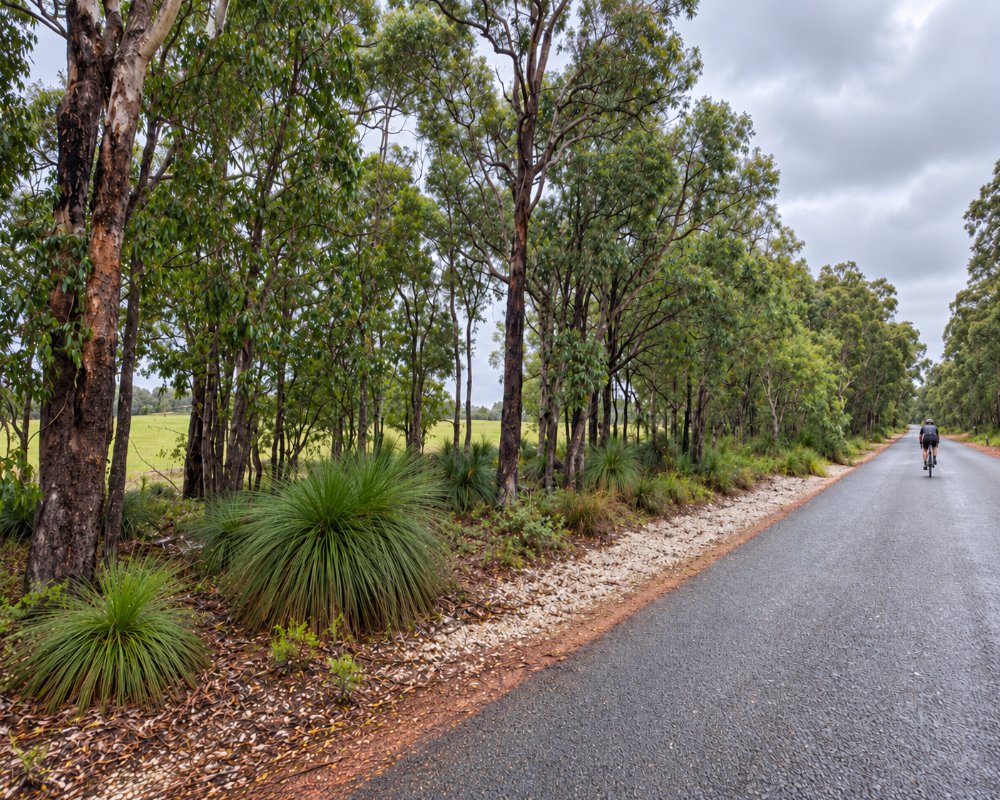
Bailup is a small rural locality on Perth’s north-eastern fringe, about 57 km from the CBD and around an hour’s drive along Toodyay Road, about 15 km past Gidgegannup. It’s a place of large bush blocks, jarrah, marri and wandoo woodland and the wetland of Red Swamp Brook, rather than a town.
Only about 50 people live here, in an area split between the Shire of Mundaring and the Shire of Toodyay, on Noongar country close to the boundary between the Whadjuk and Ballardong peoples.
Known For
- Jarrah, marri and wandoo woodland
- Red Swamp Brook wetland
- Close to Avon Valley National Park
- Birdwatching
Things To Do in Bailup
Morangup Nature Reserve
In the Shire of Toodyay, Morangup Nature Reserve protects woodland around Morangup Hill, also spelt Mortingup Hill. Park at Perth Road and Black Swamp Road and follow the track about 1.5 km north. There’s no track to the 450-metre summit, which is a difficult climb.
Birdwatching
The woodland is good for birdwatching, and square-tailed kites are among the birds seen here.
Avon Valley National Park
The national park, with its granite hills, wildflowers and bush campgrounds, is close by, reached on gravel roads.
Noble Falls and Gidgegannup
Noble Falls and the Gidgegannup showgrounds are about 15 minutes back towards Perth.
Exploring the Area
Bailup is a quiet base for exploring the country between the Perth Hills and the Avon Valley. Toodyay‘s museums, bakery and Moondyne Joe history are about 25 minutes north-east, Lake Leschenaultia is around half an hour south, and the scenic drives through Gidgegannup are lined with wildflowers from August to October. Bring water and supplies, as there are no services in the locality.
Where To Stay
There’s no accommodation in Bailup itself. Cabins and farm stays in Gidgegannup are the closest. Caravanners can try the campgrounds in Avon Valley National Park, reached on gravel roads, or the powered sites at Lake Leschenaultia in Chidlow.
Eat & Drink
There are no shops or cafés in Bailup. The Noble Falls Tavern on Toodyay Road in Gidgegannup is the nearest place to eat.
History
The name comes from a creek, and from a police station and inn set up on Toodyay Road in the 1840s, and is of Noongar origin. The locality name was approved in 1999. In 2021 the Wooroloo bushfire brought evacuation warnings to the area.
Getting to Bailup
Bailup is about 57 km from Perth, around an hour’s drive via Toodyay Road, or about 30 minutes from Mundaring via Bailup Road. There’s no public transport, so a car is needed.
Spring is the best time for wildflowers and birdlife. Summer brings high fire danger.
Experiences
- Nature based
- Remote
- Rural/Country
- Self-Drive
Popular Activities
- Driving
- Sightseeing
About Bailup
- Locality: Rural locality
- Bailup Postcode: 6082
- State: Western Australia
- Region: Perth & surrounds
- Latitude: -31.73837
- Longitude: 116.29571
- Elevation: 274m
- Population: 40
- Median Income: $30628
- Area (Sq/km): 47.033
- Timezone: Australia/Perth
