
Tambellup, WA
Tambellup is a small farming town on the Great Southern Highway and the Gordon River, about 320 km south-east of Perth and 40 km south of Katanning, in the Shire of Broomehill-Tambellup. About 280 people live here, in sheep and grain country about 45 minutes from the Stirling Range.
This is Goreng Noongar country, and the town’s Noongar Trail shares Goreng stories along the river. The name is Noongar, said to mean place of thunder or place of many tammar wallabies. Tambellup grew up as a station on the Great Southern Railway in 1889.
Known For
- Heritage, river and Noongar walking trails
- The Gordon River Weir picnic area
- A free RV rest stop for self-contained travellers
Things To Do in Tambellup
Heritage Trail
Three walks start in town: the 600 m Town Trail past historic buildings, the River Trail of more than 2 km heading north, and the 1.5 km Noongar Trail south along the Gordon River.
Corner Shop Museum
In the former stationmaster’s house on Norrish Street, the museum tells the town’s story and opens by arrangement.
Gordon River Weir
On Tambellup West Road, the weir has a picnic area, and black swans are often seen.
Toolbrunup School
About 4 km south, an old one-room school still has its original desks.
Flood markers
The railway water tank stand shows the heights of the 1955 and 1982 floods.
Diprose Park
The park has a playground, free barbecues and toilets.
Stirling Range
About 45 minutes south-east, Stirling Range National Park has Bluff Knoll and Toolbrunup Peak.
Where To Stay
The Tambellup Caravan Park offers unpowered sites as a free 48-hour rest stop for fully self-contained travellers, with powered sites also available. The nearest confirmed dump points are at Broomehill and Katanning. Fuel is available in town, and the highway is sealed.
Eat & Drink
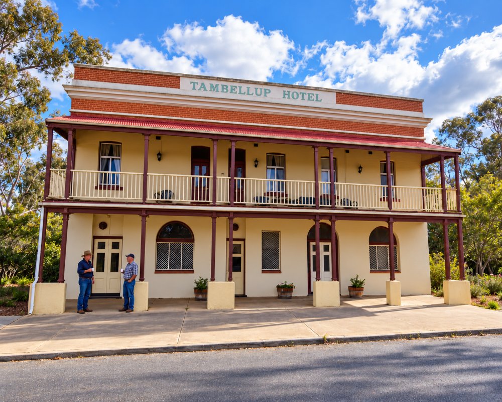
The Tambellup Hotel serves pub meals and has rooms, and the Tambellup Post Cafe and the local store sell coffee and light meals.
History
J.S. Roe passed through in 1849, and Josiah Norrish arrived in 1872, first cutting sandalwood and then farming sheep. The railway station opened in 1889, and the townsite was gazetted in 1899. Floods have hit the town several times, most severely in 1955 and in 1982 after a tropical cyclone.
Getting to Tambellup
Tambellup is about 320 km south-east of Perth, around three and a half hours’ drive, 40 km south of Katanning and 36 km west of Gnowangerup.
Spring is best for wildflowers along the river reserves, and for trips to the Stirling Range. Winters are cold, and summers hot and dry.
Experiences
- Historic/Heritage
- Rural/Country
Popular Activities
- Driving
- Sightseeing
About Tambellup
- Locality: Urban locality
- Tambellup Postcode: 6320
- State: Western Australia
- Region: Margaret River & the South West
- Latitude: -34.04314
- Longitude: 117.64095
- Elevation: 269m
- Population: 375
- Median Income: $24700
- Area (Sq/km): 5.412
- Timezone: Australia/Perth
