
Roebourne, WA
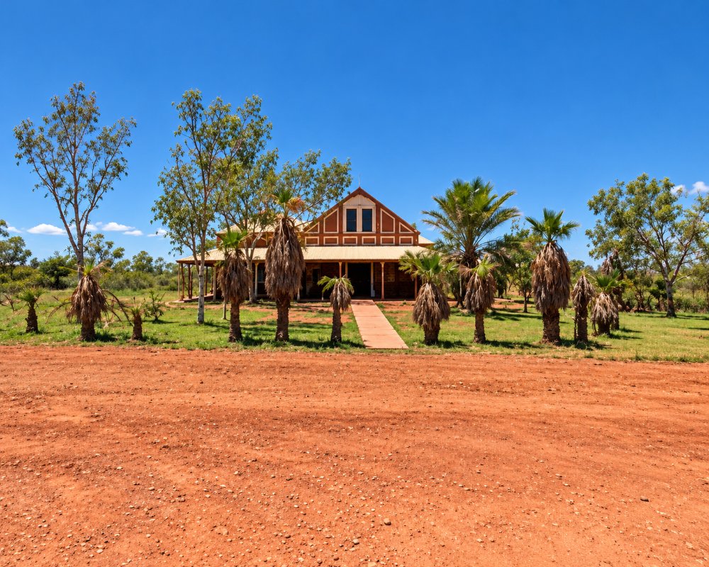
Roebourne is the oldest town on the coast between Geraldton and Darwin, settled in the 1860s on the banks of the Harding River, about 40 km east of Karratha on the North West Coastal Highway. Its stone buildings from the 1880s and 1890s, including the Old Roebourne Gaol, recall the days when this was the administrative centre of the north-west.
This is Ngarluma country, known to its people as Ieramugadu, and Yindjibarndi, Banyjima and Kurrama people also live in the town. Roebourne is known for its Aboriginal art, with galleries on the main street showing the work of local artists, and for its strong community culture. It is a rewarding stop on the way to Cossack, Point Samson and Millstream.
Known For
- The oldest town between Geraldton and Darwin, with pre-1900 stone buildings
- Aboriginal art at Yinjaa-Barni Art and the Roebourne Art Group
- The Old Roebourne Gaol
Things To Do in Roebourne
Old Roebourne Gaol
The Old Roebourne Gaol is a striking stone building from the late 1800s, designed by the architect George Temple-Poole. It is now a museum and heritage precinct. The visitor centre has moved out of the gaol, so pick up information at the Karratha Visitor Centre.
Yinjaa-Barni Art
Yinjaa-Barni Art, in historic Dalgety House on Roe Street, is a gallery and studio for Yindjibarndi and other local artists, known for their vivid paintings of country.
Roebourne Art Group
The Roebourne Art Group, also on the main street, shows and sells work by artists from around the town.
Ganalili Centre
The old Victoria Hotel has been redeveloped as the Ganalili Centre, a cultural space for the community and visitors.
Heritage walk
A walk around town takes in stone buildings from the 1880s and 1890s, including churches, the old post office and the Union Bank.
Mount Welcome and the Harding River
Mount Welcome has views over the town, and the Harding River and Harding Dam south of town are pleasant spots for a picnic or a fish.
Where To Stay
Accommodation in Roebourne is limited. The Harding River Caravan Park has been sold in recent years and its status is uncertain, so check before you go. Most visitors stay in Karratha or Point Samson. Fuel is available on the highway. Free rest areas along the North West Coastal Highway to the east, such as Peawah River West near Whim Creek, are used by caravanners. The highway is sealed and suits all vehicles.
Eat & Drink
Food options in Roebourne are limited, so most travellers eat in Karratha or Point Samson, both within an hour. Carry snacks and water when exploring.
History
Roebourne was settled in the 1860s and gazetted in 1866, named after John Septimus Roe, Western Australia’s first Surveyor-General. It became the main town of the north-west, serving pearlers at Cossack and the pastoral stations inland. Cyclones in 1872 and 1925 caused great damage. In 1983 the death in police custody of young Yindjibarndi man John Pat became a turning point in the national conversation about Aboriginal deaths in custody. Today the town has around 700 people and a strong Aboriginal community.
Getting to Roebourne
Roebourne is on the North West Coastal Highway, about 40 km east of Karratha and about 200 km west of Port Hedland. Karratha has the nearest airport, with flights from Perth.
The best time to visit is May to September. Summers are very hot, and in January 2022 Roebourne recorded 50.5 degrees.
Experiences
- Caravan and Camping
- Historic/Heritage
- Rural/Country
Popular Activities
- Driving
- Sightseeing
About Roebourne
- Locality: Urban locality
- Roebourne Postcode: 6718
- State: Western Australia
- Region: Exmouth & the Coral Coast
- Latitude: -20.77542
- Longitude: 117.14662
- Elevation: 11m
- Population: 981
- Median Income: $19448
- Area (Sq/km): 161.835
- Timezone: Australia/Perth
