
Wanaaring, NSW
Wanaaring is a village of about 80 people on the Paroo River, roughly 190 km west of Bourke and 230 km east of Tibooburra. It is the only settlement on the road between the two and the last fuel before the long dirt run to Corner Country.
Known For
- The Paroo, the last free-flowing river of the basin
- Only fuel between Bourke and Tibooburra
- Start of the Cut Line to Corner Country
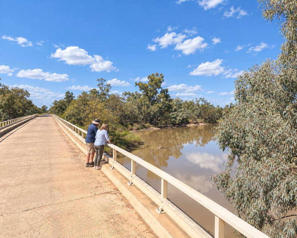
The big news for travellers is that the road from Bourke has now been sealed all the way, the last section in 2026, so Wanaaring can be reached on bitumen for the first time. West of the village nothing has changed: the road known as the Cut Line is unsealed, corrugated and closed after rain. The village itself is a store, a school, a police station and a scatter of houses beside a river lined with coolabahs and river red gums.
Things To Do in Wanaaring
The Paroo River
The Paroo is the only river in the Murray-Darling Basin with no dams or weirs, and it flows only after rain in Queensland. When it runs, the waterholes fill with birds, and there is fishing for yellowbelly from the bank near the bridge.
Nocoleche Nature Reserve
About 20 km south, this reserve protects a stretch of the Paroo and its floodplain wetlands. It is a place for a picnic, birdwatching and a quiet look at the river.
Village History
The remains of an old wool scour lie on the riverbank, and the public school has been open without a break since 1887.
The Cut Line
The drive on to Tibooburra crosses red sandhills, claypans and gibber country with almost no traffic. It is one of the classic outback crossings of the state, for well-prepared travellers in dry weather.
King Charlie Waterhole
The only part of Nocoleche Nature Reserve open to the public is the King Charlie Waterhole picnic area, on the Paroo about 20 km south of Wanaaring along the unsealed Wilcannia road. When the river is up it is a good spot for a picnic, a fish and some birdwatching among the coolabahs, but National Parks closes it at times after rain, so ask at the store before driving down.
Narriearra Caryapundy Swamp National Park
Near the western end of the Cut Line, Narriearra Road turns north into this park on the Queensland border, about 45 km from Tibooburra. After big rain the Caryapundy Swamp spreads into lakes and channels full of waterbirds, and in spring the sandhills carry cassias, wattles and fan flowers. There is a campground at the Caryapundy lookout, and the gravel roads close after rain.
Where To Stay
The Wanaaring Store runs a small caravan park and has a few air-conditioned rooms and cabins.
Caravans and Camping
The caravan park behind the store has eight powered sites and room for unpowered camping. With the road from Bourke now sealed, any caravan can get this far. Going on to Tibooburra is another matter: there is no fuel, water or phone coverage for 230 km, and the road suits off-road vans and high-clearance vehicles. Ask at the store about conditions before leaving.
Bourke, about 190 km east, has two caravan parks, Kidman’s Camp and the Mitchell Caravan Park, and riverside camping at Mays Bend on the Darling. Heading west, the next beds are about 230 km away in Tibooburra, which has the Granites Caravan Park and Motel and rooms at both its hotels, as well as Dead Horse Gully campground in Sturt National Park. There is no confirmed dump point in Wanaaring, so empty tanks in Bourke.
Eat & Drink
The Wanaaring Store is the village’s supply and fuel stop, on O’Grady Street with the caravan park, selling groceries and supplies for the run west; it is also the place to ask about the roads. Hours are limited, so arrive during business hours and ring ahead if you are counting on fuel. The village pub has opened only occasionally in recent years, so do not count on it. Bourke, two hours east, has supermarkets, a bakery, cafes and several pubs and is the last big supply stop before Corner Country, and to the west there is nothing for 230 km until Tibooburra, where both hotels serve meals and fuel is sold. Fill every tank and carry extra water before leaving Wanaaring, and allow for corrugations and sand, which push fuel use well up.
History
This is the country of the Paaruntyi people. Europeans surveyed the Paroo in 1860, an inn opened in 1867 and by the 1890s the village had two hotels, two stores and a saddler serving the surrounding stations. In January 2019 Wanaaring recorded an overnight minimum of 36.6 degrees, the hottest night measured in Australia.
Getting to Wanaaring
From Bourke follow the signs west from the town; the road is sealed throughout and takes about two hours. From Tibooburra allow at least three and a half hours on dirt. Bourke Shire issues road reports, and the roads west of Wanaaring are closed whenever it rains.
Experiences
- Historic/Heritage
- Nature based
- Remote
- Rural/Country
- Self-Drive
Popular Activities
- Bird Watching
- Caravan and Camping
- Driving
- Fishing
- Off Road Driving
- Outback
- Sightseeing
About Wanaaring
- Locality: Rural locality
- Wanaaring Postcode: 2840
- State: New South Wales
- Region: Outback NSW
- Latitude: -29.70627
- Longitude: 144.14734
- Elevation: 110m
- Timezone: Australia/Sydney
