
Truro, SA
Truro is a town of about 500 people on the Sturt Highway at the north-eastern edge of the Barossa, 90 km from Adelaide and 20 minutes from Nuriootpa. For travellers coming from Sydney or the Riverland it is the first Barossa town, set on the last ridge before the road drops to the Murray plains.
Known For
- Gateway to the Barossa from the east
- A highway stop with a bakery and pub
- Cornish mining heritage
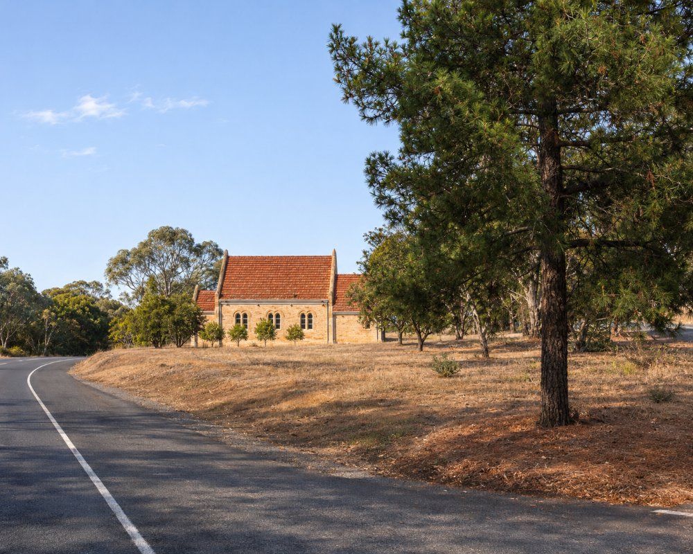
The highway is the main street, and hundreds of trucks pass through each day; a bypass has been promised for years but has not been built. Step off the road and Truro is an attractive old place of stone cottages, with wide views east over dry, open country.
Things To Do in Truro
Heritage Walk
A walk around the town takes in the high homes, stone cottages built on the hillside by Cornish miners in the 1850s, the old churches and the town hall.
Wheal Barton
Copper was found here in 1846, and the Wheal Barton mine, two kilometres east, employed about a hundred men from 1849. Little remains, but the story explains the town’s Cornish name.
Lavender Federation Trail
The long-distance walking trail from Murray Bridge passes through, with a section north to Eudunda starting here.
Parks
Pioneer Park and the memorial park opposite the hall have playgrounds, shelters and a fenced dog park, useful on a long drive.
Op Shop and Vintage Stores
The Truro Community Op Shop, where almost everything costs a dollar, fills the historic town hall from Wednesday to Saturday; volunteers have run an op shop in the town since the 1970s, and the money now goes to Rotary and local projects such as the dump point at the oval. Along the main street, Alma and Ann Vintage sells antiques and retro goods, with a strong line in vintage clothing, mirrors and lighting, and a collection of old electric organs.
Pioneer Park
The cor-ten steel sculptures in Pioneer Park inspired the town’s new branding, and the park has an electric vehicle charger, so it is a good place to recharge both car and driver on the drive between Adelaide and the Riverland.
Where To Stay
The hotel may have rooms; ask ahead.
The community runs low-cost bush camping at the oval, at about $10 a night, with a dump point.
Camping at the Truro Oval is run by the Truro and Districts Community Association, which is building the recreation park up as a bush camping area; stays are limited to seven nights and are paid online through the association’s website. The town has been a resting place for drovers, teamsters and travellers since the 1840s, and the oval keeps up the habit for vans on the long run between Adelaide and the Riverland. Trucks use the highway day and night, so light sleepers should pick a site away from the road.
For a powered site, BIG4 Barossa Tourist Park at Nuriootpa, about 22 km south-west, has drive-through sites, cabins, a pool and a dump point. The nearest rooms beyond the hotel are the two vineyard cottages for couples at Light Pass, about 20 km south-west, Alberts Cottage at The Willows Vineyard and the Tomfoolery Winemaker’s Cottage, and the many cottages and bed and breakfasts of Angaston and Nuriootpa. Heading east, the highway drops to the Murray at Blanchetown, about 50 km away.
Eat & Drink
The Truro Hotel, an 1863 building, reopened in 2025 after a renovation, and the bakery on the highway is a well-known stop.
The Truro Hotel at 15 Moorundie Street, the main street, reopened in mid-2025 under the Perks Hospitality group after a renovation and new fit-out of the 1863 building; it stocks a good range of local drinks and has a bottle shop. Sunrise Bakery on the highway belongs to a small Barossa group of three bakeries and is a takeaway stop here, with pies, pastries, cakes and Amanti coffee; its branches at Angaston and Lyndoch have seating for dining in.
For more choice, the Stockwell Hotel, about 15 km west, serves lunch and dinner seven days, and Nuriootpa and Angaston, 20 minutes away, have a full range of cafes, restaurants and pubs.
Truro has a service station on the main street; for supermarkets, go to Nuriootpa or Angaston.
History
The stock route from the Murray to Gawler ran through here from 1840. The town was surveyed in 1848 and named after Truro in Cornwall. It was on the main road between Adelaide and Sydney from 1856, and a railway terminus from 1917.
Getting to Truro
Truro is on the Sturt Highway, about an hour and a quarter from Adelaide. Moculta and Angaston are to the south-west.
Experiences
- Historic/Heritage
- Rural/Country
- Self-Drive
Popular Activities
- Bush Walking
- Caravan and Camping
- Driving
- Shopping
- Sightseeing
About Truro
- Locality: Urban locality
- Truro Postcode: 5356
- State: South Australia
- Region: Barossa
- Latitude: -34.4087
- Longitude: 139.12687
- Elevation: 346m
- Population: 548
- Median Income: $31564
- Area (Sq/km): 213.379
- Timezone: Australia/Adelaide
