
Tolmie, VIC
Tolmie is a small farming district on a high plateau about 22 km north of Mansfield, at almost 800 metres above sea level. Snow is common in winter, and the green, rolling highlands are a world away from the hot plains below.
It is rich in bushranger history, close to the Stringybark Creek site where the Kelly gang killed three police in 1878 and to Powers Lookout, named after the bushranger Harry Power.
Known For
- Stringybark Creek and Kelly history
- Mount Samaria State Park
- Powers Lookout
Things To Do in Tolmie
Stringybark Creek
The Stringybark Creek historic site, about 11 km away, marks where the Kelly gang killed Sergeant Kennedy and Constables Lonigan and Scanlan in October 1878. It has interpretive signs and a free campground.
Mount Samaria State Park
Mount Samaria State Park, west of the Tolmie to Mansfield road, has forest walks, waterfalls such as Wild Dog Creek Falls and lookouts.
Powers Lookout
Powers Lookout, near Whitlands on the road to Whitfield, gives sweeping views over the King Valley. A short walk with ladders leads to the second lookout, near Harry’s Watering Hole, named after the bushranger Harry Power.
Tolmie Sports Day
The Tolmie Sports Day, held in February or March for well over a century, has foot races, a dog jump, wood chopping and a bush dance.
When To Visit
Summer and autumn are cool and pleasant on the plateau. Winter can bring snow, and gravel roads may be slippery.
Whitlands and the King Valley
North of Tolmie, the road climbs onto the Whitlands plateau, at about 800 metres, where cool-climate white wines are grown, then drops past Powers Lookout into the King Valley and its Italian family wineries around Whitfield and Cheshunt.
Nearby
Mansfield is about 20 minutes south, with Mount Buller beyond, and Benalla is about 45 minutes north-west via Tatong.
Where To Stay
For campers, Mount Samaria State Park has free camps at Spring Creek and Samaria Well, with walk-in sites at Wild Dog Creek Falls and Camphora; bring water, and expect gravel roads where 4WD is recommended. Stringybark Creek also has a campground. Mansfield, 20 minutes south, has caravan parks and motels.
Tolmie has few places to stay, so most travellers base themselves in Mansfield, about 25 km south, at the High Country Holiday Park, the Alzburg Resort or the town’s motels, or in the King Valley around Whitfield, about 30 km north over the range. In Mount Samaria State Park, Spring Creek Sawmill and Samaria Well are free camping areas reached by the park’s gravel road across the range, which is open all year to most vehicles but steep and rocky in places, so leave caravans in town. Stringybark Creek, reached by a well-graded dirt road, suits tents and camper trailers better than big vans; bring water and firewood.
The Mansfield-Whitfield road over the Tolmie plateau is sealed, but the descent from Whitlands past Powers Lookout to Whitfield is long, steep and winding, so take it slowly in a low gear when towing. Snow and black ice are possible on the plateau in winter, and gravel side roads turn slippery after rain. The nearest public dump point is at the Goulburn Valley Water depot on Withers Lane in Mansfield, and Mansfield and Benalla have the nearest supermarkets and fuel.
Eat & Drink
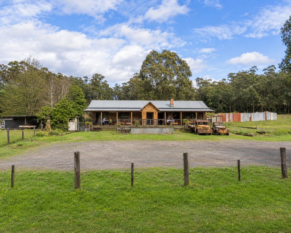
The Tolmie Tavern on the Mansfield to Whitfield road opens from Thursday to Sunday for lunch and dinner, with a deck looking over the hills. Otherwise, eat in Mansfield or Whitfield.
The Tolmie Tavern at 2798 Mansfield-Whitfield Road is the only place to eat on the plateau. It has a timber bar, a lounge and outdoor seating, and its lunch, dinner and snack menus run from house-crumbed schnitzels to pizzas for the table, with vegetarian dishes and meals for children; it opens from Thursday to Sunday.
Mansfield, about 25 km south, has the widest choice, from the Produce Store on High Street for breakfast to the Mansfield Hotel and Anvil Brewing Co for dinner. Over the range in the King Valley, about 30 km north, Dal Zotto Wines at Whitfield is known for its prosecco and Italian-style food, and Pizzini Wines makes Italian varieties such as sangiovese and nebbiolo. Take a picnic for Powers Lookout and Mount Samaria, as there are no kiosks in the parks.
Tolmie has no shop or fuel; buy groceries and fill up in Mansfield or Benalla.
History
This is Taungurung Country. The post office opened in 1877 as Wombat and was renamed Tolmie in 1879 after Ewen Tolmie. The district was the haunt of the bushranger Harry Power in the 1860s and the Kelly gang in 1878. Bushfires burnt the area in 2006 and 2007.
Getting to Tolmie
Tolmie is about 213 km north-east of Melbourne, around 2.5 hours’ drive via Mansfield. The road north to Tatong is partly gravel, and there is no public transport.
Experiences
- Mountain
- Nature based
- Rural/Country
Popular Activities
- Bush Walking
- Caravan and Camping
- Food and Wine
- National Park
- Sightseeing
About Tolmie
- Locality: Rural locality
- Tolmie Postcode: 3723
- State: Victoria
- Region: High Country
- Latitude: -36.9332
- Longitude: 146.2849
- Elevation: 924m
- Timezone: Australia/Melbourne
