
Sheringa, SA
Sheringa is a roadhouse and a few houses on the Flinders Highway, about 113 kilometres north-west of Port Lincoln and 48 kilometres south of Elliston. Fewer than 40 people live in the district.
The beach, eight kilometres west, is the reason to stop.
Known For
- White dunes and surf at Sheringa Beach
- Salmon fishing from the sand
- Relics of the coaching days
Things To Do in Sheringa
Sheringa Beach
A gravel road leads to a long beach backed by high white dunes and limestone cliffs. Salmon and mulloway are caught in the surf, and there are reef breaks for experienced surfers. The sea here is powerful, so swim with care.
Round Lake
A stone-lined pool beside a lake near the settlement was built in the 1840s to wash sheep before shearing.
Lake Hamilton Eating House
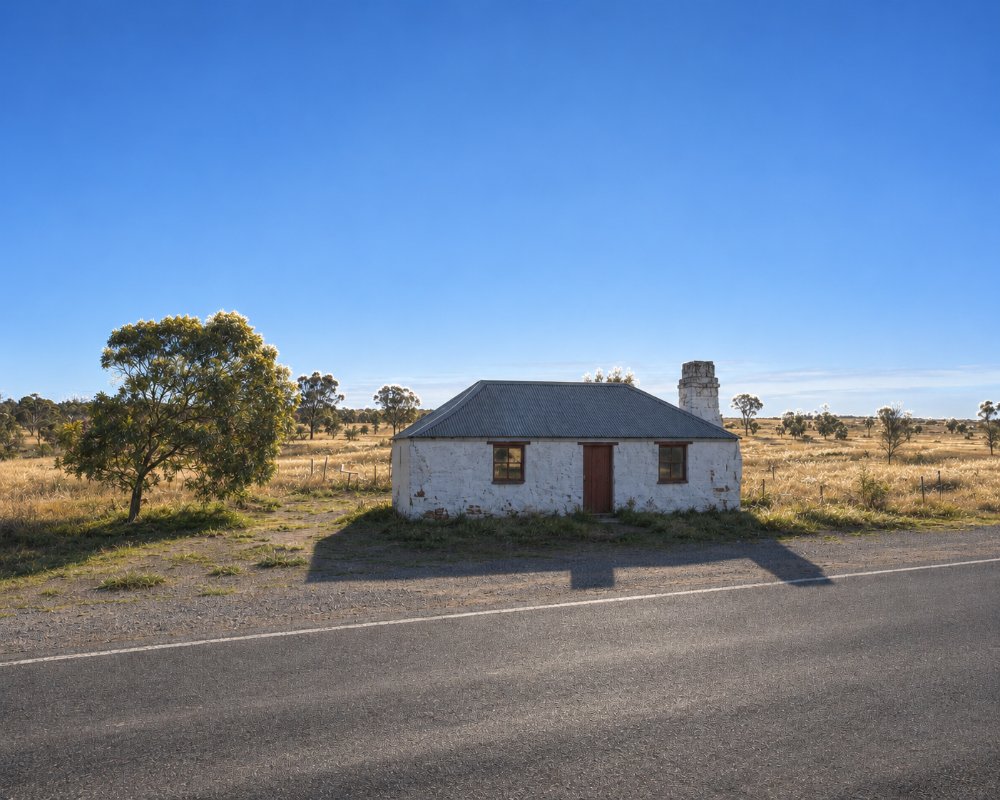
South of Sheringa, beside the highway, a small stone building of about 1857 was a meal stop for coach passengers. It was restored in the 1970s.
Hooded Plovers
Sheringa Beach is a nesting beach for the hooded plover, a small shorebird that lays its eggs on the open sand. In spring 2026 volunteers fenced a nest here and two chicks hatched. From about September to March, watch for signs and fenced areas, keep dogs on a lead, and drive only below the high-tide line or on marked tracks.
Salmon Fishing Championship
Each winter, from June to August, Elliston’s Australian Salmon Fishing Championship is fished along the beaches and rocks from Sheringa north to Mount Camel, and Sheringa Beach is one of the favourite spots. Anglers from all over the state camp here during the competition, so the campground fills on good weekends.
Locks Well
About 32 km north, toward Elliston, a timber staircase of 283 steps leads down the cliff to Locks Well beach, one of the best-known salmon beaches on the coast. The lookout at the top is worth the stop even if you do not walk down.
Where To Stay
There is no accommodation at Sheringa other than camping.
The Elliston council’s campground at Sheringa Beach has two areas. One has ten numbered sites with a toilet and a cold shower, and the other is open and exposed. Caravans fit. Book and pay online, about $20 a night, with a limit of 14 nights. Bring drinking water. Elliston has a caravan park with a dump point.
The Sheringa Beach campground is run by the District Council of Elliston and is booked through the Eyre Peninsula camping website or by calling the council in Elliston. Payment is taken when you book, so book before you leave town. It is bush camping a short walk over the dunes from the beach. There is no power, so bring a generator or solar, and carry enough drinking water for your whole stay.
The nearest alternative is the council’s Walkers Rock campground north of Elliston, about 60 km away, run on the same booking system. The nearest caravan parks, with cabins, powered sites and showers, are the Elliston Caravan Park and Waterloo Bay Tourist Park, 48 km north; Port Lincoln, about 113 km south-east, has several larger parks. Elliston Caravan Park has the nearest dump point.
Eat & Drink
The roadhouse has sold fuel, takeaway and groceries, but check that it is open; it has been for sale.
Sheringa has no cafe or pub. The roadhouse on the highway has long been the only shop, so check before you travel that it is open. The nearest certain meals are in Elliston, 48 km north, where the Elliston Hotel on Beach Terrace serves seafood and pub dinners, and Bakery #9 does breakfast, coffee and pies. Port Lincoln, about 113 km south-east, has supermarkets and a full range of cafes. Carry enough fuel to cover the 170 km between Port Lincoln and Elliston without counting on Sheringa, and stock up on food and water before you come.
History
Sheringa is on Nauo country, and the name comes from a Nauo word for a root that was eaten. The township was proclaimed in 1883.
Getting to Sheringa
Sheringa is on the sealed Flinders Highway. The beach road is gravel and suits ordinary cars.
Experiences
- Caravan and Camping
- Nature based
- Relaxation
- Self-Drive
Popular Activities
- Beach
- Bird Watching
- Caravan and Camping
- Fishing
- Kayaking
- Surfing
About Sheringa
- Locality: Rural locality
- Sheringa Postcode: 5607
- State: South Australia
- Region: Eyre Peninsula
- Latitude: -33.84467
- Longitude: 135.2319
- Elevation: 12m
- Timezone: Australia/Adelaide
