
Sandy Hollow, NSW
Sandy Hollow is a small village on the Golden Highway, 15 minutes west of Denman and 35 minutes from Muswellbrook. It sits beside the Goulburn River where the Upper Hunter narrows between sandstone ranges.
Known For
- Sandstone escarpments above the Goulburn River
- The start of the Bylong Valley Way
- Vineyards and horse country
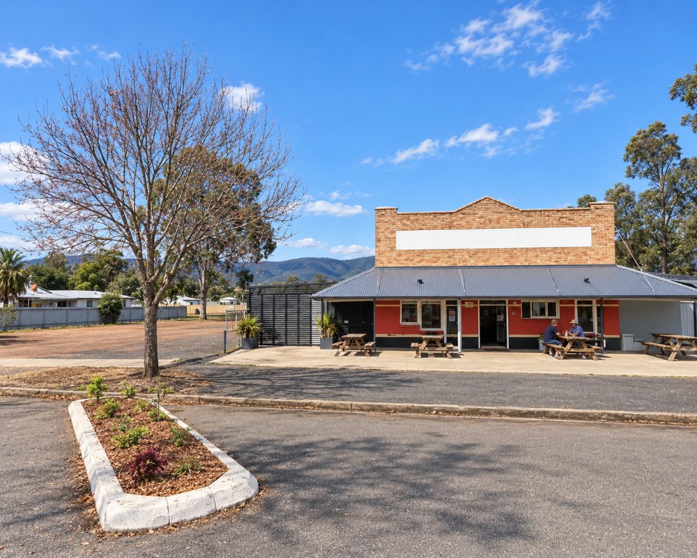
The village is a pub, a store, a school, a caravan park and a few houses. Its setting is the appeal: orange cliffs on both sides of the valley, with Wollemi National Park behind them.
Things To Do in Sandy Hollow
Drive the Bylong Valley Way
The road turns south at Sandy Hollow and runs about 115 kilometres through Baerami and Bylong to Rylstone, and about 140 kilometres in all to the Castlereagh Highway at Ilford. It is sealed, quiet and one of the best scenic drives in the state, with cliffs and farmland the whole way.
Wine and local produce
There are a few cellar doors in the Sandy Hollow and Baerami area, part of the Upper Hunter wine district, and more around Denman. Ring ahead, as some open only at weekends.
The river and the cliffs
The Goulburn River runs past the village and is pleasant for a picnic or a paddle when the level is right. A short drive up any side road brings the escarpment close.
Camping on the Goulburn River
Goulburn River National Park’s two NPWS campgrounds, Spring Gully and Big River, are reached by a 22 km dry-weather gravel road from Wollar on the Mudgee side; camping is free with a $6 booking fee, and they suit tents and camper trailers rather than caravans. From Sandy Hollow it is about 100 km by the Bylong Valley Way and Wollar.
Wybong Mouse Races
At Easter the Wybong valley, north of Sandy Hollow, holds a community day of markets, music and mouse racing, with the Wybong Cup on the Saturday, and camping is allowed at the hall grounds over the weekend.
Where To Stay
The hotel has offered rooms in the past, so check first, and the caravan park has cabins and powered sites. There are vineyard cottages nearby and motels in Denman.
Sandy Hollow Tourist Park, beside the service station on the highway, has powered and unpowered sites, cabins and a pool, and was under new management in 2026. Denman Van Village at 14 Macauley Street has 59 serviced ensuite sites, cabins, a cottage and a dump point among shady trees in Denman. Merriwa’s council caravan park on the river has powered and unpowered sites and takes big rigs, with a public dump point and drinking water outside it, and self-contained travellers can stay free behind the Merriwa RSL Club, 40 km west. The Golden Highway is an easy tow, and the Bylong Valley Way is sealed but narrow and winding in places.
Eat & Drink
The hotel and the service station have served meals and takeaway in the past, but we could not confirm that either is trading now, so check before relying on them.
For more choice, Denman, 17 km east, has The Denman Hotel, Vocal Cafe and the Two Rivers cellar door, and Merriwa, about 45 km west, has pub and club meals. Carry supplies if heading down the Bylong Valley Way, as services are thin until Rylstone and Kandos.
History
This is Wonnarua country. Work on a railway from Sandy Hollow west towards Maryvale, near Wellington, began and stopped several times and was abandoned unfinished in about 1950. Its tunnels and cuttings were finally put to use in the 1980s for the coal line from Ulan.
The railway reached Sandy Hollow in 1917 with the Merriwa branch. In the 1940s oil shale was trucked from Baerami Creek to retorts at Sandy Hollow, but the works closed after the war. A coal mine opened at Ulan in 1977, and in 1982 the half-built line was finally completed to carry its coal to Newcastle; coal trains still pass the village.
Getting to Sandy Hollow
Sandy Hollow is about three and a quarter hours from Sydney by the Hunter Expressway and the Golden Highway. The highway continues west to Cassilis and Dubbo.
Experiences
- Food and Wine
- Mountain
- Nature based
- Relaxation
- Rural/Country
- Self-Drive
Popular Activities
- Bird Watching
- Bush Walking
- Caravan and Camping
- Driving
- Food and Wine
- National Park
- Sightseeing
- Wildlife
- Wine Tasting
About Sandy Hollow
- Locality: Rural locality
- Sandy Hollow Postcode: 2333
- State: New South Wales
- Region: Hunter
- Latitude: -32.33475
- Longitude: 150.56679
- Elevation: 145m
- Population: 169
- Median Income: $37960
- Area (Sq/km): 46.379
- Timezone: Australia/Sydney
Accommodation In Sandy Hollow
Discover some of the accommodation in and around Sandy Hollow
