
Red Cliffs, VIC
Red Cliffs lies on the Calder Highway about 15 km south of Mildura and around 530 km from Melbourne. It was founded after the First World War as one of the largest soldier settlement schemes in Australia, and is surrounded by vineyards and citrus groves, with high ochre cliffs above the Murray to the east.
It is best known as the home of Big Lizzie, a giant early tractor that helped clear the land.
Known For
- Big Lizzie, the giant tractor
- Ochre cliffs above the Murray
- The Red Cliffs Country Market
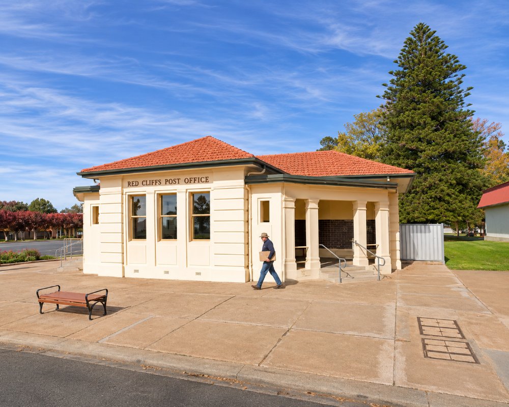
Things To Do in Red Cliffs
Big Lizzie
Big Lizzie, a 45 tonne steam-age tractor with a 60 horsepower engine and a top speed of about 3 km/h, set out from Melbourne in 1915 bound for Broken Hill. It reached Mildura in 1917 after a 17-month journey, could not cross the flooded Murray, and stayed to clear land for the soldier settlement until 1924. Found derelict in 1971, it now stands in Barclay Square on the Calder Highway and can be seen at any time.
Red Cliffs Scenic Reserve
The Red Cliffs Scenic Reserve, about 4.5 km east of town, has lookouts over the river from the high ochre cliffs and walking trails along the edge.
Historical Steam Railway
The Red Cliffs Historical Steam Railway runs on the first Sunday of the month (except January and February, because of fire danger), and on long weekends and at Easter.
Museums and Art
The Red Cliffs Military Museum and the historical society’s displays in the old courthouse tell the town’s story, and Workspace 3496 and Gallery shows local art.
Red Cliffs Country Market
The Red Cliffs Country Market, on the first Sunday of each month, is one of the biggest markets in the region.
When To Visit
Spring brings jacarandas in bloom, and autumn and winter are warm and dry. Summer is very hot.
Where To Stay
The Red Cliffs Colonial Motor Lodge has rooms. For caravans and campers, the BIG4 Red Cliffs on the Calder Highway, formerly the Red Cliffs Caravan Park, has a pool, a camp kitchen with a pizza oven and pet-friendly sites.
The Red Cliffs Colonial Motor Lodge on Jacaranda Street is family run and right in the town centre, a short walk from Big Lizzie and the pub. The BIG4 Red Cliffs is owner-operated, with cabins and campsites among shady grounds, a playground and open space for children. Kings Billabong Park, along the river to the north-east, has a bush camping area at the Red Cliffs Boat Ramp as well as Psyche Bend, Butlers Bend and Bruce’s Bend closer to Mildura; these are basic sites on dirt tracks, so check Parks Victoria for conditions after rain or when the river is high.
The Coachman Tourist Park at Irymple, about 8 km north on the Calder Highway, is the next nearest caravan park, and Mildura, 15 km north, has motels, riverside holiday parks and houseboats. For a quiet stay on the river, the Nangiloc Caravan Park is about 30 minutes south-east, and Hattah-Kulkyne National Park’s lake campgrounds are about 50 minutes south. The nearest official dump point is the free one at the council’s Benetook Works car park on Benetook Avenue in Mildura, about 15 minutes north.
Eat & Drink
The Red Cliffs Club on Heytesbury Avenue has a bistro, and the Reddy Pub serves hearty meals. Geo Origins is a cafe in a converted service station, and The Shed Cafe and the Red Cliffs Bakery are local favourites. Mildura Farms sells dried fruit and nuts, and Cappa Stone Wines has tastings.
The Reddy Pub on Jacaranda Street is the town’s hotel, with hearty meals and a laid-back front bar. The Red Cliffs Club on Heytesbury Avenue, just off the Calder Highway, adds a children’s games area and a sports lounge to its bistro, which makes it an easy family dinner. The Shed Cafe at 59 Jacaranda Street is the main coffee stop, and the Mildura Farms shop, selling locally grown dried fruit and nuts, began beside it; Coffee on Indi on Indi Avenue is another good coffee.
Look out for Mannes Desert Honey, a local honey producer. The Red Cliffs Country Market spreads over the footpaths of Indi Avenue, Ilex Street and Barclay Square on the first Sunday of each month, with more than 100 stalls of growers and makers. Cappa Stone Wines on Twenty Second Street has a cellar door for tastings.
For supplies there is a Ritchies IGA on Ilex Street and a Foodworks on Indi Avenue, and fuel on the Calder Highway through town.
History
This is the Country of the Latji Latji people. After the First World War, more than 700 soldier settlers took up blocks here from about 1920 and planted vines, with Big Lizzie helping to clear the mallee. The town celebrated its centenary in 2022.
Getting to Red Cliffs
Red Cliffs is about 530 km north-west of Melbourne, around 5 hours 45 minutes’ drive via the Calder Highway. V/Line coaches to Mildura stop here, and a bus runs daily from Mildura.
Experiences
- Historic/Heritage
- Rural/Country
- Self-Drive
Popular Activities
- Bush Walking
- Caravan and Camping
- Driving
- Fishing
- Food and Wine
- Sightseeing
- Wine Tasting
About Red Cliffs
- Locality: Urban locality
- Red Cliffs Postcode: 3496
- State: Victoria
- Region: The Murray
- Latitude: -34.30835
- Longitude: 142.18653
- Elevation: 72m
- Timezone: Australia/Melbourne
