
Port Julia, SA
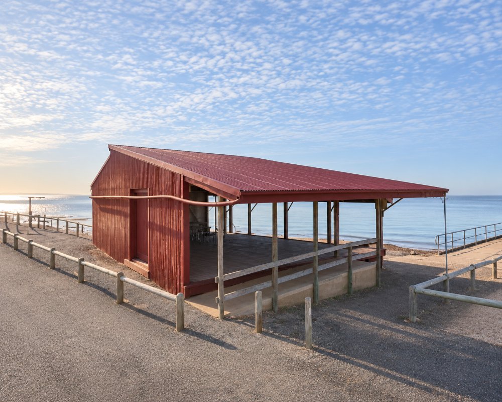
Port Julia is a settlement of about 60 people on the coast road, 18 kilometres north of Port Vincent. A short jetty and a tin shed stand below low red cliffs, with a strip of sand and a few dozen houses behind.
It was once the port for the farms around Curramulka. Today it is a peaceful swimming and fishing spot with a simple camp that takes caravans.
Known For
- A heritage-listed jetty and cargo shed
- Red cliffs and a sheltered swimming beach
- Basic, low-cost camping at the oval
Things To Do in Port Julia
Jetty and Shed
The jetty, finished in 1913, is only 72 metres long. The corrugated iron shed beside it stored bagged wheat waiting for the ketches and doubled as the district hall. Both are on the State Heritage Register.
Beach and Cliffs
The beach below the red cliffs is good for swimming at high tide and crabbing at low. There is a boat ramp.
Graham Ward Walking Trail
A path built by local volunteers follows the cliff top, with views up and down the gulf.
Walk the Yorke South to Port Vincent
From the jetty the trail follows the coast south for 4.8 kilometres to Sheoak Flat, a shack settlement where locals fish for whiting from the beach, and then 9.9 kilometres on to Port Vincent. The whole walk takes about three and a half hours one way. North of Port Julia, walkers stay on the beach for 9 kilometres to Black Point while cyclists take the highway.
Where To Stay
The Reichenbach camping ground at the Port Julia oval is run by the community. It is basic bush camping with toilets, a sheltered barbecue and non-drinking water, takes caravans and big rigs, and charges a small nightly fee collected on site. There is a dump point for campers.
A few holiday houses are let. Port Vincent has two caravan parks with full facilities.
The Reichenbach Memorial Park camping ground is run by the Port Julia Progress Association, and a caretaker lives on site; check in when you arrive, even if you only want to look around. Sites are on open grass beside the oval, with room for long rigs, and the toilets, barbecue shelter, picnic tables and dump point are shared. Port Julia has no town water, only rainwater tanks, so arrive with full tanks; the nearest places to fill up with drinking water are Port Vincent and Ardrossan.
The nearest powered sites are at the small Black Point camping ground, about 10 kilometres north, which has 13 powered sites with hot showers, and the Pine Point Caravan Park, about 15 kilometres north. Port Vincent’s two caravan parks, 18 kilometres south, have cabins, villas and camp kitchens, and the Port Vincent Motel and Apartments on Main Street is 150 metres from the water.
Eat & Drink
Nothing is sold at Port Julia. Port Vincent, 15 minutes south, has a pub, a kiosk and a general store.
There is no shop, pub or kiosk at Port Julia, so bring food, drinking water and ice. The closest meals are 18 kilometres south at Port Vincent: the Ventnor Hotel on the corner of Main Street has a waterfront bar and dining room, the Port Vincent Kiosk on the beach sells coffee, doughnuts and takeaway, and the Memorial Bowling Club puts on Friday night teas in summer. To the north, the Pine Point Caravan Park kiosk, about 15 kilometres away, sells hot takeaway, groceries and bait every day. Port Vincent has an IGA and 24-hour fuel; there is no fuel at Port Julia.
History
Port Julia is on Narungga country. It was named after Julia Wurm, whose family farmed here, and was also known as Port Curramulka. The shed dates from about 1905.
Getting to Port Julia
Port Julia is on the coast road between Pine Point and Port Vincent, about two hours and ten minutes from Adelaide. The inland road leads to Curramulka.
Experiences
- Caravan and Camping
- Nature based
- Relaxation
- Self-Drive
Popular Activities
- Beach
- Bush Walking
- Caravan and Camping
- Fishing
- Surfing
- Swimming
About Port Julia
- Locality: Rural locality
- Port Julia Postcode: 5580
- State: South Australia
- Region: Yorke Peninsula
- Latitude: -34.64752
- Longitude: 137.86852
- Elevation: 37m
- Timezone: Australia/Adelaide
