
Orient Point, NSW
Orient Point is a quiet village on the southern side of the Crookhaven River mouth, opposite Greenwell Point and just north of Culburra Beach.
Known For
- Sheltered estuary water
- A boat ramp close to the river mouth
- A quiet fishing village
Things To Do at Orient Point
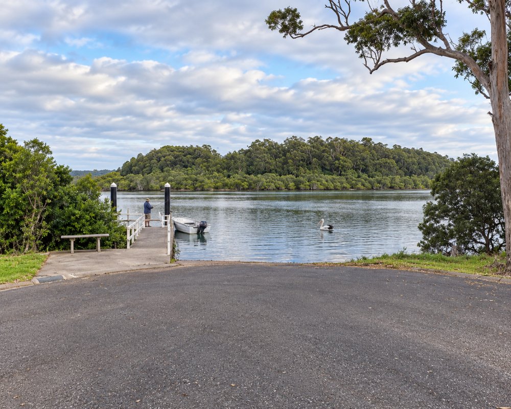
It is a place for people with a boat or a rod. The ramp gives quick access to the river and the ocean, the flats hold flathead, whiting and bream, and the foreshore reserve has picnic tables and a view across the oyster leases. The village is also home to the Jerrinja Aboriginal community.
Boat ramps and the river
Orient Point has two boat ramps and wharves close to the river mouth, making it one of the quickest launching spots for boats heading out through Crookhaven Heads to the ocean. Inside the river, the sand flats and oyster leases hold flathead, bream and whiting, and prawns run in summer.
Crookhaven Heads
The Crookhaven Heads lighthouse, built in 1904, is about 2 km east at the end of Prince Edward Avenue, reached by a short bush track. The tower is closed and in poor repair, but the headland has wide views over the river mouth and Shoalhaven Bight, and Aboriginal carved poles stand on the grassland nearby.
Where To Stay
There are a few holiday houses. Culburra Beach, five minutes away, has a holiday park and motels.
The Jerrinja Aboriginal Community is a residential community, not a place to visit, so please respect its privacy. There is no caravan park in the village.
Holiday Haven Culburra Beach, on Prince Edward Avenue about 3 km away, has powered grass and slab sites, ensuite sites, cabins, a pool, a camp kitchen and a dump point; its pet rules were unclear in 2026, so ring before arriving with a dog. Culburra Beach Motel on Brighton Parade is also about 3 km away. Across the river at Greenwell Point, about 12 km by road, Coral Tree Lodge Tourist Park has powered sites, waterfront units and a dump point. Nowra Showground Campground takes caravans and campervans only. The sealed roads from Nowra suit caravans, but the village streets are narrow, so park the van before taking the boat to the ramp.
Eat & Drink
Orient Point has no shops or cafes; everything is in Culburra Beach, about 3 km south. Fishwicks is the local cafe there, and Culburra Beach Bowlo has The Lemon Tree bistro, serving modern Australian and Asian food from Tuesday to Sunday. The Culburra shopping strip has takeaways, a supermarket and a service station. For seafood, go to Greenwell Point, where Pelican Rocks sells award-winning fish and chips and Jim Wild’s Oysters sells oysters straight from the farm.
Culburra Beach also has Mirritya Mundya, an Aboriginal-owned restaurant cooking with native ingredients (book ahead), and The Little Snapper, which does local seafood with an Asian twist.
History
Orient Point is Jerrinja country; the Jerrinja are part of the Wandi Wandian people of the Yuin nations. George Bass named Crookhaven in December 1797. The Berrys took up 155 acres here in 1836 and in the 1840s moved Aboriginal and Māori workers here from their Coolangatta estate. In 1900, 27 acres became the Roseby Park Aboriginal Reserve, run by the Aborigines Protection Board, and its school opened in 1903. Roseby Park was renamed Jerrinja after 1966, and the land passed to the Jerrinja Local Aboriginal Land Council under the 1983 Land Rights Act. Henry Halloran’s company sold the Orient Point Estate in the 1920s.
Getting to Orient Point
From Nowra, follow Greenwell Point Road, Pyree Lane and Culburra Road, then turn into Prince Edward Avenue for the village, about 25 minutes.
From Sydney it is about 180 km, around 2.5 hours, by the M1 and the Princes Highway to Nowra. The roads are sealed and suit caravans. The nearest railway station is Bomaderry, and Kennedy’s buses run a few local services from Nowra to Culburra and Orient Point.
Experiences
- Cultural
- Nature based
- Relaxation
Popular Activities
- Bird Watching
- Fishing
- Kayaking
- Sailing
- Sightseeing
- Swimming
About Orient Point
- Locality: Urban locality
- Orient Point Postcode: 2540
- State: New South Wales
- Region: South Coast
- Latitude: -34.9108
- Longitude: 150.74966
- Elevation: 24m
- Population: 611
- Median Income: $24700
- Area (Sq/km): 2.053
- Timezone: Australia/Sydney
