
Murujuga National Park, WA
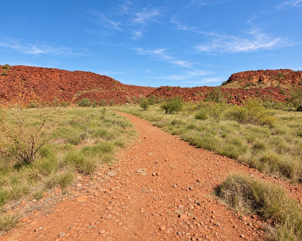
Murujuga National Park, on the Burrup Peninsula and the islands of the Dampier Archipelago near Karratha, protects what may be the densest collection of rock engravings in the world. Across its red granophyre boulders are one to two million petroglyphs, showing animals, people and symbols, including creatures long extinct on the mainland such as the thylacine. In July 2025 the Murujuga Cultural Landscape was inscribed on the World Heritage List.
The park is owned by the Murujuga Aboriginal Corporation, representing the Ngarluma, Yindjibarndi, Yaburara, Mardudhunera and Wong-Goo-Tt-Oo peoples, known together as Ngarda-Ngarli, and is jointly managed with Parks and Wildlife. It was the first jointly managed national park in Western Australia. People have cared for this country for more than 47,000 years.
Known For
- One to two million rock engravings, among the densest in the world
- World Heritage listed in July 2025
- More than 47,000 years of human presence
Things To Do in Murujuga
Ngajarli Trail
The Ngajarli Trail, formerly known as Deep Gorge, is a 700 m elevated boardwalk among the rock piles, accessible for wheelchairs and prams, with viewing platforms, seats and signs. Allow 30 to 45 minutes. Late afternoon light, when shadows deepen the shallow engravings, is the best time to see them.
Ranger-guided rock art tours
Murujuga Aboriginal Corporation rangers lead rock art tours at Ngajarli on set days of the week, lasting up to an hour and a half. Book through the Karratha Visitor Centre, and bring a hat, enclosed shoes and water.
Cultural awareness training
The Murujuga Aboriginal Corporation also runs cultural awareness sessions for visitors on set days.
Wildlife
The rocks are home to Rothschild’s rock-wallabies, Pilbara olive pythons, bats and reptiles, and shorebirds feed along the coast.
Hearson Cove
Hearson Cove, a sheltered beach about 2 km further along the road, is a good place for a swim or a picnic, and for the Staircase to the Moon.
Where To Stay
There is no camping in Murujuga National Park. Stay in Karratha, which has caravan parks including Discovery Parks Pilbara Karratha, or at the City of Karratha’s coastal camps at Cleaverville and Forty Mile, which charge a fee in the busy season. Dampier also has a small caravan park. There are no toilets at Ngajarli. Entry to the park is free, and pets are not allowed. The roads from Karratha and Dampier are sealed.
Eat & Drink
There is nowhere to eat in the park. Dampier, about 15 minutes away, has a waterfront cafe, and Karratha has restaurants and supermarkets.
History
The engravings on Murujuga span tens of thousands of years, recording changes in the landscape and sea levels. In 1868 many Yaburara people were killed in the Flying Foam Massacre. Industry arrived on the Burrup from the 1960s, including gas plants and a fertiliser plant, and the effect of emissions on the rock art is still debated. The national park was created in 2013, and the World Heritage listing followed in July 2025. A planned Living Knowledge Centre had not opened by 2026.
Getting to Murujuga
Ngajarli is about 30 minutes’ drive from Karratha and 15 minutes from Dampier. From the Dampier Highway, take Burrup Road, then Hearson Cove Road, and turn at the Ngajarli sign. Karratha Airport has flights from Perth.
The best time to visit is May to September, when it is cooler. Summers are very hot, and cyclones are possible from November to April.
Experiences
- Eco Tourism
- Nature based
Popular Activities
- Bush Walking
- National Park
- Wildlife
About Murujuga National Park
- Locality: Rural locality
- Murujuga National Park Postcode: 6713
- State: Western Australia
- Region: Exmouth & the Coral Coast
- Latitude: -20.6160
- Longitude: 116.7930
- Timezone: Australia/Perth
