
Murrurundi, NSW
Murrurundi is a small town on the New England Highway at the head of the upper Hunter Valley, 40 km north of Scone and about 315 km from Sydney. It lies in a narrow valley on the Pages River, tightly enclosed by the steep, grassy slopes of the Liverpool Range. Its main street is a heritage conservation area, and it has developed a reputation for art, antiques and good coffee.
Known For
- A heritage streetscape beneath the Liverpool Range
- Galleries and antique shops
- The King of the Ranges stockman’s challenge
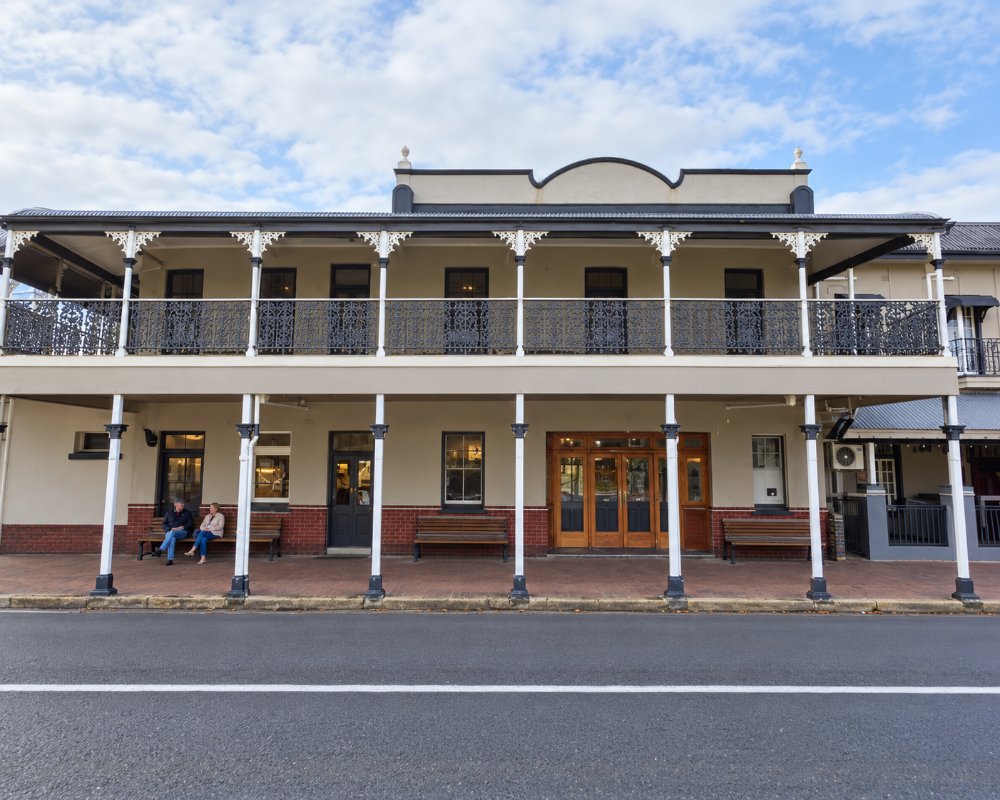
About 900 people live in Murrurundi. The highway climbs out of town over the range into the Liverpool Plains, so for travellers heading north this is the last town of the Hunter.
Things To Do
Heritage Walk
Mayne Street and the streets around it have dozens of nineteenth-century buildings, including the White Hart Hotel, the Royal Hotel with its Cobb and Co stables, the courthouse, the Literary Institute, old stores and stone churches.
Galleries
Several galleries, among them one run by a leading Sydney art dealer in a group of restored buildings, show work by established Australian artists, alongside antique and design shops.
Paradise Park and the Eye of the Needle
On the edge of town, a short walk climbs through a cleft in the rock, known as the Eye of the Needle, to a lookout over the town and valley.
King of the Ranges
On the last weekend in September, riders compete in a stockman’s challenge that includes packhorse handling, whip cracking, bareback riding and a cross-country course, with a bush festival around it.
Burning Mountain
Twenty minutes south at Wingen, a walk leads to a coal seam that has been burning underground for thousands of years.
Wallabadah Rock and the Range
North of town, the highway crosses the range at Nowlands Gap, with lookouts over the Liverpool Plains.
Pioneer Cottage and the river trail
Murrurundi Pioneer Cottage at 127 Mayne Street is an 1889 slab cottage moved into town and furnished with farm and household items. Turning the Pages is a riverside trail of laser-cut metal banners showing local plants, and corten steel sculptures mark both town entrances.
History
Murrurundi is in the country of the Wonnarua and Kamilaroi peoples.
Settlers moved into the valley in the 1820s, and the town was gazetted in 1840. It was an important stop on the Great North Road, where teamsters rested before the climb over the range. The railway reached it in 1872, and the tunnel through the range, opened in 1877, was a major engineering work of its day.
Where To Stay
Murrurundi has motels, hotels, a caravan park and several stylish guesthouses and cottages.
Murrurundi Caravan Park at 11 Bernard Street, a short walk from the main street, has powered and unpowered sites, cabins, a camp kitchen and a fire pit lit most evenings. The Valley View Motel on the highway has a pool and parking for long vehicles and trailers, the Murrurundi Motel on Mayne Street has 24-hour self check-in, and the White Hart Hotel has pub rooms. We found no official free camp or public dump point in town; ask at the visitor centre at 113 Mayne Street.
Scone has more accommodation.
Eat & Drink
The main street has cafes, a bakery, pubs and a restaurant or two.
The White Hart Hotel and the Royal Hotel have both served pub meals, but we could not confirm their current kitchen hours, so check ahead. Life of Pie at 13 Mayne Street is a bakery and cafe known for its pies, Mayne St at 59-63 Mayne Street is a cafe and pantry, and Thanh’s Bowlo at the bowling club serves Chinese and some Vietnamese dishes (closed Monday and Tuesday). Scone has the supermarkets.
Life of Pie’s pies have won awards, and it opens every day. The Michael Reid Murrurundi gallery, on the corner of Boyd and Mayne streets, has a small kiosk from Wednesday to Sunday.
Getting There
Murrurundi is on the New England Highway, about three and three quarter hours from Sydney and an hour south of Tamworth. Trains from Sydney to Armidale stop here.
North of town the highway climbs the Liverpool Range on long grades, so use a low gear with a van on the way down. The NSW TrainLink Xplorer to Armidale and Moree stops daily.
Experiences
- Cultural
- Historic/Heritage
- Rural/Country
- Self-Drive
Popular Activities
- Bush Walking
- Caravan and Camping
- Horse Riding
- Shopping
- Sightseeing
About Murrurundi
- Locality: Urban locality
- Murrurundi Postcode: 2338
- State: New South Wales
- Region: Hunter
- Latitude: -31.76369
- Longitude: 150.83494
- Elevation: 468m
- Timezone: Australia/Sydney
Accommodation In Murrurundi
Discover some of the accommodation in and around Murrurundi
