
Mount Wellington, TAS
Mount Wellington, known by its Aboriginal name kunanyi, is the mountain that rises 1,271 metres directly behind Hobart. Its dolerite cliffs and often snow-dusted summit are visible from almost everywhere in the city, and a road climbs to the top in half an hour, giving one of the great urban lookouts of the world. Around it, Wellington Park protects 18,000 hectares of forest, alpine moorland and waterfalls laced with walking and cycling tracks.
Known For
- The summit lookout, 1,271 metres above the city
- The Organ Pipes and alpine scenery
- Forest walks, waterfalls and mountain bike trails
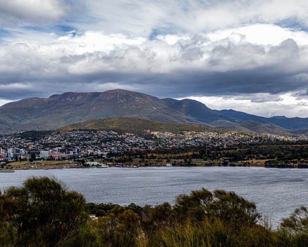
The mountain is reached from South Hobart through the village of Fern Tree, which sits on its lower slopes at about 450 metres. From there Pinnacle Road winds up through tall eucalypt forest to the Springs, a picnic area at 720 metres, and on through snow gums and boulder fields to the summit plateau.
Conditions at the top are utterly different from those in the city. It is usually around ten degrees colder, the wind can be ferocious, and snow can fall in any month, so bring warm, windproof clothing even on a summer day.
Things To Do on Mount Wellington
The Summit
At the top of the road, a stone and glass shelter and a series of boardwalks and platforms look east over Hobart, the Derwent estuary, the Tasman Peninsula and Bruny Island. To the west the view stretches across the ranges of the south-west wilderness. Sunrise is spectacular for those prepared for the cold, and on winter days the summit is the nearest place to the city to play in snow. Cloud often covers the top, so check the webcam before driving up.
The Organ Pipes
The towering columns of dolerite on the eastern face are the mountain’s most recognisable feature. A walking track from the Springs traverses beneath them, with the cliffs above and the city spread out below, and they are among the best-known rock climbing crags in Tasmania. The track links with others to make circuits of two to four hours.
Walking Tracks
There are walks for every level. From Fern Tree, an easy loop through fern gullies leads to Silver Falls, and the level Pipeline Track follows the route of the city’s nineteenth-century water supply through the forest. From the Springs, the Pinnacle and Zig Zag tracks climb steeply to the summit in about two hours. Longer routes cross the plateau to Collins Bonnet and Wellington Falls. Weather changes fast, and walkers on the upper mountain need proper gear, a map and warm clothing.
Mountain Biking
The North-South Track is a purpose-built mountain bike trail that descends from the Springs through forest and across scree to the bike park at Glenorchy, one of the best rides in the state. Operators offer guided descents from the summit by road and trail, with bikes and transport supplied.
The Springs and Fern Tree
The Springs was the site of a grand hotel that burnt down in the 1967 bushfires. It now has picnic lawns, shelters, the start of many tracks and a cafe in a converted shipping container. Fern Tree has a tavern, a small timber church built in 1893 that survived the fires, and a park with barbecues at the foot of the walking tracks.
Where To Stay
There is no accommodation on the mountain itself.
Fern Tree has a few bed and breakfasts and self-contained cottages set in forest and gardens, with wallabies at the door and walking tracks nearby. They suit visitors who want quiet and cool air ten minutes from the city.
South Hobart, at the foot of the mountain, has boutique hotels and guesthouses, including a Regency mansion hotel with mountain views. Most visitors stay in central Hobart, 20 minutes’ drive from the Springs.
Camping is not permitted in Wellington Park except by arrangement for extended walks.
The Regency mansion hotel in South Hobart is the Islington, a small luxury hotel on Davey Street with a walled garden, about 15 minutes’ drive from the Springs. Fern Tree is the closest base for walkers planning an early start or a summit sunrise, but beyond the tavern it has no shops, so bring supplies from Hobart.
Pinnacle Road is sealed but narrow and winding, with tight bends, cyclists and walkers on the road and limited parking at the Springs and the summit, so it is best driven in a car or tackled on the kunanyi / Mt Wellington Explorer Bus rather than with a caravan in tow. The nearest caravan parks are in Hobart’s suburbs: the Hobart Showground Motorhome and Caravan Park at Glenorchy, with powered sites, a dump point for paying guests and a ten-day maximum stay, and Discovery Parks Hobart at Risdon on the eastern shore, each about 30 minutes from the Springs.
Leave the van there, or park in Fern Tree at Stephenson Place or the Fern Glade car park and take the Explorer Bus, which stops at Fern Tree Park; the Fern Tree Tavern car park is for customers only.
Wellington Park closes to all users on days of extreme or catastrophic fire danger, so check the forecast in summer.
Eat & Drink
The cafe at the Springs serves coffee, toasted sandwiches and cakes to walkers and cyclists, and is the only place to buy food on the mountain. There is nothing at the summit, so bring a hot drink.
The Fern Tree Tavern offers pub meals beside a fire, and South Hobart, on the way down, has good cafes and the beer garden of the Cascade Brewery, founded in 1824 with water from the mountain’s streams.
Lost Freight, the cafe in a shipping container at the Springs, serves coffee and locally made food; its days are short and change with the season and the weather, so check opening hours before you go. The Fern Tree Tavern, on Huon Road a few kilometres below the Springs, serves meals from Wednesday to Sunday and is closed on Mondays and Tuesdays. On the way back to the city, the Cascade Brewery in South Hobart has a bar with meals, tables you can book and brewery tours.
History
The mountain is central to the culture of the muwinina people and to Tasmanian Aboriginal people today, and it was given the official dual name kunanyi/Mount Wellington in 2013. The explorer George Bass made the first recorded European ascent in 1798. It was called Table Mountain until the 1820s, when it was renamed for the Duke of Wellington. Charles Darwin climbed it in 1836.
Its springs supplied Hobart with water from the 1830s. The summit road was built by relief workers between 1934 and 1937. Bushfires in February 1967 swept the mountain and killed more than 60 people in southern Tasmania. A long-debated proposal for a cable car was refused in 2022.
Getting to Mount Wellington
By car, follow Davey Street and Huon Road from Hobart to Fern Tree, then turn onto Pinnacle Road. The summit is 21 kilometres from the city centre. The road is narrow and is closed at times by snow and ice, in which case it may be open only as far as the Springs.
A shuttle bus runs from the Hobart waterfront to the Springs and the summit several times a day, and city buses go as far as Fern Tree.
Experiences
- Active
- Mountain
- Nature based
- Self-Drive
Popular Activities
- Bush Walking
- Driving
- Mountain Biking
- Rock Climbing
- Sightseeing
About Mount Wellington
- Locality: Rural locality
- Mount Wellington Postcode: 7054
- State: Tasmania
- Region: Hobart and South
- Latitude: -42.89458
- Longitude: 147.23681
- Elevation: 1253m
- Timezone: Australia/Hobart
