
Mount Barney, QLD
Mount Barney is a massive twin-peaked mountain on the Queensland and New South Wales border, about 120 kilometres south of Brisbane beyond Rathdowney. Rising to 1,359 metres, it is the second highest peak in south-east Queensland and the centrepiece of Mount Barney National Park, a wilderness of crags, gorges, creeks and forest that forms part of the Gondwana Rainforests of Australia World Heritage Area.
Known For
- One of the great summit bushwalks of Queensland
- Gorge walks to rock pools at the Lower Portals
- Lodges, bush camps and river camp grounds beneath the peaks
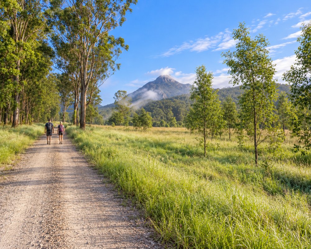
The national park covers a group of mountains: Barney itself, with its East and West peaks, and its neighbours Mount Maroon, Mount May, Mount Ernest and Mount Lindesay. Farmland along the upper Logan River and its creeks surrounds them. There is no town, only a locality of cattle properties, a lodge and several private camp grounds reached by partly unsealed roads.
This is serious bushwalking country, but there are easier walks and swimming holes for those who want to enjoy the mountain from below.
Things To Do at Mount Barney
Summit Routes
Climbing Mount Barney is a full-day undertaking of eight to ten hours, with more than a thousand metres of ascent on rough, steep, unmarked tracks. The South Ridge, often called Peasants Ridge, is the most straightforward way to the saddle between the peaks and on to the East Peak. Other routes, such as Logans Ridge and the South East Ridge, involve exposed scrambling. Walkers need fitness, navigation skills, plenty of water and an early start, and should leave details of their plans. People are rescued from the mountain every year.
Lower Portals
The most popular walk in the park is the track to the Lower Portals, about 7.4 kilometres return across ridges and creek flats to a deep, clear pool where Mount Barney Creek cuts through a rocky gorge. It takes three to four hours, with some short steep sections, and the pool is a superb place to swim on a hot day.
Shorter Walks and Lookouts
From the Yellow Pinch car park, a climb of about a kilometre leads to a lookout with a fine view of the mountain. The Cronan Creek track follows an old forestry road through rainforest to a small waterfall, about 12 kilometres return. On the northern side of the park, Mount Maroon offers a steep half-day climb to a rocky summit with one of the best views in the region.
Rock Climbing and Guided Adventures
The cliffs of Mount Maroon and other peaks have long traditional rock climbs. A lodge at the foot of Mount Barney runs guided summit walks, abseiling, navigation training and nature activities, a good option for anyone unsure about tackling the mountain alone.
Rivers, Wildlife and Stars
The upper Logan River and Mount Barney Creek have swimming holes at several camp grounds. The park protects rare plants, brush-tailed rock wallabies, glossy black cockatoos and platypus. With almost no artificial light, the night sky is brilliant.
Upper Portals
The Upper Portals track, about 8 kilometres return, leads to a gorge and its pools on Mount Barney Creek upstream of the Lower Portals. It has steep, rough sections that need rock-hopping skills, and the start at Cleared Ridge can be reached only in a 4WD.
Where To Stay
Staying near the mountain allows an early start and a well-earned rest afterwards.
A long-established lodge at Yellow Pinch, beside the national park, offers self-contained cabins and homesteads, camp sites and a camp kitchen, with walking tracks from the door.
Private camp grounds on the Logan River and on creeks around the mountain take tents, camper trailers and caravans, with river swimming and campfires. Several are large and popular with families and groups.
Remote bush camping in the national park requires a permit booked in advance. Farm stays and eco retreats are found in the valleys, and Rathdowney, 20 minutes away, has a hotel.
Mt Barney Lodge sits on about 70 acres of bush with full creek frontage. As well as its homesteads and cabins, it has glamping in deluxe camper trailers and hybrid caravans, and its unpowered creekside camping ground has hot showers, open fireplaces and a shelter shed. For powered sites, Bigriggen Camping and Caravan Park, on the Logan River near Rathdowney, takes caravans on 100 acres of river flats, and Barney View Bush Camping has five large grassy sites on the river below Mount Maroon. Kingsland Camping, surrounded by national park, is the handiest base for the Mount Maroon climb.
For a cottage, Tuckeroo Cottages has four cottages named after local birds, each with a fireplace, and a main house for up to 13.
All camping inside the park is at remote bush camps reached only on foot, with no facilities. The Lower Portals camp has three sites beside Mount Barney Creek, 3.7 kilometres from its car park. The Forestry camp at Cronan Creek is about an hour from Yellow Pinch along a fire trail, and the Old Hut Site camp, in the saddle between the peaks, is four to five hours up South Ridge. Book 3 to 6 weeks ahead, or 6 to 8 weeks for public holidays. In the Mount Maroon section, camping is allowed only at the marked remote bush camps.
Eat & Drink
There are no shops or cafes at the mountain. Visitors must bring all food, and carry at least three to four litres of water each for a summit walk. Creek water should be treated.
The hotel, cafe and store at Rathdowney are the nearest places to eat, with limited hours. Supermarkets are in Beaudesert, about 50 minutes north.
There is no food or kiosk inside the park. The nearest meals are at the Rathdowney Hotel, about 20 minutes away, which serves pub meals seven days a week. Oaky Creek Farm and Harvest Cafe, a family cafe with views of Mount Barney’s peaks, serves breakfast and lunch from local produce and has a farm shop, and The Shed at Olive and Stone Farm serves country food and cakes among olive groves. Stock up on food and fuel in Beaudesert before driving in.
History
Mount Barney is in the country of the Mununjali people of the Yugambeh language region and the neighbouring Githabul people, for whom it is a place of great spiritual significance. The first recorded European ascent was made in 1828 by Captain Patrick Logan, commandant of the Moreton Bay penal settlement, who reached the West Peak on 3 August 1828 after the botanist Charles Fraser turned back.
Timber-getters and cattlemen worked the surrounding valleys from the 1840s. The mountain was declared a national park in 1947 and was included in the World Heritage listing of the Gondwana rainforests in 1994.
Getting to Mount Barney
By car, follow the Mount Lindesay Highway from Brisbane through Beaudesert to Rathdowney, then the Boonah-Rathdowney Road and Upper Logan Road to Yellow Pinch. The drive takes about two hours. The last few kilometres are gravel.
There is no public transport and little mobile phone coverage. Check the national park alerts for closures before travelling, particularly after heavy rain or during bushfire season.
Experiences
- Mountain
- Nature based
- Self-Drive
- Soft Adventure
Popular Activities
- Bird Watching
- Bush Walking
- Caravan and Camping
- National Park
- Rock Climbing
- Swimming
- Wilderness
About Mount Barney
- Locality: Rural locality
- Mount Barney Postcode: 4287
- State: Queensland
- Region: Brisbane
- Latitude: -28.30386
- Longitude: 152.71502
- Elevation: 429m
- Timezone: Australia/Brisbane
