
Mirrabooka, NSW
Mirrabooka is a small suburb on the southern side of the Morisset Peninsula, between Brightwaters and Sunshine on Lake Macquarie.
Known For
- Views to Pulbah Island
- A quiet lake shore
- Sunrise over the water
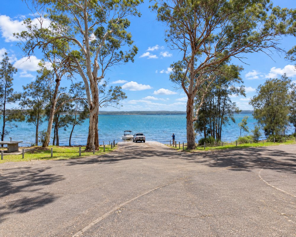
The name is an Aboriginal word for the Southern Cross. The suburb is a few streets of houses running down to the lake, and it would be wrong to suggest there is much to do.
Things To Do in Mirrabooka
Small reserves give access to the shore for fishing and paddling. Pulbah Island, a nature reserve covered in forest, lies about three kilometres to the north-east, off the tip of the peninsula, and can be circled by boat or by experienced paddlers in calm weather.
Pulbah Island Nature Reserve
The forested island is a 69 ha nature reserve managed by NPWS, important to the Awabakal people and home to sugar gliders and a breeding pair of white-bellied sea eagles. It can only be reached by boat, and there are no facilities.
Mirraview, the village that faded
Between 1934 and the early 1970s a small village called Mirraview grew on the hilltop by Fishery Point Road, with a post office, a school and a branch library. It never thrived, the services closed, and the suburb went back to the older estate name of Mirrabooka.
Sailing at Sunshine
The South Lake Macquarie Amateur Sailing Club is just around the point at Sunshine, under 2 km away, and its weekend dinghy racing in the warmer months is good to watch from the shore.
Where To Stay
Look for holiday houses, or stay at Trinity Point or in Morisset.
There is nowhere to camp. The pub at Bonnells Bay, about 5 km west, has motel rooms (it was offered for sale in 2024, so check), and the Lake Macquarie Hotel in Morisset has pub rooms. Caravans can use Morisset Showground, booked through the council, or the holiday parks at Mannering Park and Wangi Point, both more than 20 km by road.
Eat & Drink
The nearest shops are at Bonnells Bay.
The Bay Shopping Centre there has a Coles supermarket, cafes and takeaways. For a sit-down meal, 8 at Trinity at Trinity Point serves modern Australian food from Thursday to Sunday, about 6 km away. Fill up in Morisset before driving out.
History
This is Awabakal country. Lake Mac’s local history service gives the name as the Aboriginal word for the Southern Cross. The land was granted to James Stinson, and the Mirrabooka Estate was declared on 5 December 1927. Timber cutting was the main industry, with logs carted to the Morisset sawmills or shipped across the lake, and fishing and small farms filled the gaps. As Mirraview, the area had a school from 1934 to 1972 and a post office from 1936 to 1971.
Getting to Mirrabooka
Mirrabooka is about 12 minutes from Morisset and 50 minutes from Newcastle.
From Sydney it is about 125 km: leave the M1 at the Morisset exit and follow Fishery Point Road about 10 km east. The roads are sealed but hilly near the end of the peninsula. Hunter Valley Buses routes 278 and 279 run to Morisset station.
Experiences
- Nature based
- Relaxation
Popular Activities
- Bird Watching
- Fishing
- Kayaking
- Sailing
- Swimming
About Mirrabooka
- Locality: Suburb
- Mirrabooka Postcode: 2264
- State: New South Wales
- Region: Hunter
- Latitude: -33.10863
- Longitude: 151.55501
- Elevation: 52m
- Population: 728
- Median Income: $30888
- Area (Sq/km): 0.784
- Timezone: Australia/Sydney
