
Meckering, WA
Meckering is a small town on the Great Eastern Highway, about 130 km east of Perth and 32 km east of Northam, home to around 230 people. On 14 October 1968, one of the largest earthquakes ever recorded on land in Australia struck here, destroying most of the town and tearing a fault line more than 30 km long through the surrounding farmland.
This is Ballardong Noongar country. No one was killed, but the town was largely rebuilt, and today Meckering has an earthquake memorial, a preserved section of the fault line and a giant camera-shaped museum on the highway.
Known For
- The 1968 Meckering earthquake
- A preserved section of the fault line
- The Big Camera on the Great Eastern Highway
Things To Do in Meckering
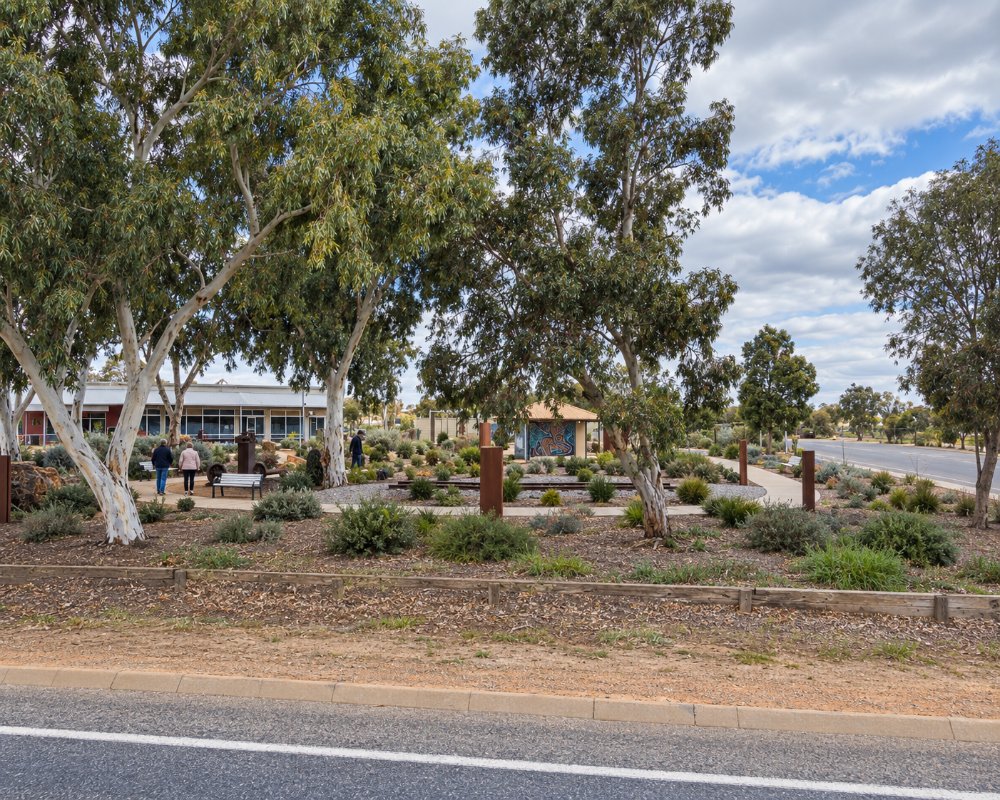
Earthquake memorial
In Memorial Park, a gazebo and rose garden display a buckled section of railway line and a twisted piece of the Golden Pipeline, along with photos of the damage.
Fault line
About 12 km south-west on the York to Meckering road, follow the Earthquake Site signs to a preserved section of the fault scarp, which was up to 2 m high.
Salisbury Farm Ruins
About 2 km north, the ruins of a 1904 stone homestead flattened by the quake have before and after photos.
The Big Camera
This museum of photography on the Great Eastern Highway is housed in a building shaped like a giant camera, with thousands of old cameras on display. Check opening days, as it is closed mid-week.
Cunderdin Museum
About 22 km east, the Cunderdin Museum has an earthquake house that simulates the shaking.
Where To Stay
Meckering has no caravan park, but self-contained travellers have used Memorial Park as an overnight stop, with toilets and a dump point; check current rules with the Shire of Cunderdin. Cunderdin, about 20 minutes east, and Northam have caravan parks. Fuel is available at the roadhouse on the highway, which is sealed.
Eat & Drink
The Ampol Meckering Roadhouse on the Great Eastern Highway sells takeaway food and fuel around the clock, and is the only place to eat in town. The town’s hotel was destroyed in the 1968 earthquake and was never rebuilt. Cunderdin’s Ettamogah Pub, about 20 minutes east, serves lunch and dinner daily, and Northam, 32 km west, has many more choices.
History
The railway reached the area in 1895, and the townsite was gazetted as Beebering that year and renamed Meckering in 1897. The Golden Pipeline passes the town. The earthquake struck at 10:59 am on 14 October 1968, injuring around 20 people and causing major damage.
Getting to Meckering
Meckering is about 130 km east of Perth on the Great Eastern Highway, around an hour and a half’s drive, and 22 km west of Cunderdin.
The best time to visit is spring, for wildflowers.
Experiences
- Historic/Heritage
- Rural/Country
Popular Activities
- Driving
- Sightseeing
About Meckering
- Locality: Rural locality
- Meckering Postcode: 6405
- State: Western Australia
- Region: Esperance & the Golden Outback
- Latitude: -31.63183
- Longitude: 117.00675
- Elevation: 200m
- Population: 236
- Median Income: $28496
- Area (Sq/km): 216.049
- Timezone: Australia/Perth
