
Kroombit Tops National Park, QLD
Kroombit Tops is a sandstone plateau rising to more than 900 metres in the ranges about 85 kilometres south-west of Gladstone and 60 kilometres east of Biloela. It is high enough to be cool and often misty, with tall blackbutt forest, rainforest gullies, cliffs and creeks. It also holds one of Queensland’s most moving wartime relics.
Known For
- The wreck of the bomber Beautiful Betsy
- Escarpment lookouts
- Remote four-wheel-drive touring and bush camping
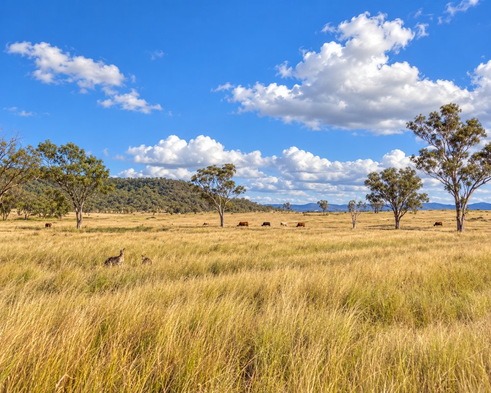
This is a park for self-reliant visitors. Roads are rough, there is no phone coverage, and the only toilet is at the main lookout. Nights are cold, even in summer.
Things To Do in Kroombit Tops National Park
Beautiful Betsy
In February 1945 an American Liberator bomber named Beautiful Betsy disappeared on a flight from Darwin to Brisbane with eight men aboard, six Americans and two British airmen. The wreck lay unfound in the forest for 49 years, until a park ranger came across it in 1994. A short walking track from The Wall day-use area leads around the scattered wreckage, with signs telling the story. The site is a war grave in spirit; leave everything as you find it. The road to it is for high-clearance four-wheel drives in dry weather only.
Kroombit Tops lookout
The lookout on the eastern escarpment has wide views over the Boyne Valley towards the coast, with a picnic area and toilets.
Loop road
A four-wheel-drive circuit of about 35 kilometres links the main features, dropping off the plateau into dry rainforest and climbing back up. Parts are one-way, steep and rocky.
Wildlife
The plateau’s creeks are the only home of the Kroombit tinker frog, a critically endangered species the size of a thumbnail. You are more likely to see glossy black-cockatoos, sooty owls and wallabies.
Planning around the weather
Weather damage in 2026 has left the park’s roads rough, and Queensland Parks recommends high-clearance vehicles for all access within the park until further notice, including the run to Griffiths Creek that is usually fine for conventional cars in dry weather. Roads can close after rain, so check the park alerts the day before you leave. The cooler, drier months suit a visit best, but pack for near-freezing nights on the plateau.
Where To Stay
There are three bush camping areas, Griffiths Creek, The Razorback and The Wall, with fire rings and nothing else. Griffiths Creek is the easiest to reach; the other two need a four-wheel drive. Permits must be booked with Queensland Parks before you arrive. Bring all your water.
Leave caravans and camper trailers at a base below the range. The closest are the Boyne Valley Community Discovery Centre at Ubobo, with powered and unpowered sites, hot showers and a camp kitchen, and the free Boynedale Bush Camp on Lake Awoonga, about 26 km west of Calliope, which has toilets, shelters and a dump point. Lake Awoonga Caravan Park, off the Bruce Highway at Benaraby, has cabins and powered sites but takes no pets.
On the Biloela side, the town’s caravan parks and motels are the natural base for the Valentine Plains approach. In the park, the Razorback camp sits in tall blackbutt forest at the end of the park’s most remote high-clearance track, while Griffiths Creek is on open grass beside the creek. Domestic animals are not allowed in the national park.
Eat & Drink
There is nothing in the park. Stock up in Gladstone, Calliope or Biloela, and carry spare fuel.
There is no food, water or fuel anywhere in the park, and no kiosk at the lookout. Calliope, about 60 km away on the Dawson Highway, has shops, pubs, fuel and highway takeaway, and Biloela, about 60 km to the west, has the same. Coming from the Boyne Valley, the Grand Hotel at Many Peaks serves meals six days a week (closed Tuesdays), but it is a long drive round by road.
History
The plateau is the country of the Gooreng Gooreng, Bailai and Gangulu peoples. It was logged for hardwood and grazed through the 1900s, became a forest reserve, and was declared a national park in stages from the 1970s.
Getting to Kroombit Tops National Park
From Gladstone, drive through Calliope and follow Tableland Road, which becomes gravel and climbs steeply onto the plateau; allow two hours. From Biloela, the route is through Valentine Plains. Neither is suitable for caravans, and both can close after rain. Check park alerts before you leave, as the park is sometimes closed entirely.
Experiences
- Historic/Heritage
- Mountain
- Nature based
- Remote
Popular Activities
- Bird Watching
- Bush Walking
- Caravan and Camping
- National Park
- Off Road Driving
- Wilderness
About Kroombit Tops National Park
- Locality: Rural locality
- Kroombit Tops National Park Postcode: 4680
- State: Queensland
- Region: Gladstone
- Latitude: -24.3700
- Longitude: 151.0100
- Timezone: Australia/Brisbane
