
Kambalda, WA
Kambalda is a mining town of two halves, Kambalda East and Kambalda West, set about 4 km apart on the western shore of Lake Lefroy, about 60 km south of Kalgoorlie. It was here in 1966 that Western Mining Corporation found the nickel that started Australia’s nickel boom, and the town was built to house the workers.
Kambalda lies in the Marlinyu Ghoorlie claim area, recognised by the Federal Court in December 2025. Nickel mining has been on care and maintenance since 2024, and gold from the nearby St Ives mine is now the main industry. For visitors, the highlights are the views over the vast salt lake from Red Hill and a free RV stop close to the shops.
Known For
- Lake Lefroy, a huge salt lake used for land sailing
- Red Hill Lookout
- Australia’s first nickel mine, opened in 1966
Things To Do in Kambalda
Red Hill Lookout
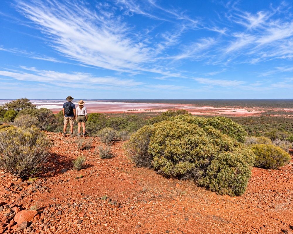
In Kambalda East, Red Hill Lookout gives sweeping views over the silver salt pan of Lake Lefroy. There are covered picnic tables and a loop walk of about 1.5 km.
Lake Lefroy
Covering around 510 square kilometres, Lake Lefroy rarely holds water, and its flat, hard surface has long been used for land sailing. It hosted international land-sailing events, although formal events have been limited in recent years.
Nullarbor Links
The Kambalda Golf Club is home to one hole of the Nullarbor Links, the world’s longest golf course, which stretches 1,365 km from Kalgoorlie to Ceduna in South Australia.
Nature reserves
Granite outcrops and bushland around the town have picnic spots, and the area is bright with wildflowers after winter rain.
Events
The Nickeltown Ute, Car and Bike Show is usually held in October. Ask at the Kambalda visitor centre in Kambalda West about what’s on.
Where To Stay
Fully self-contained vehicles can stay free for up to 48 hours on Barnes Drive in Kambalda West, beside the recreation centre, pool and skate park. The stop has a dump point and drinking water, bins and room for pets on a lead; generators and grey water on the ground are not allowed. The shops and supermarket are a short walk away. There is no commercial caravan park in town, so those wanting powered sites should stay in Kalgoorlie, about 45 minutes away.
Kambalda has fuel, a supermarket and a post office, and all roads in are sealed. The nearest hospital is in Kalgoorlie.
Eat & Drink
Kambalda’s choice is small, and it has shrunk since the nickel mines went into care and maintenance in 2024. The family-run Kambalda Hotel on Bluebush Road in Kambalda West, home of The Nickel Bar, serves pub meals and beer on tap, has a kids’ play area and rooms, and takes online orders for takeaway; locals once nicknamed it the Swinging Arms. The shire offered the café space at the recreation centre for lease from 2026, so ask locally about coffee. The shopping centre on Bluebush Road has a supermarket and fuel, and for much more choice, Kalgoorlie is about 45 minutes north.
History
Gold was found here by Percy Larkin in 1896, and the first town of Kambalda was gazetted in 1897. When the Red Hill mine closed around 1907, the town was abandoned. In the 1950s, prospectors George Cowcill and John Morgan took rock samples that led WMC geologists to the area, and on 28 January 1966 the drill hit nickel. The Silver Lake shaft became Australia’s first nickel mine, and the twin towns were built in the late 1960s and 1970s. BHP took over WMC in 2005. In 2024, falling nickel prices led to the local nickel mines and BHP’s concentrator being placed on care and maintenance.
Getting to Kambalda
Kambalda is about 60 km south of Kalgoorlie on the Goldfields Highway, around 45 minutes’ drive, and about 616 km east of Perth. The Coolgardie-Esperance Highway also runs past the town on its way south to Widgiemooltha and Norseman. Kalgoorlie has the nearest airport.
The best time to visit is April to October. Summers are hot, and winter nights are cold.
Experiences
- Historic/Heritage
- Rural/Country
Popular Activities
- Driving
- Sightseeing
About Kambalda
- Locality: Suburb
- Kambalda Postcode: 6442
- State: Western Australia
- Region: Esperance & the Golden Outback
- Latitude: -31.2083
- Longitude: 121.6433
- Timezone: Australia/Perth
