
Hamersley Range, WA
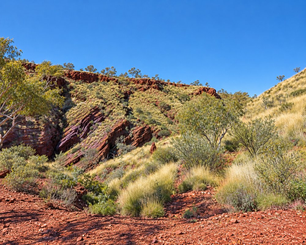
The Hamersley Range is a vast, rugged range running for about 460 km through the Pilbara, south of the Fortescue River. It holds the 20 highest peaks in Western Australia, including Mount Meharry, at 1,249 m the highest point in the state. Its red rock is some of the oldest on Earth, banded iron formations laid down about 2.5 billion years ago, and the range is both one of the world’s great iron ore provinces and home to the spectacular gorges of Karijini National Park.
This is the country of the Banyjima, Kurrama and Innawonga peoples in the Karijini area, and the Eastern Guruma further west. The mining towns of Tom Price and Paraburdoo sit within the range, and Tom Price, at about 747 m, is the highest town in Australia. For travellers, the range is best explored from Tom Price or from inside Karijini.
Known For
- Western Australia’s highest peaks, including Mount Meharry
- Banded iron rock around 2.5 billion years old
- The gorges of Karijini National Park
Things To Do in Hamersley Range
Karijini National Park
Karijini, at the centre of the range, is famous for deep, narrow gorges such as Dales, Weano, Hancock, Joffre and Kalamina, with waterfalls, pools and walks along the gorge floors. See the Karijini guide for details.
Hamersley Gorge
In the north-west corner of Karijini, Hamersley Gorge has spectacular folded rock layers and the Spa Pool. The turn-off is about 67 km from Tom Price, and the road is sealed to the lower car park and lookout.
Mount Meharry
Mount Meharry, the highest point in Western Australia, can be reached by 4WD in the dry season. Check access and conditions in Tom Price before attempting it.
Mount Nameless
Mount Nameless (Jarndunmunha), just outside Tom Price, has a lookout with sweeping views over the town and the range, especially at sunset.
Mining country
Huge iron ore mines operate around Tom Price and Paraburdoo, and the long ore trains running to the coast are a striking sight. Ask at the Tom Price visitor centre about current mine tours.
Where To Stay
Tom Price has a tourist park with powered sites and cabins, and is the main base for exploring the range. Inside Karijini, the Dales campground and the Karijini Eco Retreat offer camping and safari tents. The roads to Tom Price and through Karijini are mostly sealed, but some tracks, including the road to Mount Meharry, are gravel or 4WD only. Note that the old asbestos town of Wittenoom and the roads into its gorge are permanently closed.
Eat & Drink
Tom Price and Paraburdoo have supermarkets, cafes and a tavern. Karijini Eco Retreat has a restaurant in the park. Elsewhere in the range there are no services, so carry food, water and fuel.
History
Francis Thomas Gregory named the range in June 1861 after Edward Hamersley, a supporter of his expedition. Blue asbestos was found at Wittenoom in 1917 and mined from the 1930s until 1966, leaving a toxic legacy that led to the town’s closure. Iron ore mining began in the 1960s, when Tom Price and Paraburdoo were built. In May 2020, ancient rock shelters at Juukan Gorge, in the western range, were destroyed during mining, causing national outrage and changes to heritage laws.
Getting to Hamersley Range
Tom Price, the main town in the range, is about 1,500 km north of Perth and about 330 km south of Karratha on the Manuwarra Red Dog Highway. Paraburdoo has an airport with flights from Perth. The Great Northern Highway runs along the eastern side of the range past Karijini.
The best time to visit is May to September, when days are warm and nights cool. Summers are extremely hot, and some gorges may close in the hottest months.
Experiences
- Eco Tourism
- Nature based
- Rural/Country
Popular Activities
- Bush Walking
- Caving
- National Park
- Outback
- Rock Climbing
- Sightseeing
- Wildlife
About Hamersley Range
- Locality: Rural locality
- Hamersley Range Postcode: 6716
- State: Western Australia
- Region: Exmouth & the Coral Coast
- Latitude: -22.05444
- Longitude: 116.8875
- Elevation: 475m
- Area (Sq/km): 7312.936
- Timezone: Australia/Perth
