
Great Otway National Park, VIC
Great Otway National Park covers more than 100,000 hectares of forest, waterfalls and wild coast in the Otway Ranges, stretching from near Torquay and Anglesea past Lorne and Apollo Bay to Princetown. It takes in tall mountain ash and messmate forests, fern gullies and cool temperate rainforest, rivers tumbling over waterfalls, and long, empty beaches.
The Great Ocean Road runs through the park for much of the way, so many of its highlights are short walks from the car. Lorne, Apollo Bay, Forrest and Beech Forest are the main bases, and campgrounds range from beachside sites to quiet bush camps.
Known For
- Rainforest walks and dozens of waterfalls
- The Great Ocean Walk from Apollo Bay to the Twelve Apostles
- Beachside camping at Blanket Bay, Aire River and Johanna
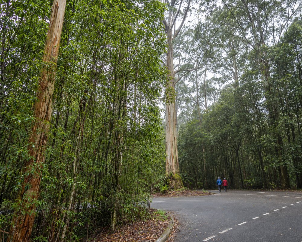
The Otways are some of the wettest country in Victoria, and it shows: moss on every log, ferns taller than a person and streams running clear and cold over the rocks. On the coast, the forest meets the sea in a line of headlands and coves, with the Great Ocean Road threading between them.
Things To Do in the Park
Maits Rest
About 17 km west of Apollo Bay, Maits Rest is an easy loop of about 1 km on boardwalks through a gully of giant myrtle beech and tree ferns, and the most accessible taste of Otway rainforest.
Waterfalls
The park has dozens of waterfalls. Near Beech Forest, Triplet Falls (a 2 km loop with stairs), Hopetoun Falls (a steep walk to the base) and Beauchamp Falls (3 km return) are among the most beautiful. Around Lorne, Sheoak Falls and the lower Kalimna Falls walks have reopened after the January 2026 storms, but Erskine Falls has been listed as temporarily closed, and Phantom Falls, Henderson Falls, the St Georges River loop and Cora Lynn Cascades remain closed. Check the current status before setting out.
Great Ocean Walk
The Great Ocean Walk runs about 100 km from Apollo Bay to the Twelve Apostles over about eight days, through forest, along clifftops and across remote beaches, with hike-in campsites that must be booked. Day sections are popular, such as Apollo Bay to Marengo, or the walks from Blanket Bay and Johanna.
Cape Otway and the Koalas
Lighthouse Road, which leads to the Cape Otway Lightstation, is lined with manna gums, and koalas are often seen in the trees. The lightstation itself, at the tip of the cape, is Australia’s oldest surviving mainland lighthouse.
Melba Gully and the Glow Worms
Near Lavers Hill, Melba Gully is a pocket of rainforest with a short loop walk, where glow worms light up the banks after dark.
Lookouts and Coastal Walks
Near Lorne, Teddy’s Lookout gives a famous view of the Great Ocean Road winding along the coast. Further east, the bush around Aireys Inlet and Moggs Creek has walks with views over the sea and wildflowers in spring.
Where To Stay
Campgrounds in the park are split between two managers. Since 1 July 2026 the Great Ocean Road Coast and Parks Authority runs the coastal sites, booked on its own website up to 12 months ahead, with camping fees halved until July 2027. Blanket Bay, off Lighthouse Road, has 22 unpowered sites by a sheltered beach, not suitable for caravans. Johanna Beach has 25 sites of varying size, some suitable for caravans. Aire River West has about 40 sites, many suitable for caravans, though large vans are not encouraged; the access roads are gravel and sand, and the Hordern Vale Road bridge has a 5-tonne limit. Allenvale near Lorne is walk-in only. In peak summer, Blanket Bay and Johanna have minimum stays.
Parks Victoria still runs the inland campgrounds, booked on its own site, including Big Hill, which takes vans but closes in winter, Hammond Road and Lake Elizabeth, which is tent-only. Free state forest camps just outside the park, such as Beauchamp Falls Reserve, Dandos and Stevensons Falls, are popular with self-contained travellers. For full facilities, base yourself at the holiday parks in Lorne, Apollo Bay or Gellibrand.
Eat & Drink
There is nowhere to eat inside the park. Apollo Bay and Lorne have the widest choice of cafes, pubs and restaurants, the Wye Beach Hotel at Wye River is a great stop on the coast road, and inland, Forrest has a brewery and general store. Carry food and water on longer walks and when camping, as the campgrounds have no shops.
History
The Otways are the Country of the Eastern Maar and Wadawurrung peoples, with the Gadubanud people of the ranges and coast. Timber cutters and selectors cleared much of the forest from the late 1800s, and lighthouses and shipwrecks shaped the coast. Great Otway National Park was created on 11 December 2005, bringing together the old Otway National Park, Angahook-Lorne State Park, Carlisle State Park and Melba Gully State Park, along with former state forest.
Getting to the Park
The park runs along the Great Ocean Road from about 100 km to 250 km from Melbourne. Lorne is about two hours from Melbourne and Apollo Bay about three. Inland roads link the coast with the Princes Highway: the Deans Marsh road to Lorne, the Forrest Apollo Bay Road, and the Colac Lavers Hill Road through Gellibrand. V/Line coaches run along the coast from Geelong to Lorne and Apollo Bay.
For campground bookings, the Great Ocean Road Coast and Parks Authority is on 1300 736 533 and Parks Victoria on 13 19 63.
Experiences
- Eco Tourism
- Nature based
- Remote
Popular Activities
- Bush Walking
- Caravan and Camping
- National Park
- Wildlife
About Great Otway National Park
- Locality: Rural locality
- Great Otway National Park Postcode: 3233
- State: Victoria
- Region: Great Ocean Road
- Latitude: -38.7578
- Longitude: 143.5613
- Timezone: Australia/Melbourne
