
Coorong National Park, SA
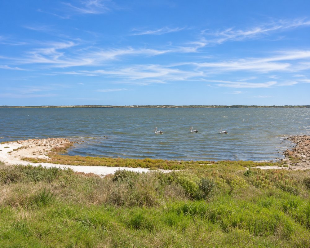
The Coorong is a long, narrow lagoon that runs for about 130 kilometres down the coast from the mouth of the Murray, cut off from the Southern Ocean by the high dunes of the Younghusband Peninsula. The national park that protects it covers nearly 50,000 hectares of water, saltmarsh, dune and beach, starting about 150 kilometres from Adelaide.
The Ngarrindjeri people call it Kurangk, the long narrow neck, and it remains the heart of their country. To many Australians it is the setting of the book and films of Storm Boy.
It is a wetland of world importance. Pelicans breed on islands in the lagoon, and tens of thousands of migratory waders arrive each summer from as far away as Siberia. The southern lagoon has become too salty in recent decades and is the subject of a long effort to restore it, but for the visitor the Coorong is still a place of big skies, strange light and very few people.
Known For
- A 130 kilometre lagoon between dunes and mallee
- Pelicans, waders and Ngarrindjeri country
- Bush campgrounds and a four-wheel drive ocean beach
Things To Do in the Coorong
Jack Point Pelican Observatory
A walk of 1.2 kilometres return leads to a shelter overlooking the islands where Australian pelicans nest. Bring binoculars. The turn-off is on the highway south of Policemans Point.
Walks
The Lakes Nature Trail, a three kilometre loop near Salt Creek, passes freshwater soaks and salt lakes. Chinamans Well, a 1.3 kilometre walk, visits a stone-lined well built about 1856 on the route that Chinese diggers walked to the Victorian goldfields. Short loops at Parnka Point explain how Ngarrindjeri people lived on the lagoon. The Nukan Kungun Hike is a two-day walk of about 25 kilometres from Salt Creek to 42 Mile Crossing.
Parnka Point
Here the lagoon narrows to about a hundred metres, dividing the northern lagoon from the southern. It is a favourite spot for kayaks, birdwatching and sunsets.
The Ocean Beach
Four-wheel drives can reach the ocean beach at 42 Mile Crossing and, in summer, Tea Tree Crossing, and can drive along the sand between the tide marks at low tide. It is soft, remote and serious driving: lower your tyres, carry recovery gear and check the tides. The beach north of Tea Tree Crossing is closed to vehicles from 24 October to 24 December each year to protect nesting hooded plovers, and erosion has made some sections hazardous.
On the Water
Cruises from Goolwa enter the northern end of the park through the barrage lock and land on the peninsula for a walk across the dunes. Guided kayak trips leave from Hindmarsh Island, and a fishing family at Meningie runs boat tours from Long Point.
Fishing
Mulloway and Coorong mullet are caught in the lagoon and from the beach. After the algal bloom of 2025, the ocean beach between the Murray Mouth and 28 Mile Crossing was still closed to recreational pipi collection in late 2026; check the current rules.
Salt Creek
The tiny settlement of Salt Creek, on the highway, has a replica of the rig that drilled for oil here in the nineteenth century, after a rubbery substance found on the lagoon was mistaken for a sign of petroleum.
Pelican Point
At the northern end of the park, Pelican Point looks out where Lake Alexandrina drains into the Coorong through the Tauwitchere barrage, and it is a good spot for pelicans, cormorants and waders. There is no public access onto the barrage itself, and fishing is not allowed within 150 metres of the barrages.
Boat and Kayak Tours
From Goolwa, Spirit of the Coorong runs a 1.5 hour Murray Mouth cruise and longer Coorong Discovery and Coorong Adventure cruises of 3.5 and 6 hours, passing through the barrage lock to the Younghusband Peninsula. Canoe the Coorong, based on Hindmarsh Island, runs guided half-day and full-day kayak tours and sunset paddles into the park. From Meningie, Coorong Wildside Tours runs small-boat trips such as its Seabird and Seals tour, where seals are often seen lazing on the barrages.
Dupang Festival
The Dupang Festival, held over three days in March 2026 on the Coorong waterfront off Long Point Road, is a celebration of Ngarrindjeri culture hosted by Ngarrindjeri elders and the Tal-Kin-Jeri Dance Group. Visitors could join weaving, carving and dance workshops, browse a First Nations market and watch a sunset smoking ceremony, with camping on Country for those who brought their own gear. Watch regional event listings for the next festival.
Where To Stay
There is no entry fee for the park, but every campsite must be booked and paid for online before you arrive. Sites are unpowered, with pit toilets at most and no bins or drinking water.
The parks service recommends 42 Mile Crossing, Parnka Point, Long Point and Mark Point for caravans, along with the caravan sites on Loop Road near Salt Creek. 42 Mile Crossing is the largest, with 30 sites among the dunes a short walk from the surf. The campgrounds further south and those on the beach are for four-wheel drives with tents or off-road campers.
Outside the park, there is a free lakeside camp at the Narrung ferry and a lakefront caravan park at Meningie, and Kingston, at the southern end, has caravan parks too.
Campsites are booked through the National Parks and Wildlife Service SA website up to 12 months ahead. Beyond the main caravan campgrounds, 28 Mile Crossing also takes caravans, Seven Mile Road has three sites with a boat launch and lookout, and the four small Loop Road campgrounds near Salt Creek, among them Hooded Plover and Malleefowl, share 14 sites. Parnka Point has 15 sites with sheltered picnic tables and a boat ramp, and Sandpiper has four short-stay sites for tents and camper trailers.
Godfreys Landing and Barker Knoll can be reached only by boat or canoe. Kartoo Road, Tea Tree Crossing, Wreck Crossing (summer only) and the ocean beach itself are four-wheel-drive camps with no facilities, and the parks service advises against towing caravans south of 42 Mile Crossing or to Tea Tree Crossing.
The tap water at 42 Mile Crossing, Parnka Point and Godfreys Landing is not safe to drink. Gas stoves are allowed except on total fire ban days. Wood fires are allowed only on the beach below the high-water mark and in set spots at 42 Mile Crossing, and not at 42 Mile Crossing from 1 November 2026 to 24 March 2027. The park closes on catastrophic fire danger days, and phone coverage is patchy.
For a roof, holiday houses on Seven Mile Road near Noonameena look over the northern lagoon. The nearest official dump points are at Meningie and Tailem Bend.
Eat & Drink
There is nowhere reliable to buy food or fuel along the Coorong. The Heart of the Coorong Roadhouse at Salt Creek has closed. Fill the tank and the esky at Meningie or Kingston.
There is no food or fuel for sale anywhere in the park, and nothing at Salt Creek. Meningie, at the northern end and 22 kilometres from Parnka Point, has the Meningie Hotel, Breeze Cafe with Coorong mullet always on the menu, the Meningie Bakery, Freshies Cafe and Bar, a Foodland supermarket and a BP for fuel. Coorong Wild Seafood in Meningie sells mullet straight from its own catch if you order ahead, and Coorong Wildside Tours runs a seafood factory tour with tastings. At the southern end, Kingston SE, 145 kilometres from Meningie, has cafes, pubs and supermarkets.
History
The Ngarrindjeri have lived on the Coorong for thousands of years, and their middens line its shores. The barrages that keep sea water out of the lakes were built in the late 1930s, changing the flow of fresh water into the lagoon. The national park was proclaimed in 1967.
Getting to the Coorong
The Princes Highway runs beside the lagoon for most of its length, from Meningie, 150 kilometres from Adelaide, to Kingston. The side roads to the campgrounds and lookouts are mostly good gravel. The northern tip, near the Murray Mouth, is reached by boat from Goolwa or by four-wheel drive along the beach.
Experiences
- Caravan and Camping
- Eco Tourism
- Nature based
- Remote
- Self-Drive
Popular Activities
- Bird Watching
- Bush Walking
- Caravan and Camping
- Fishing
- Kayaking
- National Park
- Wildlife
About Coorong National Park
- Locality: Rural locality
- Coorong National Park Postcode: 5264
- State: South Australia
- Region: Murray River Lakes and Coorong
- Latitude: -35.98742
- Longitude: 139.48193
- Elevation: 16m
- Timezone: Australia/Adelaide
