
Churchill, VIC
Churchill is a planned town in the Latrobe Valley, about 160 km south-east of Melbourne and 11 km south of Morwell. Built from 1965 to house workers for the power industry, it was named after Sir Winston Churchill, who died that year. It is a quiet, leafy place of curving streets and parks, home to Federation University’s Gippsland campus.
For visitors it is the doorway to the green Strzelecki Ranges, with Morwell National Park close by and the scenic road south to Tarra-Bulga.
Known For
- The 1960s town symbol
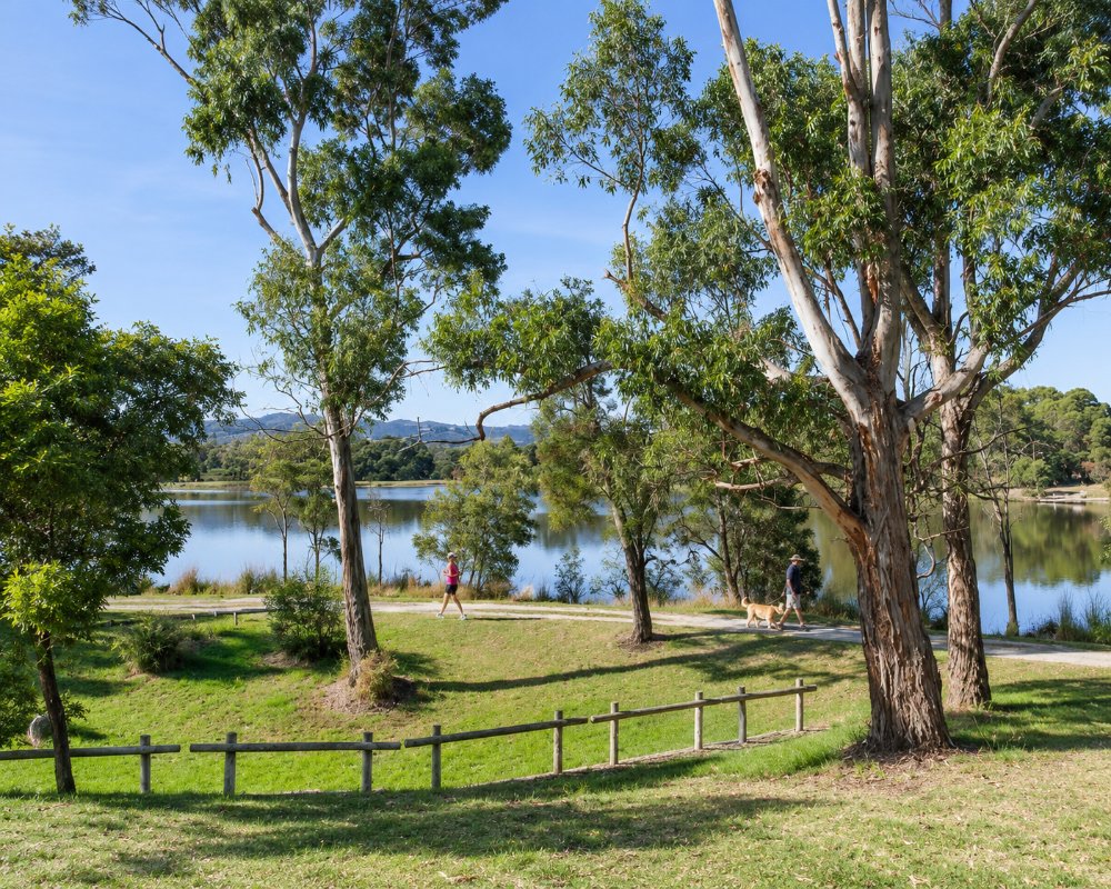
- Lake Hyland and Mathison Park
- Morwell National Park
Things To Do in Churchill
The Town Symbol
The tall golden spire in the town centre, about 32 metres high, was built by the Housing Commission as a symbol for the new town and unveiled in December 1967. Locals soon nicknamed it the Big Cigar, a nod to the town’s namesake, and it is now recognised as the Churchill Town Symbol.
Lake Hyland and Mathison Park
Lake Hyland, in Mathison Park on Mackeys Road, has a walking path and fishing decks and is a pleasant spot for a stroll or a picnic.
Federation University
Federation University’s Gippsland campus, formerly Monash University’s, is on Northways Road, and its grounds are open bushland.
Morwell National Park
Morwell National Park, about 10 km south-west, protects tall forest and fern gullies. The Fosters Gully Nature Walk is the highlight, and the park is known for its rare butterfly orchids. Dogs are not allowed.
Strzelecki Scenic Drive
The Strzelecki scenic drive heads south over the ranges through farmland and forest to Tarra-Bulga National Park, with views back over the valley.
Sport and Recreation
Churchill and Monash Golf Club has a 9-hole course, and Latrobe Leisure Churchill has a 25 metre pool. The Hazelwood Pondage, once popular for warm-water swimming and fishing, has been closed to the public since 2019.
When To Visit
Spring is the best time for the bush and the orchids at Morwell National Park. Autumn is mild and settled, while winter is cool and damp.
Where To Stay
The Churchill Hotel Motel on Balfour Place has rooms. Morwell and Traralgon, 15 to 20 minutes away, have many more motels and the nearest caravan parks.
The Churchill Hotel, at 1 Balfour Place, is a pub with accommodation, a bistro, a sports bar with a TAB and an outdoor beer garden, so dinner is on site. In Morwell, about 11 km north, Cedar Lodge Motel is a family-run motel with 27 rooms in the town centre, The Olive Tree Motel has modern rooms finished in timber and leather, and the Morwell Hotel has rooms as well as a bistro. Caravanners have two good choices close by. The Yinnar RV stop, about 9 km west at 57 Main Street, is a free community-run stop for self-contained vans and motorhomes, with a toilet, a shower, a 48-hour limit and a dump point.
Traralgon Holiday Village and BIG4 Traralgon Park Lane, about 20 km north-east, have cabins, powered and drive-through sites and pools. For a country stay, the hills south of town around Mirboo North, about 30 km away via Boolarra, have farm cottages and B&Bs. Note that the Grand Ridge Road and the back roads into the Strzeleckis are narrow, steep in places and partly unsealed, and are best left to cars.
Eat & Drink
Ziziz Cafe, on the corner of Monash Way and Marina Drive, serves breakfast and lunch, and the town centre has pizza and Chinese takeaways. The Yinnar Hotel, about 8 km west, is well known for its parmas.
The Churchill Hotel is the town’s main sit-down choice, serving classic pub meals in its bistro and out on a grassy beer garden under umbrellas and string lights, with a sports bar and TAB for race days. The pizza and Chinese takeaways in the town centre cover a quick dinner. A short drive west, Yinnar is worth the detour: the Yinnar Hotel serves country pub fare with a sunny courtyard, the old general store now houses the Yinnar Bakery and Coffee Shop with warm pies and fresh cakes, and Cafe 3869 does breakfasts and lunches with wraps, quiches, salads and burgers.
In Morwell, about 11 km north, Cafe Qu Bah at the Mid Valley Shopping Centre serves breakfast, lunch and dinner. The Churchill shopping centre covers basic groceries; Morwell has the most choice of supermarkets and fuel.
History
This is Gunaikurnai Country. Churchill was planned by the Housing Commission as a satellite town for the power industry, with building starting in 1965. It was going to be called Hazelwood, but was named after Winston Churchill instead, and a 1989 vote narrowly kept the name. The post office opened in 1966 and the shopping centre in 1967. Monash University opened its Gippsland campus here, which later became part of Federation University. In 2009 the Black Saturday fires swept through the hills nearby and 11 people died in the district.
Getting to Churchill
Churchill is about 160 km south-east of Melbourne, around 1 hour 50 minutes’ drive via the Princes Freeway and Morwell. The nearest V/Line station is at Morwell, with local buses to Churchill.
Experiences
- Historic/Heritage
- Nature based
- Rural/Country
- Self-Drive
Popular Activities
- Bird Watching
- Bush Walking
- Caravan and Camping
- Fishing
- National Park
- Shopping
- Sightseeing
