
Buxton, QLD
Buxton is a very small riverside settlement on the Burrum River, about 20 minutes east of Childers. It consists of a few streets of houses and fishing shacks on a bend of the river, a boat ramp and a park. Apart from a small general store and cafe on Hume Street, there are no shops and no accommodation to speak of. People come here for one reason, which is to get out on a quiet tidal river that is full of fish and crabs.
Known For
- A boat ramp on the upper tidal reaches of the Burrum River
- Mud crabs, barramundi and mangrove jack
- A quiet spot well off the highway
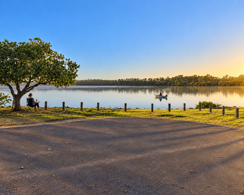
The Burrum is a broad, mangrove-lined river that meets the sea at Burrum Heads, about 15 kilometres downstream by water. At Buxton it is still tidal but sheltered and calm, with sandbanks, rock bars and side creeks. Sections of Burrum Coast National Park line the banks nearby, so the river feels remote even though the highway is not far away.
Things To Do in Buxton
Fishing and crabbing
The river is known for mud crabs, and for bream, flathead, whiting, mangrove jack, grunter and barramundi; a closed season applies to barramundi over summer. Launch a small boat at the ramp and work the rock bars and creek mouths, or fish from the bank around the top of the tide.
Paddling
Kayaks and canoes suit the river well. Paddle upstream towards the junction with the Gregory and Isis rivers, or drift down with the ebb past mangroves alive with herons, kingfishers and kites. Check tide times, as some reaches become very shallow.
Picnic by the river
The riverside reserve near the ramp has tables and shade, a pleasant place to stop for lunch on a drive between Childers and the coast.
Nearby
Woodgate, with its long beach and national park walks, is about half an hour away, and the heritage main street of Childers is 20 minutes inland.
Four rivers by boat
Buxton sits where the Isis and Gregory rivers feed into the Burrum, and with the Cherwell close by, a small boat can reach four river systems from the one ramp. The lower Burrum runs on to Walkers Point and Burrum Heads at the mouth, so a full day with the tide can take in mangrove creeks, prawning flats and the open estuary. Carry a chart or GPS, as sandbanks shift.
Burrum Coast National Park, Buxton section
The Buxton section of Burrum Coast National Park lines the river near the village. It has no facilities and camping is not allowed, but the forest edges and mangroves are good for birds from a kayak. The nearest national park camping is at Burrum Point in the Woodgate section, which is 4WD only and closed until mid-December 2026 (QPWS alert).
Where To Stay
There is no commercial accommodation in Buxton beyond the occasional holiday house.
Childers has motels and a tourist park, and Woodgate has a beachfront holiday park and many holiday houses.
There are no caravan parks or national park campgrounds at Buxton, and camping is not allowed in the Buxton section of the national park. The closest commercial stays are around Childers, about 30 km away: Childers Tourist Park & Camp off Stockyard Road, with powered and unpowered bush sites, and Lake Redbrook Holiday Retreat at North Isis, with cabins, camping and caravan sites beside a private lake. Self-contained rigs can stay up to 20 hours in the council’s Crescent Street parking area in central Childers, which has a dump point and water.
For the coast, Woodgate is about 45 minutes away and has a beachfront holiday park and many holiday houses, and Burrum Heads, at the river mouth, has its own tourist parks but is a long drive round by road through Howard. The road in is sealed and easy for caravans, and the Wharf Street ramp has trailer parking, so many anglers base themselves in Childers and tow the boat in for the day.
Eat & Drink
The general store and cafe on Hume Street is the only shop in the village. Bring food, drinking water, bait and fuel from Childers.
Beyond the general store in Hume Street, the nearest food stop is at the Farm Shed Fruit Stall on the Bruce Highway at Isis River, near the Buxton Road turn-off, which sells barista coffee, local fruit, honey, cheese and Mammino macadamia ice cream. Childers, about 30 km away, has cafes such as Insane Caffeine and Sugarbush Coffee Shop, the Grand Hotel for pub meals, and supermarkets. Fuel: none at Buxton. Fill up in Childers.
History
The river is in the country of the Butchulla and Taribelang Bunda peoples. In the nineteenth century the Burrum carried timber and coal from the hinterland to ships at its mouth, and small landings such as Buxton served the farms of the Isis district. Once the railways were built the river trade ended, and the settlement became a fishing retreat for local families.
Getting to Buxton
From the Bruce Highway south of Childers, take Buxton Road east for about 20 kilometres. The road is sealed. There is no public transport.
Experiences
- 18-35's
- Caravan and Camping
- Environmental
- Nature based
- Relaxation
- Remote
- Rural/Country
- Self-Drive
Popular Activities
- Bird Watching
- Canoeing
- Driving
- Fishing
- Fishing - Beach
- Fishing - Estuary
- Kayaking
- Sailing
- Sightseeing
- Swimming
- Wildlife
About Buxton
- Locality: Rural locality
- Buxton Postcode: 4660
- State: Queensland
- Region: Bundaberg
- Latitude: -25.19668
- Longitude: 152.53704
- Elevation: 6m
- Population: 430
- Median Income: $20020
- Area (Sq/km): 72.393
- Timezone: Australia/Brisbane
