
Burnside and Waterfall Gully, SA
The eastern suburbs of Adelaide climb gently towards the hills, and at Burnside they meet them. This is the city’s leafiest and wealthiest district, eight kilometres from the centre, with fine gardens and a smart shopping centre. Its real attraction for visitors lies at the end of a winding valley road: Waterfall Gully, where First Falls drops over a rock face into a fern-lined pool and the most popular walking trail in South Australia sets off for the summit of Mount Lofty.
Known For
- First Falls, the largest waterfall close to Adelaide
- The steep and famous walk to Mount Lofty Summit
- Koalas, creeks and gardens on the edge of the city
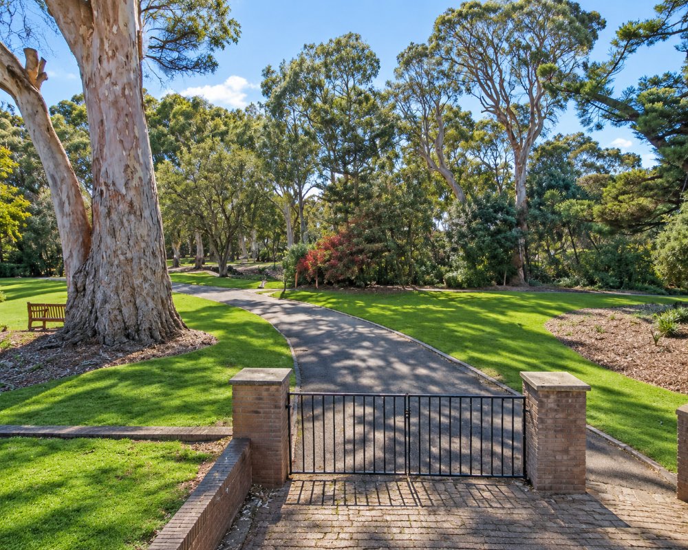
Burnside takes its name from the creek, or burn, beside which a Scottish settler built his house in 1839. Several creeks still run down from the hills through its parks, lined with huge river red gums.
Waterfall Gully is a narrow suburb of a few dozen houses strung along one road. At its end is a small car park, a heritage kiosk and the entrance to Cleland National Park.
Things To Do in Burnside and Waterfall Gully
First Falls
The waterfall is a two minute walk on a sealed path from the car park, with a viewing area at its base and steps to a lookout above. It flows strongest from June to October and can slow to a trickle by late summer. The setting, in a rocky amphitheatre, is lovely in any season.
Waterfall Gully to Mount Lofty
From the falls a well-made but steep trail climbs about 3.75 kilometres to Mount Lofty Summit, 710 metres above sea level, passing Second Falls and tall stringybark forest. Allow two to three hours return and carry water. At the top are a lookout over the whole city and gulf and a cafe. The walk is a daily fitness test for many locals, so expect company, and start early on warm days.
Koalas and Wildlife
Koalas are common in the gums along the trail and in nearby Chambers Gully, which has a quieter walking track. Cleland Wildlife Park, where visitors can walk among kangaroos and hold a koala, is near the summit in the Adelaide Hills and reached by road or by a side trail.
Hazelwood Park and Beaumont House
Hazelwood Park has a creek, old gums, a playground and an outdoor swimming centre. Close by, Beaumont House, built in 1849 and once home to the pioneer olive grower Sir Samuel Davenport, is kept by the National Trust and opens on set days with its garden and olive grove.
Mount Osmond Lookout
A short drive up from Glen Osmond Road leads to a hilltop reserve with one of the best views of the city skyline, popular at sunset.
Burnside Village
This upmarket shopping centre on Greenhill Road has Australian and international fashion labels, homewares and cafes, and has recently been enlarged.
Before You Walk
Cleland National Park and the Mount Osmond Reserve close on days of Catastrophic fire danger and may close on Extreme days, and in 2026-27 both are shut at set times for pest animal control, so check the National Parks alerts before you set out. If the main trail is crowded, the Steub Trail is a quieter 7 km return route to the summit through rocky creek lines and stringybark forest, and the Chambers Gully hike is a 7 km loop that suits walkers who want koalas and fewer people.
Where To Stay
Burnside is residential and has very little visitor accommodation beyond a few bed and breakfasts and motels on Glen Osmond Road and Greenhill Road.
Most walkers come out from city hotels, 20 minutes away. For a hills stay close to the summit, look at guesthouses around Crafers and Stirling.
For a stay right on the trail, National Parks SA lets Cleland Cottage, a self-contained country cottage near the Waterfall Gully to Mount Lofty Summit trail that sleeps up to 10 in three bedrooms, with a full kitchen and a front veranda looking over the city; book it through the National Parks site.
Closer to the shops, The Osmond Motel and Apartments on Glen Osmond Road at Fullarton, about 3 km south-west of Burnside Village, has motel rooms and apartments; parking is limited, so book a space. The Adelaide Royal Coach on Dequetteville Terrace, about 5 km west at the edge of the city, is a larger motel within walking distance of the East End.
Caravanners can base themselves at Adelaide Caravan Park in Hackney, about 6 km north-west, which has gravel powered sites and cabins beside the River Torrens; the Waterfall Gully car park is small and steep and does not suit caravans or large motorhomes.
Eat & Drink
Utopia at Waterfall Gully occupies the chalet-style kiosk built beside the falls in 1912 and serves breakfast, lunch, high tea and coffee to take on the trail. It is a busy spot on weekend mornings.
Down the hill, the Feathers Hotel at Burnside is a large, comfortable pub with a good bistro, and Burnside Village and the shops along Greenhill Road and Kensington Road have plenty of cafes.
Utopia @ Waterfall Gully, at 170 Waterfall Gully Road, sits beside First Falls in the old stone chalet and is best known for its big breakfasts, with vegetarian dishes and coffee to take on the trail; ring ahead to book a table for weekend breakfast. At the top of the climb, the Mount Lofty Summit cafe and restaurant has coffee and meals with the view over the plains, which makes a good halfway stop on a return walk.
The Feathers Hotel, at 516 Glynburn Road, Burnside, has a bistro and its Pavilion Cafe for lunch, dinner or a drink in the foothills. About 4 km north, Hibernia Cafe in the old Magill Institute building at 611 Magill Road is a local favourite for breakfast and brunch, and the cellar door and Kitchen at Penfolds Magill Estate are nearby.
Burnside Village on Greenhill Road has cafes and a supermarket, and fuel is easy to find on Greenhill and Portrush roads.
History
The gully is part of the country of the Kaurna people. Europeans were visiting the falls for picnics by the 1840s, and in 1884 the area was made a public reserve, one of the first in the colony. The kiosk was built in 1912 in the style of a Swiss chalet.
Burnside grew from a scatter of villages, vineyards and quarries into a garden suburb in the early twentieth century. It still has more street trees than almost any other council area in the state.
Getting to Burnside and Waterfall Gully
By car, follow Greenhill Road east and turn onto Waterfall Gully Road, about 20 minutes from the city. The car park at the falls is small and fills early on weekends; extra parking is further down the road, and fines apply for parking on the verge. Buses from the city run to Burnside and to the lower end of the gully road, leaving a walk of about two kilometres to the falls.
Experiences
- Active
- City
- Nature based
Popular Activities
- Bush Walking
- National Park
- Shopping
- Wildlife
About Burnside and Waterfall Gully
- Locality: Suburb
- Burnside and Waterfall Gully Postcode: 5066
- State: South Australia
- Region: Adelaide
- Latitude: -34.93650
- Longitude: 138.66003
- Elevation: 124m
- Timezone: Australia/Adelaide
