
Burakin, WA
Burakin, located in Western Australia’s Wheatbelt, is a small yet historically rich town approximately 242 kilometers north-northeast of Perth. A drive from Perth to Burakin takes around 3 hours, making it a feasible destination for those curious about regional history and rural landscapes.
Known For
- Unique seismic activity and the “Burakin Swarm.”
- Historical significance as a railway junction.
- Nearby natural attractions like Petrudor Rocks.
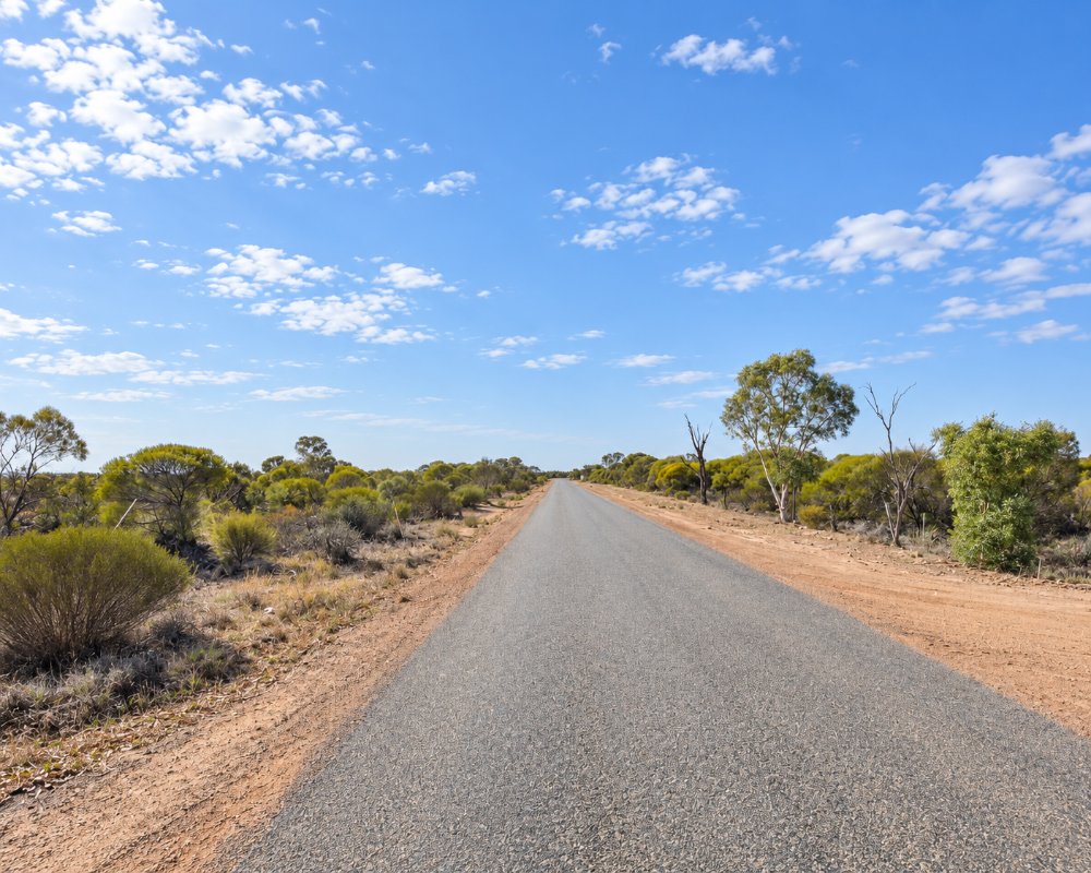
Burakin is a tiny railway junction locality on the Dowerin–Kalannie Road, about 20 km south-south-east of Kalannie and 30 km north of Cadoux, with the road east to Beacon starting here and Kulja about 12 km away. There is no shop or fuel, just the junction and the wheat paddocks around it.
Things To Do in and around Burakin
Petrudor Rocks
While Burakin itself is small, its surrounding area offers natural attractions that appeal to those seeking quiet, scenic outings. Nearby, Petrudor Rocks provides an excellent spot for picnicking and photography, especially during the wildflower season. Mollerin Rock is another nearby destination, known for its serene landscapes and opportunities to connect with nature.
Petrudor Rocks, about 15 km south-west of Kalannie, is a large granite outcrop with waterholes at its base and a rock pool that fills after good winter rain. Orchids, grevilleas and the red-flowered Kunzea pulchella grow on the rock, and it was a resting place for Aboriginal people and early travellers.
Mollerin Rock Nature Reserve
About 40 km east of Burakin, Mollerin Rock has picnic and camping areas and a toilet. You can climb the rock for wide views over the farmland, and orchids and wildflowers grow around its base from late winter into spring.
Koorda Native Flora Reserve
On Mulji Road, 16 km north of Koorda, this 28-hectare reserve has a wildflower walk trail, barbecues, tables and a toilet, and it is an easy stop if you continue south-east to Koorda.
Further Afield
For those interested in exploring further afield, Wongan Hills and Dalwallinu are within reach, offering additional points of interest, including scenic trails and local events.
Where To Stay
Accommodation options within Burakin are limited, but visitors can find comfortable lodging in neighboring towns. Wongan Hills offers motels and bed-and-breakfasts that cater to travelers, while Dalwallinu provides a mix of modern hotels and cozy farm stays. These locations also serve as convenient bases for exploring the broader Wheatbelt region.
The nearest van park is the basic Kalannie Caravan Park, also called the Rabbit Proof Fence Caravan Park, about 20 km away in Kalannie; Wongan Hills Caravan Park is the larger option further south-west. Get fuel and supplies in Kalannie or Wongan Hills.
Kalannie Caravan Park on Roche Street is a basic park for caravans, motorhomes and tents, booked through the general store in Kalannie. About 30 km south, Cadoux Recreation Ground is a free stop with water, a few powered sites and paid showers, and Mollerin Rock has bush camping with a toilet.
Dalwallinu Caravan Park, about 70 km west, has 44 powered sites and a free dump point and needs booking from July to September, and Koorda Caravan Park, about 55 km south-east, has 24 powered sites and a free dump point.
Eat & Drink
Dining in Burakin is sparse, reflecting its small population. However, nearby towns offer a variety of options for meals and refreshments. In Wongan Hills, you’ll find local cafes and family-friendly restaurants. Dalwallinu’s offerings include country-style pubs and bakeries, serving hearty meals that reflect the character of the Wheatbelt.
Visitors to Burakin should be prepared for the town’s limited amenities. Essentials such as fuel and groceries are more reliably available in nearby Wongan Hills or Dalwallinu. Planning ahead is recommended, especially for extended stays or group visits.
There is nothing to buy in Burakin. In Kalannie, the general store opens early on weekdays and on weekend mornings, there is a card-operated fuel station, and the sports and recreation club is licensed. Wongan Hills has a bakery and cafe, a hotel serving meals every day and a roadhouse, and to the south-east the Koorda Hotel serves counter lunches daily. Carry water and snacks for the rocks and reserves.
History
Burakin’s origins date back to the late 1920s when it was officially gazetted as a town. The name “Burakin” is derived from an Aboriginal word of uncertain meaning. Early development in the town was significantly influenced by its role as a railway junction, serving as a vital link in the Amery to Kalannie line. Although railway services in the area have since declined, this history remains a defining part of Burakin’s identity.
In 2000 and 2001, Burakin gained attention as the epicenter of a series of earthquakes known as the “Burakin Swarm.” These seismic events offered valuable insights into the South West Seismic Zone, solidifying Burakin’s place in geological studies.
Burakin is on Noongar country, and the Shire of Wongan-Ballidu acknowledges the Ballardong and Yued Noongar people. The road board suggested the name in 1927, first spelt Borrikin, and the townsite was gazetted in 1928. Premier Phillip Collier opened the railway through Burakin to Kulja and the Kalannie extension on 17 May 1929, and the branch east to Bonnie Rock opened on 27 April 1931. The 2021 census counted 30 residents.
Getting to Burakin
Most visitors to Burakin travel by car, enjoying the scenic route through the Wheatbelt. The journey from Perth is straightforward, following the Great Northern Highway before transitioning to local roads. Public transportation options are limited, so a personal vehicle is the most practical choice for those looking to explore the area independently.
From Perth it is about 245 km and three hours, by the Great Northern Highway to Dalwallinu and then east through Kalannie, or via Wongan Hills and Cadoux. The main routes are sealed and suit caravans, and local roads are gravel.
Experiences
- Nature based
- Rural/Country
- Self-Drive
Popular Activities
- Bush Walking
- Caravan and Camping
- Driving
About Burakin
- Locality: Rural locality
- Burakin Postcode: 6467
- State: Western Australia
- Region: Esperance & the Golden Outback
- Latitude: -30.52521
- Longitude: 117.17319
- Elevation: 355m
- Population: 32
- Median Income: $45500
- Area (Sq/km): 342.545
- Timezone: Australia/Perth
