
Bungulla, WA
Tucked into the Wheatbelt region of Western Australia, Bungulla offers a glimpse into the quieter, more grounded side of rural life. Situated just 191 km from Perth—a two-hour drive along the Great Eastern Highway—this small locality is part of the Shire of Tammin. Bungulla’s roots as a railway station turned township highlight its role in connecting people and industries across WA, making it a historically significant stopover for travelers and locals alike.
Known For
- Historic railway connections
- Nearby natural attractions like Yorkrakine Rock
- Rich agricultural heritage
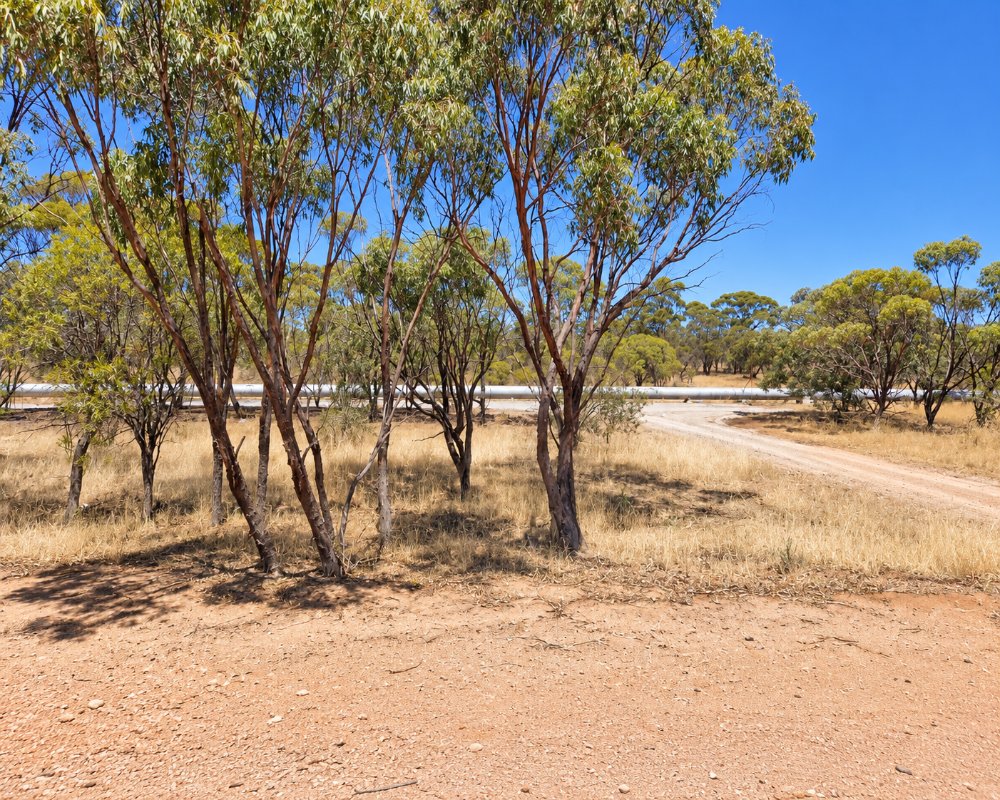
Bungulla sits on the Great Eastern Highway about 10 km east of Tammin and 12 km west of Kellerberrin, roughly 195 km from Perth. It is a scatter of farms, a grain siding and the highway, so most travellers see it on the way through, with Tammin and Kellerberrin each a few minutes away for fuel, food and a bed.
Though small in population, Bungulla plays a role in the broader Wheatbelt’s thriving agricultural sector. The town is surrounded by vast fields of wheat and canola, which paint the landscape in golden hues during harvest season. The Mediterranean-style climate, with mild winters and hot, dry summers, complements its farming activities.
Things To Do in and around Bungulla
Yorkrakine Rock
Bungulla itself may be small, but the surrounding Wheatbelt region offers numerous attractions that cater to nature enthusiasts and history buffs alike. Yorkrakine Rock, a colossal granite outcrop 26 km north of Tammin, is a highlight. The rock’s panoramic views, diverse flora, and opportunity for hiking make it a must-visit spot.
Hunt’s Well and Charles Gardner Reserve
For those interested in cultural heritage, Hunts Well—a historic site south of Tammin—offers insight into the life of 19th-century explorers. Constructed by Charles Hunt in 1865, this well represents the ingenuity of early settlers in sustaining life in WA’s arid regions. Another nearby gem is the Charles Gardner Reserve, which bursts into color with wildflowers during winter and spring.
Kadjininy Kep
Kadjininy Kep, located in Tammin, combines functionality and beauty. This hydrology model and amphitheater doubles as an educational site and a space for local performances, providing an excellent opportunity to unwind in a serene setting.
Tammin’s main street also has a fenced dog exercise area with lawn, a water point and long-vehicle parking, which suits caravan travellers with pets.
Kellerberrin Hill Lookout
A winding sealed road climbs past granite outcrops to a lookout and picnic area above Kellerberrin, looking over the town, the railway and the farmland towards Lake Baandee. It is a stop on the Golden Pipeline Heritage Trail and a good leg-stretch when towing.
Cunderdin Museum
About 34 km west, Cunderdin‘s museum is in the old No. 3 pumping station of C. Y. O’Connor’s Goldfields Water Supply Scheme and tells the story of the pipeline, the railway and Wheatbelt farming.
The Granite Way and Mount Stirling
South of Kellerberrin, the Granite Way is a 60 km self-drive trail linking granite outcrops and reserves across the Kellerberrin, Bruce Rock and Quairading shires. Mount Stirling, about 22 km south of Kellerberrin, has gnamma holes, a summit cairn from Ensign Dale’s 1830 expedition and a colony of rock-wallabies.
Where To Stay
Visitors to Bungulla and the surrounding areas will find simple yet welcoming accommodations. Tamma Village in Tammin is the Shire’s aged housing, not tourist lodging, so look to Kellerberrin or Cunderdin for rooms. For travelers on the move, the Tammin Caravan Site provides convenient camping facilities.
The Tammin Caravan Site at Donnan Park has a dump point, and Kellerberrin Caravan Park is about 12 km east of Bungulla; both are on the sealed Great Eastern Highway.
The shire-run Tammin Caravan Site at Donnan Park has a large parking area for vans and motorhomes, a few powered outlets and plenty of unpowered space, with toilets, hot showers and barbecues, and its dump point is reached by a separate road to the south. Book online through the shire.
Kellerberrin Caravan Park, on the corner of George and Moore streets under Kellerberrin Hill, has powered sites, budget rooms with shared facilities, a camp kitchen and a new toilet block. Kellerberrin also has the Kellerberrin Motel Hotel on Massingham Street, the pet-friendly Rest Away Cottage and The Prev, a historic guesthouse on George Street. For a free bush camp, Kwolyin campground on the Granite Way has toilets and a camp kitchen.
Eat & Drink
When it comes to dining, the Tammin roadhouse on the Great Eastern Highway ensures that essential supplies and quick meals are always within reach. For a more authentic Wheatbelt experience, consider visiting local cafes in Kellerberrin or Cunderdin, which serve hearty meals and refreshing beverages.
Bungulla has no shop or pub, so Kellerberrin has the best choice. On Massingham Street, the highway through town, the Kellerberrin Pie Shop and Bakery does pies and slices (closed Mondays), the Harvest Cafe opens for breakfast and lunch on weekdays and Saturday morning, and the Kellerberrin Motel Hotel serves pub meals every evening.
The Farmers Co-op IGA in Kellerberrin covers groceries, and the United Fuels Roadhouse is open around the clock with fuel and hot food. Bring a picnic if you plan to spend the day at Yorkrakine Rock or Charles Gardner Reserve, which have tables but no other facilities.
History
Bungulla began its journey in the early 20th century as a railway station, vital to the movement of goods and people in the Wheatbelt region. Officially gazetted in 1910, its name originates from “Bun-Galla,” an Aboriginal term referring to the area above the hips—a nod to its local cultural significance. While Bungulla remains modest in size, its historical importance is felt across the region, particularly in the development of Western Australia’s agricultural backbone.
Today, remnants of its past can still be found, from old railway sites to the stories of settlers who called this area home. The enduring connection between Bungulla and the Wheatbelt’s farming traditions provides visitors with a chance to step back in time while appreciating the resilience of rural communities.
Bungulla lies on Noongar country, close to where Ballardong lands around Tammin meet Njaki Njaki lands around Kellerberrin. Surveyor Charles Hunt passed through in 1864 and 1865, sinking wells along his track east from York. The railway to Southern Cross opened through the district in 1894 and 1895, and the Goldfields Water Supply pipeline followed in 1903. The townsite never grew beyond a siding, and today the district is wheat, canola and sheep country.
Getting to Bungulla
Reaching Bungulla is straightforward, whether by car or train. The Great Eastern Highway offers a scenic route from Perth, weaving through picturesque farmland and quiet townships. Alternatively, the Transwa Prospector stops at nearby Tammin and Kellerberrin (some stops must be booked ahead), with a short drive to Bungulla. This reliable rail link makes Bungulla an ideal destination for a stress-free day trip or weekend getaway.
The Great Eastern Highway via Northam, Meckering and Cunderdin is a sealed road that carries road trains, so it suits caravans of any size. There is no train stop at Bungulla itself.
Basic amenities are centered around nearby towns like Tammin, which provide access to schools, medical services, and community hubs. For those seeking a slower pace of life or a weekend retreat, Bungulla and its surrounds deliver a refreshing escape from urban hustle.
Experiences
- Historic/Heritage
- Rural/Country
- Self-Drive
Popular Activities
- Caravan and Camping
- Driving
- Sightseeing
About Bungulla
- State: Western Australia
- Region: Esperance & the Golden Outback
- Timezone: Australia/Perth
