
Brim, VIC
Brim is a very small grain town on the Henty Highway, about 15 minutes north of Warracknabeal and around 350 km north-west of Melbourne. It is a quiet place of a few houses, an old hotel and a row of grain silos, set on the Yarriambiack Creek in the flat wheat country of the northern Wimmera.
Those silos made Brim famous. In 2015 and 2016 the artist Guido van Helten painted four huge portraits of local farmers on them, the first silo artwork in Victoria and the beginning of the Wimmera Silo Art Trail.
Known For
- Victoria’s first painted silos
- The start of the Silo Art Trail
- A creekside camp at Redda’s Park
Things To Do in Brim
The Brim Silos
Guido van Helten’s portraits of four local farmers, painted over the summer of 2015 and 2016, cover the old grain silos beside the highway and are best seen in the early morning or late afternoon light. They inspired the Silo Art Trail, which now links painted silos from Rupanyup in the south to Patchewollock in the north.
Redda’s Park
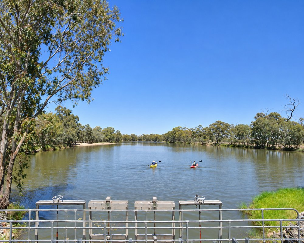
Redda’s Park, beside the weir pool on Yarriambiack Creek, has walking tracks, a playground and barbecues, and the pool is used for swimming in summer when it holds water.
James Simson’s Grave
On Simson Street, the grave of James Simson, who died in 1858, is the last marked grave of the old Brim Station cemetery, a reminder of the district’s pastoral beginnings.
When To Visit
Spring is the best time to visit the northern Wimmera, when the wheat is green, wildflowers line the roadsides and the weather is mild. Autumn is also pleasant, while summer can be very hot, often above 40 degrees, and winter nights are cold and frosty. The silos look their best in the soft light of early morning and late afternoon, so plan to arrive then, or stay overnight at Redda’s Park and see them at both ends of the day. From Brim the rest of the Silo Art Trail is an easy day’s drive: Sheep Hills and Rosebery to the south, and Lascelles and Patchewollock to the north.
Redda’s Park and the Weir Pool
The Brim Lions Club built Redda’s Park in 2001 on the foreshore of the Brim Weir Pool, a dammed stretch of Yarriambiack Creek. When the pool holds water, small boats and kayaks are allowed, and walking tracks follow the creek. It is a good place to stretch your legs between the Brim and Rosebery silos.
More About the Silos
The four GrainCorp silos that Guido van Helten painted were built in 1939, and his portraits of a quartet of local men and women farmers were painted in a soft, translucent spray technique that makes them look almost ghostly from close up. Park off the Henty Highway and walk round to the side of the silos: the faces change with the angle and the light.
Where To Stay
Redda’s Park has powered and unpowered sites with amenities, barbecues and a playground, an easy overnight stop for caravans on the Henty Highway. The nearest dump point is at Warracknabeal, which also has a caravan park and motels.
Redda’s Park is run as a low-cost council camp, with a large gravel area that takes big rigs and plenty of unpowered sites as well as the powered ones. Bring drinking water and everything you need, as Brim has no shop or fuel. The Henty Highway is sealed and flat in both directions and suits caravans of any size.
For a full caravan park, cabins or a motel room, Warracknabeal is about 24 km south. Heading north on the trail, Lake Lascelles Cabins and Camping at Hopetoun, about 55 km away, has powered sites on the lake foreshore, free unpowered camping around the lake, cabins, a camp kitchen and a laundry. Further north again, the free Lions Caravan Park in Woomelang has hot showers and a few powered sites. Fill up with fuel in Warracknabeal before you head into the Mallee, where towns are 20 to 40 km apart and some have no fuel at all.
Eat & Drink
The Brim Hotel, built in 1886, reopened in 2024 after six years closed and has served meals and pizza several nights a week, and in November 2025 it was sold to a local family, who reopened it that December. There is no general store, so bring supplies from Warracknabeal.
Brim is a one-pub town. The Brim Hotel on Swann Street, a short walk from the Henty Highway, is now run by a local family who reopened it in December 2025 with a community focus. It serves dinner each night it trades and a cooked or continental breakfast, which makes it handy for travellers staying at Redda’s Park. The new owners have been fixing up the old fireplaces and adding an outdoor area with a community barbecue space at the back. It is closed on Mondays and Tuesdays, so plan around that, and check opening hours before you go.
There is no store, cafe or fuel in Brim. Warracknabeal, about 24 km south, is the place for supermarkets, cafes, bakeries and fuel, so stock up there before you drive north on the Silo Art Trail.
History
This is Wotjobaluk Country. The name Brim is said to mean a spring or well of water. The town grew with the railway, which arrived in 1893, and the grain silos that now carry the famous artwork were built to handle the district’s wheat.
Getting to Brim
Brim is on the Henty Highway about 25 km north of Warracknabeal. V/Line coaches between Ararat and Ouyen stop at Brim, connecting with trains at Ararat.
Experiences
- Cultural
- Historic/Heritage
- Remote
- Rural/Country
- Self-Drive
Popular Activities
- Caravan and Camping
- Driving
- Sightseeing
