
Bribie Island, QLD
Bribie Island is a long, low sand island at the northern end of Moreton Bay, about an hour’s drive north of Brisbane. It is the only island in the bay reached by a bridge, which makes it the easiest of all to visit. The southern end is a relaxed seaside community with calm beaches on one side and surf on the other; the rest, about four-fifths of the island, is national park and forest.
Known For
- Calm-water beaches on Pumicestone Passage and surf at Woorim
- Four-wheel driving and camping in Bribie Island National Park
- Dugongs, dolphins and hundreds of bird species
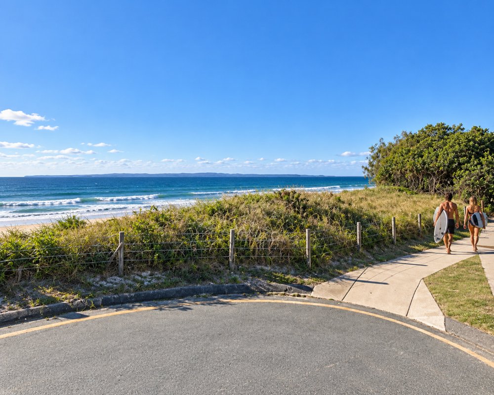
The island is about 34 kilometres long and up to eight wide, separated from the mainland by Pumicestone Passage, a shallow, sheltered waterway of sandbanks, mangroves and seagrass that is protected as a marine park. Its northern tip lies just off Caloundra, though the only road access is from the south.
Across the bridge, Bongaree and Bellara face the passage, with a waterfront park, a jetty and views to the Glass House Mountains. Banksia Beach, to the north, has canals and a golf course, and Woorim, on the ocean side, is the island’s small surf town. Many residents are retirees, and the pace is gentle.
Things To Do on Bribie Island
Bongaree and the passage
The foreshore at Bongaree is ideal for families, with a long jetty for fishing, shallow sandy swimming spots, playgrounds and barbecues under the trees. Hire a kayak, a tinnie or a barbecue pontoon to explore the passage, or join a cruise to look for dolphins, turtles and dugongs. Sunset over the mountains is the daily show.
Woorim Beach
On the eastern shore, Woorim has a patrolled surf beach with usually gentle waves, sheltered by Moreton Island, and a view across the bay to its sandhills. It is the closest surf beach to Brisbane on the north side.
Bribie Island National Park
With a high-clearance four-wheel drive and a vehicle permit, you can drive north along Ocean Beach from Woorim for about 20 kilometres, or follow sandy inland tracks to the passage side. Camping areas include Ocean Beach on the surf side and Poverty Creek and Gallagher Point on the passage, with others reached only by boat. Near the northern end are the concrete gun emplacements of Fort Bribie, built in the Second World War to guard the shipping channel.
Walks and birdwatching
The Bicentennial Trails, which start at the Community Arts Centre at Banksia Beach, loop through paperbark wetland, wallum heath and eucalypt forest, with spring wildflowers. At Buckleys Hole, at the southern tip, a bird hide overlooks a lagoon visited by spoonbills, ducks and migratory waders. More than 350 bird species have been recorded around the passage.
Museum and butterfly house
The Bribie Island Seaside Museum at Bongaree, free to enter, tells of Matthew Flinders’ landing in 1799, the castaways who lived with the islanders in the 1820s, and the reclusive artist Ian Fairweather, who painted in a hut here for 20 years. The volunteer-run Butterfly House, open on set days, lets visitors walk among hundreds of native butterflies.
Where To Stay
Most accommodation is in holiday apartments and houses at Bongaree, Bellara and Woorim, with a few motels and resort-style complexes near the golf courses.
There are caravan parks at Bongaree and Woorim, and bush camping in the national park for those with a four-wheel drive or a boat; camping and vehicle permits must be bought in advance. School holidays are busy, as the island is a favourite with Brisbane families.
The council’s Bongaree Caravan Park is on Welsby Parade, across the road from the passage near the bridge and the jetty, with powered sites close to the shops; it reopened in March 2026 after its water lines were renewed. On the ocean side, Bribie Island Caravan Park at Woorim, now part of Hampshire Holidays, is a two-minute walk from the beach and has cabins, powered sites and a dump point for guests. Just before the bridge on the mainland, BIG4 Sandstone Point Holiday Resort has villas, safari tents and camp sites, with a water park and the hotel next door.
In the national park, Ocean Beach camping area has more than 60 sites behind the dunes, and Poverty Creek, Gallagher Point, Mission Point and Lime Pocket sit on the passage side; all must be booked online in advance. Some low-lying passage sites close on very high tides, so check the park alerts before you go. For a roof, Bribie Waterways Motel, On The Beach Resort at Woorim and the rooms at the Bribie Island Hotel in Bellara are good options.
Eat & Drink
Fish and chips on the Bongaree foreshore is the island tradition, with seafood shops and cafes along the waterfront. The Bribie Island Surf Club at Woorim has meals with an ocean view, and the island’s hotels and clubs offer bistro dining. Just before the bridge on the mainland side, the Sandstone Point Hotel is a large waterfront venue known for its oyster shed and outdoor concerts.
Eating out on Bribie is low-key and spread across three centres: the passage front at Bongaree and Bellara, the shops around First Avenue and Toorbul Street, and Woorim on the surf side. Clubs play a bigger part than on most of the coast, and several run courtesy buses. Most cafes close by mid-afternoon, so plan dinner at a club, pub or the surf club.
Waterfront dining
The Surf Club Bribie Island, on First Avenue at Woorim, has the island’s best ocean view from its bistro and bar, looking across the bay to the sandhills of Moreton Island. Annie Lane Cafe, on Toorbul Street at Bongaree, looks over Brennan Park and the passage and is an all-day brunch cafe known for oversized milkshakes. Across the bridge, Bribie Beach Shack at Sandstone Point is a casual alternative to the big hotel next door.
Cafes and bakeries
Ikigai Cafe and Workshop, on Toorbul Street, is a relaxed community cafe with specialty coffee, matcha and a seasonal menu, and runs workshops and events. Kenilworth Island Bakery on First Avenue is the island outpost of the well-known hinterland bakery, with doughnuts, pies and savoury pastries.
Pubs and clubs
The Bribie Island Hotel on Sylvan Beach Esplanade in Bellara has a renovated bistro and a beer garden near the water. Bribie Island RSL in Bongaree is the island’s biggest club, with a restaurant and a courtesy bus, and the Bribie Island Bowls Club is another friendly spot for a meal. The Bribie Island Golf Club at Woorim has a licensed bar and restaurant open daily beside its 18-hole course.
Seafood and takeaway
Savige’s Seafood on First Avenue in Bongaree is an old-fashioned seafood shop selling the day’s catch, cooked or raw. Buy a parcel and eat it at the picnic tables on the Bongaree foreshore while the sun goes down behind the Glass House Mountains. Community markets are held in Brennan Park on several Sunday mornings a month; the visitor information centre has the dates.
History
Bribie Island is the country of the Joondoburri people, part of the Kabi Kabi nation, who knew it as Yarun. Matthew Flinders landed at the southern end in 1799, the first recorded European landing in what is now south-east Queensland, and named Pumicestone River for the pumice he found on the shore. In 1823 three shipwrecked timber-getters were sheltered here by the islanders for months before they were found by the explorer John Oxley.
Steamers brought day-trippers from Brisbane from 1912, and the bridge, opened in 1963, turned the island into a place to live as well as visit. During the Second World War it was a major training ground for Australian and American troops.
Getting to Bribie Island
From Brisbane, follow the Bruce Highway north and take the Bribie Island Road exit near Caboolture; the bridge is about 20 kilometres east of the highway and the whole drive is around 70 kilometres. Buses run from Caboolture station to Bongaree and Woorim. There is no road from the island to the Sunshine Coast; to reach Caloundra, return to the highway.
Experiences
- Active
- Caravan and Camping
- Eco Tourism
- Island
- Nature based
- Relaxation
Popular Activities
- Beach
- Bird Watching
- Caravan and Camping
- Cruising
- Diving
- Fishing
- Fishing - Estuary
- Kayaking
- National Park
- Off Road Driving
- Reef
- Swimming
- Wildlife
About Bribie Island
- Locality: Rural locality
- Bribie Island Postcode: 4507
- State: Queensland
- Region: Sunshine Coast
- Latitude: -26.91396
- Longitude: 153.11278
- Elevation: 12m
- Area (Sq/km): 37.807
- Timezone: Australia/Brisbane
Accommodation In Bribie Island
Discover some of the accommodation in and around Bribie Island
