
Baralaba, QLD
Baralaba is a small town on the Dawson River, about 145 kilometres south-west of Rockhampton and well off the main highways. It is a quiet cattle, cropping and coal town with a river that draws campers and anglers.
Known For
- Neville Hewitt Weir
- Saratoga and yellowbelly fishing
- A peaceful riverside camp
About 300 people live here. The town has a bowls club hotel, a store, a small museum and a hospital.
Things To Do in Baralaba
Neville Hewitt Weir
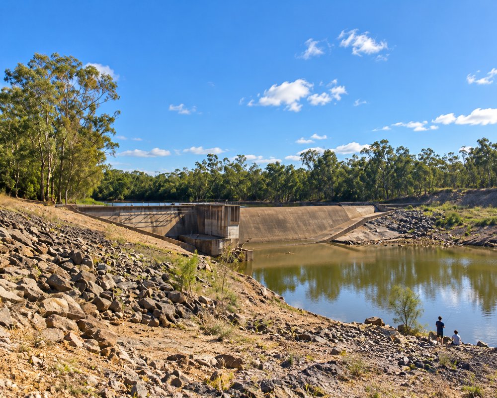
The weir on the edge of town backs the river up for many kilometres, making a long, calm stretch for boating, water-skiing and fishing. The camping area beside it has toilets, showers and a boat ramp, and is cheap.
Fishing
The Dawson holds saratoga, yellowbelly, sleepy cod and, since stocking, barramundi.
Museum
A volunteer museum tells the story of the town and its early coal mine. It opens by arrangement.
Baralaba History Loop
Banana Shire’s self-drive Baralaba History Loop starts and finishes in town and takes in the sites of the early coal mines, including the heritage-listed Dawson Valley Colliery, which made Baralaba one of central Queensland’s first coal towns after mining began in about 1901. The town takes its name from an Aboriginal word for a high mountain, after nearby Mount Ramsay.
Country events
Baralaba holds a campdraft in March, its agricultural show in May and the Saratoga Fishing Competition on the Dawson in September, when the weir camp fills up, so arrive early in those weeks.
Where To Stay
The weir camping area is the main choice, as the old Baralaba Hotel burned down in 2024.
The Neville Hewitt Weir camp is on Bedford Street at the southern end of town, on the bank of the Dawson. It is a spacious, level, mostly grassy area with 30 unmarked sites, shade and sun, a toilet block with coin-operated hot showers and a boat ramp; no booking is needed. Banana Shire has put up signs setting out the conditions of stay, and police and council officers can move on campers who break them. The bowls club hotel lists no rooms. Moura, about 45 km south, has two council camps by the Dawson Highway: Apex Park, 7 km west of town on the river, with 60-plus shady sites that suit big rigs, and Rotary Park, with 15 unpowered sites and a three-night limit.
Duaringa’s Mackenzie Park, on the Capricorn Highway to the north, allows 48-hour stays. Check road surfaces before towing: Banana Shire has been sealing the Baralaba-Woorabinda Road, parts of the Fitzroy Developmental Road towards Duaringa are still being upgraded, and the Dawson floods after big rain, so check QLDTraffic before towing.
Eat & Drink
The Baralaba Bowls Club Hotel serves meals, and the store sells takeaway and supplies.
With the Baralaba Hotel lost to fire in August 2024, the Baralaba Bowls Club Hotel at 1 Lew Drake Drive is now the town’s pub and main place for a meal. It serves dinner with specials every night, has takeaway and outdoor tables, a bar, bottle shop and Keno, and is family friendly; it does not serve meals on Christmas Day or Good Friday. Beyond that, food choices are thin, so bring supplies for a stay at the weir.
Moura, about 45 km south, has the nearest cafes, bakery, pubs and supermarket. Supermarket: the town store for basics; otherwise Moura. Fuel: treat fuel as uncertain and fill up in Moura, Biloela or on the Capricorn Highway before you come.
History
This is Gangulu country. Coal was mined here from the early 1900s, making Baralaba one of the oldest coal towns in central Queensland, and a modern mine operates nearby.
Getting to Baralaba
From Rockhampton, drive south through Mount Morgan and turn west at Dululu, or come from the Capricorn Highway at Duaringa through Woorabinda. From Moura it is about 50 minutes north.
Experiences
- Active
- Caravan and Camping
- Farm/Station
- Remote
- Rural/Country
- Self-Drive
Popular Activities
- Bush Walking
- Caravan and Camping
- Driving
- Fishing
- Fishing - Estuary
- Golfing
- Skiing - Water
About Baralaba
- Locality: Urban locality
- Baralaba Postcode: 4702
- State: Queensland
- Region: Capricorn
- Latitude: -24.18111
- Longitude: 149.81123
- Elevation: 97m
- Population: 314
- Median Income: $30576
- Area (Sq/km): 373.307
- Timezone: Australia/Brisbane
