
Balga, WA
Balga is a lively suburb located just 13 kilometers north of Perth’s central business district in Western Australia. Known for its welcoming community and evolving infrastructure, Balga offers a mix of suburban charm and urban convenience. For those traveling from Perth, it’s an easy 20-minute drive, making it a convenient escape from the city while still staying connected.
Known For
- Cultural diversity and community events
- Recreational facilities, including parks and sports centers
- Educational opportunities and local markets
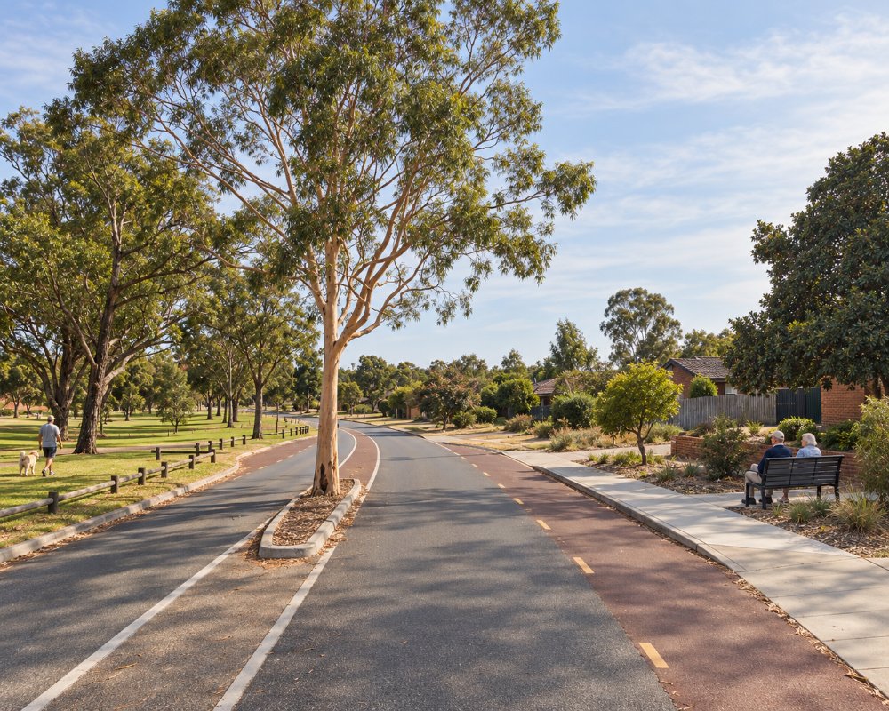
Balga is bounded by Wanneroo Road, Reid Highway, Mirrabooka Avenue and Beach Road, with Balcatta across Wanneroo Road to the west and Dianella to the south-east.
Balga is home to a diverse population of over 12,000 people. It boasts a vibrant mix of cultures, with residents hailing from Australia, India, Vietnam, Myanmar, and other nations. This blend enriches the local culture, visible in the variety of community events, dining options, and educational opportunities.
The median age of residents is 32, reflecting a balanced mix of families, young professionals, and retirees. With local schools, vocational training institutions, and family-friendly spaces, Balga caters to individuals and groups across life stages.
Education is a cornerstone of Balga’s appeal. The suburb is home to several primary schools, Balga Senior High School, and a campus of North Metropolitan TAFE. These institutions provide a variety of educational opportunities, from foundational learning to advanced vocational training.
Balga also boasts excellent amenities, including shopping centers like Fieldgate Square, health services, and recreational facilities. These features ensure a high quality of life for residents and convenience for visitors.
Things To Do in and around Balga
Princess Wallington Reserve and Bina Parkland
Balga offers several green spaces and recreational facilities. Princess Wallington Reserve is a favorite spot, complete with barbecues, cricket nets, fitness gear and playgrounds. The park serves as a hub for community activities, from sports events to leisurely picnics.
Another highlight is Bina Parkland within the reserve, with a skate plaza, BMX tracks, a parkour area and a regional playground. For those seeking more action, the Xtreme Ice Arena in neighbouring Mirrabooka provides indoor skating for visitors of all ages.
Bina Parkland also has a fenced dog park, shaded picnic areas and paths for a walk or ride, which makes it a handy stop for travellers with children or dogs who need a break from the car.
Mirrabooka Friday Market
The long-running Balga Friday Markets moved from Princess Wallington Reserve in 2019 and now run as the Mirrabooka Friday Market, held weekly from 7am to noon behind the Herb Graham Recreation Centre, selling new and second-hand goods.
It sells fruit and vegetables, plants, tools, clothes and second-hand goods, so bring cash and your own bags, and profits go back to local sport, schools and community groups.
Koondoola Regional Bushland
Just north of Beach Road, about 2 km away, Koondoola Regional Bushland is a large remnant of banksia and jarrah woodland managed by the City of Wanneroo. Sandy walking tracks wind through it, with wildflowers and small bush birds in late winter and spring.
Xtreme Ice Arena
The ice rink at 15 Chesterfield Road, Mirrabooka, about 3 km east, runs general skating sessions, ice hockey, a children’s session with snow play and bumper cars on ice. Session times change with school holidays, so check before you go.
Where To Stay
Balga has no hotels, motels or holiday parks; it is a residential suburb and visitors stay in neighbouring areas.
The nearest caravan park is Kingsway Tourist Park at Madeley, about 7 km north, with powered sites, cabins and chalets. For hotel rooms, the Perth CBD and Northbridge, 13 km south, have the widest choice, and Scarborough, about 13 km west, has beachfront hotels and apartments.
Eat & Drink
Balga’s dining scene is as diverse as its population. From casual eateries to specialized cuisines, there’s something for every palate. Local favorites include Vietnamese, Burmese, African and Chinese eateries around Fieldgate Square, which showcase the area’s culinary richness.
Fieldgate Square on Princess Road has a supermarket and a run of small Vietnamese, Burmese, African and Chinese eateries and grocers, good for a cheap lunch or ingredients you will not find in a standard supermarket. Mirrabooka Square, about 2 km east, is the area’s main shopping centre, with major supermarkets, a food court and more Asian and African restaurants nearby on Yirrigan Drive.
History
Balga’s name originates from the Noongar word for the iconic grass tree, Xanthorrhoea preissii. This connection to the land highlights the area’s cultural and natural significance, which continues to attract residents and visitors alike.
Balga’s history dates back to 1954 when its name was officially adopted. The suburb was part of the “Mirrabooka Project,” developed by the State Housing Commission. Streets were planned in the late 1950s, and housing developments followed in the 1960s and 1970s. This planned approach has contributed to Balga’s organized layout and community-focused amenities.
The area’s indigenous heritage remains an essential aspect of its identity, with the name “Balga” serving as a nod to the rich traditions of the Noongar people. Over the decades, Balga has grown into a multicultural hub, reflective of Perth’s broader diversity.
Balga is on the country of the Whadjuk people of the Noongar nation. The land was part of a grant made to T. R. C. Walters in 1840 and was used for market gardens and poultry farms, and in 1950 the State Housing Commission resumed land here for the planned Mirrabooka satellite city, which was never finished. Balga Primary School opened in 1965 and Balga Senior High School in 1970.
Getting to Balga
Balga is well-connected through an efficient public transport network. Transperth buses service the area, with routes like 374 and 375 linking it to Mirrabooka bus station and neighbouring suburbs, and routes 386, 389 and 970 running to the city. The proximity to main roads such as Wanneroo Road and Reid Highway makes it easy to travel by car.
Balga is about 13 km from the Perth CBD, a 20-minute drive via Wanneroo Road or Alexander Drive and Reid Highway. There is no train station; the nearest are Stirling and Warwick on the Yanchep line, and the high-frequency 970 runs along Mirrabooka Avenue to the city.
For those exploring the area, the convenient transportation options make Balga an accessible and appealing destination.
Experiences
- City
- Cultural
Popular Activities
- Bush Walking
- Shopping
- Sightseeing
About Balga
- Locality: Suburb
- Balga Postcode: 6061
- State: Western Australia
- Region: Perth & surrounds
- Latitude: -31.86129
- Longitude: 115.84319
- Elevation: 75m
- Population: 12685
- Median Income: $29172
- Area (Sq/km): 5.245
- Timezone: Australia/Perth
