
Kendenup, WA
Kendenup is a small farming town on the Albany Highway, about 22 km north of Mount Barker and 70 km north of Albany. It’s a quiet place today, but it has a surprisingly colourful history, from one of WA’s first big sheep stations to the colony’s first gold mine and an ambitious 1920s settlement scheme that collapsed within a few years.
The town sits in rolling farmland with views to the Stirling Range and the Porongurups, making it a handy, peaceful base for exploring both national parks. Around 420 people lived in the locality at the 2021 census.
Kendenup lies on Menang Noongar country, and the area was once known as Moorilup.
Known For
- WA’s first gold mine (1874 to 1876)
- The Hassell family’s 1840 sheep station
- C.J. De Garis’s 1920s settlement scheme
- Views to the Stirling and Porongurup ranges
- Gilberts Wines cellar door
Things To Do in Kendenup
Historic Sites
Signposted sites around town tell Kendenup’s story. The remains of the old gold mine and stamp battery are on Jellicoe Road, off the Albany Highway, though they’re in poor condition. Several 1920s brick buildings from the De Garis era still stand on Hassell Avenue, and a sign marks the site of a World War II camp where Italian prisoners of war were based. The Hassell family homesteads are heritage-listed but on private land and not open to the public.
Stirling Range and Porongurups
The Stirling Range, with Bluff Knoll, the highest peak in the south of WA, is about 45 minutes east, and Porongurup National Park, with its granite domes and the Granite Skywalk, is about 30 minutes south-east. Both are best in spring, when the wildflowers are out.
Around Town
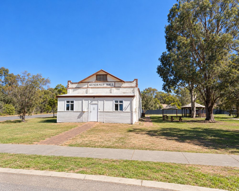
Kendenup has a skate park, giant chess pieces and a town hall that hosts local markets. The upper Kalgan River runs nearby, and spring brings wildflowers to the roadsides.
Where To Stay
Kendenup’s agricultural grounds have about 25 caravan and camping sites, including powered sites, with hot showers and drinking water, making them a cheap, quiet stop for caravanners. Group and farm stays are available, and Mount Barker, 20 minutes south, has a caravan park, motels and B&Bs. Fill up with fuel in Mount Barker. The Albany Highway is sealed all the way.
Eat & Drink
Gilberts Wines, on the Albany Highway just south of town, has a cellar door and wine café in an old apple-packing shed with views to the Porongurups. Check its opening days before you go, as they vary. Mount Barker has more cafés, a bakery and pub meals, and the wineries of the Mount Barker area are a short drive south.
History
In 1831 the explorer Alexander Collie passed through with the Menang man Mokare. In 1840 Captain John Hassell bought land here and named his farm Kendenup, and it grew into one of the biggest sheep stations in the south of the colony, running about 30,000 sheep by the early 1870s.
In 1872 Hassell sent gold samples to Perth hoping to claim a government reward, and the Standard Gold Mining Company was set up in 1874 with a small stamp battery south of town. It crushed only a few tons of rock before it was wound up in 1876. It was WA’s first gold mine, though not, as is sometimes claimed, its first gold find.
In 1920 the Melbourne promoter C.J. De Garis bought the Kendenup estate and sold small farms to around 350 families, building a brickworks and a dehydrating factory. The scheme collapsed in 1923, two Royal Commissions followed, and only about 30 families stayed. During World War II, Italian prisoners of war worked on farms in the district.
Getting to Kendenup
Kendenup is about 345 km south-east of Perth, roughly four hours’ drive via the Albany Highway. Mount Barker is 22 km south and Albany about 70 km. Transwa coaches between Perth and Albany run along the Albany Highway.
Experiences
- Historic/Heritage
- Rural/Country
Popular Activities
- Shopping
- Sightseeing
About Kendenup
- Locality: Rural locality
- Kendenup Postcode: 6323
- State: Western Australia
- Region: Margaret River & the South West
- Latitude: -34.486
- Longitude: 117.629
- Timezone: Australia/Perth
