
Cape to Cape Track, WA
The Cape to Cape Track is one of Australia’s great coastal walks, running about 130 km along the Leeuwin-Naturaliste Ridge from Cape Naturaliste Lighthouse in the north to Cape Leeuwin Lighthouse in the south. Almost all of it lies within Leeuwin-Naturaliste National Park, and it passes Yallingup, Gracetown, Prevelly and Hamelin Bay along the way.
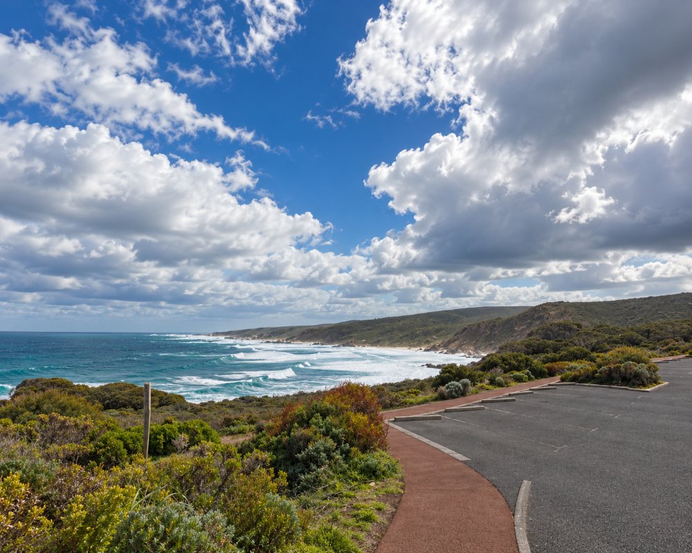
Walkers cross windswept clifftops, long stretches of soft beach sand, granite headlands, quiet river mouths and the tall karri of Boranup Forest. Most people take five to seven days to walk the whole thing, but many more do it in sections or simply walk a few kilometres as a day trip. The track is free to walk.
You’ll see lengths quoted anywhere from 123 km to 135 km, because some measurements include the link trails at each end. The parks service now gives it as 130 km.
Known For
- About 130 km between two lighthouses
- Five to seven days end to end
- Clifftops, beaches and karri forest
- Free walk-in campsites for walkers
- Whales close to shore from May to December
Walking the Track
Sections
The Friends of the Cape to Cape Track split it into five sections: Cape Naturaliste to Yallingup, Yallingup to Gracetown, Gracetown to Redgate, Redgate to Hamelin Bay, and Hamelin Bay to Cape Leeuwin. Most walkers cover 20 to 25 km a day. Many go north to south, which keeps the sun behind you for most of the day.
Best Day Walks
Good short sections include Cape Naturaliste to Sugarloaf Rock (3.4 km, sealed and suitable for prams), Smiths Point to Injidup Beach (5.8 km), Moses Rock to Quininup Falls (1.9 km, best in winter when the falls run) and Redgate Beach to Conto Road (6.6 km). Each can be walked as a return trip or with a car shuffle.
River Crossings
About halfway along, the track crosses the mouth of the Margaret River. For most of the year you can wade across at the mouth, but after heavy winter rain it can be unsafe, and walkers should take the signposted inland detour. Boodjidup Brook is the only crossing with a proper bridge.
Guided and Supported Walks
Several operators run guided walks, pack-free trips with luggage transfers and a bed each night, or self-guided packages with shuttles. These suit walkers who don’t want to carry a full pack or camp. The Friends of the Cape to Cape Track publish the official guidebook and maps.
Before You Go
Carry three to four litres of water a day in warm weather, and more if you’re camping. Dogs, bikes and horses aren’t allowed. Parts of the track can close on days of extreme fire danger and during prescribed burns, and short diversions have been in place during recent upgrades, so check DBCA’s park alerts before setting out.
Where To Stay
Four free walk-in campsites along the track, at Mount Duckworth, Moses Rock, Ellensbrook and Deepdene, are for walkers only. They can’t be booked and have no shelters, but each has a long-drop toilet, a picnic table and a rainwater tank. Treat the water before drinking it, and don’t rely on the tanks in late summer, when they can run dry. Only fuel stoves are allowed.
Walkers can also use the vehicle campgrounds at Conto, Point Road and Boranup, which must be booked through Park Stay WA, and Hamelin Bay Holiday Park near the southern end. If you’d rather sleep in a bed, the track passes close to Yallingup, Gracetown, Prevelly, Margaret River and Augusta, which all have guesthouses, cabins or caravan parks. Caravanners can base themselves at a park in Dunsborough, Margaret River or Augusta and walk the track as day sections.
Eat & Drink
There are no shops on the track, so carry your food. Yallingup and Prevelly have cafés and small stores close to the track, and the Cape Leeuwin lighthouse café makes a good finish. Margaret River, about 10 km inland from Prevelly, has supermarkets for restocking mid-walk.
History
Wadandi people walked this coast long before Europeans arrived, and in 1831 a party of settlers walked north from Augusta via Cape Naturaliste on their way to the Swan River. In the 1980s local walker Jane Scott scouted a coastal route, a Bicentennial grant in 1988 helped get the project going, and the Friends of the Cape to Cape Track formed in 1998. The track officially opened in April 2001.
Between 2023 and 2026 a state-funded upgrade rebuilt sections near Smiths Beach, Moses Rock, Gracetown and Bobs Hollow, added new boardwalks and stairways, and put 3D coastline maps at the trailheads.
Getting to the Cape to Cape Track
The northern trailhead at Cape Naturaliste Lighthouse is about 265 km south of Perth, roughly three hours’ drive, and the southern end at Cape Leeuwin is about 325 km away. Coaches run from Perth to Dunsborough, Margaret River and Augusta, and local transfer services can drop walkers at trailheads.
Spring and autumn are the best times to walk. Summer is hot and dry, and winter brings storms and high river crossings.
Experiences
- Eco Tourism
- Nature based
Popular Activities
- Bush Walking
- National Park
- Wildlife
About Cape to Cape Track
- Locality: Walking trail
- Cape to Cape Track Postcode: 6285
- State: Western Australia
- Region: Margaret River & the South West
- Latitude: -33.975
- Longitude: 114.99
- Timezone: Australia/Perth
