
Leeuwin-Naturaliste National Park, WA
Leeuwin-Naturaliste National Park is a long, narrow strip of coast that follows the Leeuwin-Naturaliste Ridge for roughly 120 kilometres, from Cape Naturaliste near Dunsborough to Cape Leeuwin outside Augusta. It is Western Australia’s most visited national park, with millions of visits a year, and it is easy to see why. In a single day you can stand under two working lighthouses, walk down into limestone caves, watch surfers at some of the country’s best-known breaks and drive through tall karri forest.
The park was not created in one go. It grew out of many small coastal reserves set aside from the early 1900s onward, and today it covers more than 19,000 hectares, threaded between farms, vineyards and the small towns of the Margaret River region. This is Wadandi country. The Wadandi, a Noongar people sometimes called the Saltwater people, have lived along this coast for tens of thousands of years, and many of the caves hold deep cultural meaning.
There is no vehicle entry fee, so most visitors simply drive Caves Road, which runs the length of the park, and pull in wherever the coast looks good. The park’s information centre is at Calgardup Cave on Caves Road, south of Margaret River.
Known For
- The 130 km Cape to Cape Track between two lighthouses
- Limestone caves including Jewel, Lake, Mammoth and Ngilgi
- Surf breaks at Yallingup, Injidup and Margaret River
- Whale watching from May to December
- Boranup karri forest and Boranup Drive
Things To Do in the Park
Lighthouses at Both Ends
Cape Naturaliste Lighthouse, built in 1903 from limestone quarried at Bunker Bay, stands at the northern tip of the park and has a whale-watching platform at its base. At the southern end, Cape Leeuwin Lighthouse is the tallest lighthouse on mainland Australia, at 39 metres, and looks out over the point that Australians treat as the meeting of the Indian and Southern oceans. Both run guided tower tours every day except Christmas Day.
Caves
More than a hundred caves have been recorded in the limestone ridge, and six are open to visitors. Ngilgi Cave near Yallingup, Mammoth Cave, Lake Cave and Jewel Cave are run by the Capes Foundation, with Lake and Jewel seen on guided tours and Mammoth and Ngilgi self-guided. For something more hands-on, Calgardup Cave and Giants Cave are self-guided adventure caves run by the parks service, where you are handed a helmet and torch and left to explore. Giants Cave involves ladders and scrambles, and it is closed from May to September outside school holidays.
Walks and Lookouts
The Cape to Cape Track links the two lighthouses, but you don’t need a week to enjoy it. The sealed 3.4 km path from Cape Naturaliste to Sugarloaf Rock suits prams and assisted wheelchairs, and the short stretch from Moses Rock to Quininup Falls is best in winter when the falls are running. The Rabbit Hill lookout above Yallingup, opened in 2024, has wide views over the surf. Other favourites include Canal Rocks, Wyadup, the 1857 Ellensbrook Homestead and the walk to Meekadarabee Falls behind it.
Boranup Forest
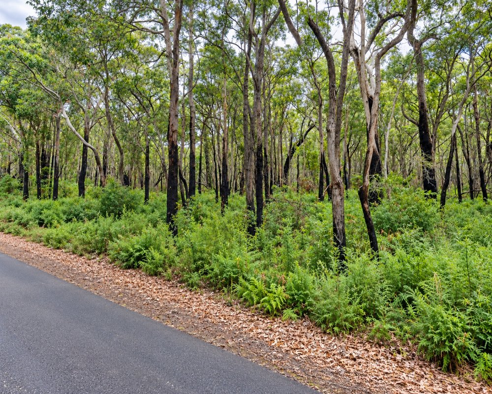
Boranup Drive is a 14 km gravel road through regrowth karri forest between Caves Road and the coast. The karri here are unusual because they grow on limestone and sand rather than the loam they normally prefer, and most have regrown since the area was clear-felled for timber more than a century ago. Stop at Boranup Lookout for a view out to the ocean. The road suits two-wheel-drive cars but not caravans.
Surf, Swimming and Whales
Surfers come for Yallingup, Injidup and the Main Break at Surfers Point near Prevelly, home of the Margaret River Pro. For calmer water, try Bunker Bay, Hamelin Bay or the sheltered Geographe Bay beaches around Meelup. Humpback and southern right whales pass close to shore from May to December.
This coast can be dangerous. King waves have swept people off the rocks at several spots, including the Injidup Natural Spa, so check the swell, stay off wet rocks and never turn your back on the sea.
Where To Stay
The park has several campgrounds run by the parks service, and all of them must be booked through Park Stay WA, up to 180 days ahead. Older guides that say first come, first served are out of date. Conto Campground, off the now-sealed Conto Road south of Margaret River, is the biggest and has areas set aside for caravans and camper trailers, with toilets, barbecue shelters and picnic tables but no power or showers. Jarrahdene Campground, beside the remains of an 1896 timber mill on Caves Road, is the other main option. Boranup Campground is tiny and only suits tents and small campervans, and Point Road Campground is four-wheel drive only.
There is no free camping anywhere in the Shire of Augusta-Margaret River or the City of Busselton, and sleeping in a vehicle counts as camping. Pets are not allowed in the park. Hamelin Bay Holiday Park, a private park on a lease inside the national park, has powered sites big enough for large caravans and fifth-wheelers. Otherwise, the caravan parks in Dunsborough, Yallingup, Margaret River, Prevelly, Gracetown and Augusta are all close by, and the towns along the park have motels, cabins, B&Bs and winery stays.
Eat & Drink
There are no shops inside the park, but you are never far from food. The Cape Leeuwin lighthouse precinct has a café, and Jewel Cave has the Deepdene Café. Bunkers Beach House at Bunker Bay is popular for breakfast and lunch, and Caves House Hotel at Yallingup has been looking after visitors since the early 1900s. The wineries, breweries and cafés of the Margaret River wine region sit just inland along Caves Road.
Fill up with fuel in Dunsborough, Cowaramup, Margaret River, Karridale or Augusta, as there is none at the beaches or the capes.
History
Wadandi people have cared for this coast for tens of thousands of years, and in Wadandi belief the caves are a passage to the afterlife. The Dutch ship Leeuwin sighted the south-west corner in 1622. In 1801 Matthew Flinders named Cape Leeuwin, while the French Baudin expedition named Cape Naturaliste and Geographe Bay after its two ships.
Settlers arrived at Augusta in 1830, and from the 1880s Maurice Coleman Davies ran karri mills at Karridale, Boranup and Jarrahdene, shipping timber from jetties at Hamelin Bay and Flinders Bay. Davies’ firm also built the Cape Leeuwin Lighthouse in the 1890s. The park was pieced together from scattered coastal reserves through the twentieth century, and the Cape to Cape Track opened along its length in 2001. A $2.7 million upgrade that began in 2023 added new lookouts, boardwalks and trailhead maps and sealed Conto Road, so expect the odd short closure while the last works finish.
Getting to the Park
The park begins about 255 km south of Perth. Take the Kwinana Freeway and Forrest Highway to Bunbury, then the Bussell Highway through Busselton to Dunsborough for the northern end, about three hours’ drive. Caves Road then runs south through the park to Augusta, about 320 km and three and a half hours from Perth. Busselton Margaret River Airport is about 30 minutes from Dunsborough, and coaches run from Perth to Busselton, Dunsborough, Margaret River and Augusta.
Spring, from September to November, brings wildflowers, orchids, whales and good walking weather. Summer is busy and fire bans apply in park campgrounds, while winter brings big swell and running waterfalls. Parts of the park can close on days of extreme fire danger, so check DBCA’s park alerts before you go.
Experiences
- Eco Tourism
- Nature based
Popular Activities
- Bush Walking
- National Park
- Wildlife
About Leeuwin-Naturaliste National Park
- Locality: National park
- Leeuwin-Naturaliste National Park Postcode: 6285
- State: Western Australia
- Region: Margaret River & the South West
- Latitude: -33.95
- Longitude: 115.00
- Timezone: Australia/Perth
