
Mount Dandenong, VIC
Mount Dandenong is the highest peak of the Dandenong Ranges, at about 633 metres, and the small locality on its slopes, about 45 km east of Melbourne. From the summit there is a famous view over the whole of Melbourne, from the Yarra Valley around to the city towers and Port Phillip Bay, and on clear nights the city lights spread out below like a carpet.
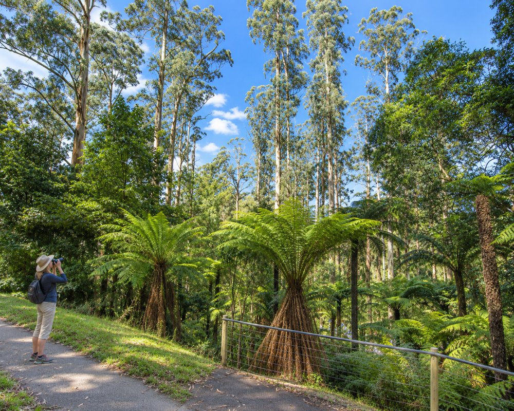
The locality is mostly forest, gardens and houses strung along the Mount Dandenong Tourist Road and Ridge Road, between Olinda and Kalorama, with lookouts, picnic grounds and walking tracks on every side.
Known For
- The SkyHigh view over Melbourne
- The William Ricketts Sanctuary
- Forest walks and picnic grounds
Things To Do in Mount Dandenong
SkyHigh Mount Dandenong
SkyHigh, at the summit on Observatory Road, has a lookout terrace, gardens, a cafe and restaurant, all with views over Melbourne. The company that ran it went into liquidation in 2026, and SkyHigh reopened in August 2026 under an interim operator while the lease is sold, so check what is open before you go. The view from the summit is the main draw, and it is spectacular at sunset.
William Ricketts Sanctuary
The William Ricketts Sanctuary, on the Tourist Road, is a forest garden filled with more than 90 clay sculptures by William Ricketts, who lived here and spent decades sculpting Aboriginal people and spirits emerging from rocks and tree ferns. It closed after the 2021 storm and reopened in August 2026, open daily from 10 am to 4 pm and free; some buildings remain closed.
Kyeema Memorial
On the slopes of the mountain, a memorial marks the 1938 crash of the Kyeema, an airliner that flew into the mountain in cloud, killing all 18 people on board. It was one of Australia’s worst air disasters of the time.
Walks and Picnic Grounds
Doongalla Forest, on the western slopes, has picnic areas, old homestead gardens and walking tracks, and the Olinda Creek and other tracks lead down the mountain towards Montrose and Mount Evelyn. After the 2021 and 2024 storms some tracks are still closed, so check Parks Victoria.
Mount Dandenong Arboretum
Off Ridge Road, the Mount Dandenong Arboretum covers about 16 hectares of maturing deciduous trees and conifers from around the world, with a grassy meadow for picnics and views out to the Great Dividing Range. Tracks link it with the Observatory at the summit and with the wider national park track network. Autumn, when the leaves turn, and late afternoon, for the sunset, are the best times to come.
Burkes Lookout and Doongalla
Burkes Lookout, at 611 metres on the western face of the mountain, looks over Melbourne to Port Phillip Bay. It is reached on foot by the steep Zig Zag Track from the Doongalla picnic grounds, where stone steps and garden plantings survive from a 32-room mansion built in 1892 and burnt in 1932. Doongalla’s Homestead and Stables picnic areas have tables, wood barbecues and toilets; bring your own firewood.
Where To Stay
Mount Dandenong has a good range of cottages and retreats, from Linden Gardens Rainforest Retreat to cottages with views and spa baths. There is no caravan park on the mountain, and the Tourist Road is steep and winding for big rigs.
Fern Falls Cottages, on Hume Lane, has two romantic cottages, Fern and Garden, with open fires, spa baths and a breakfast hamper, set among mountain ash and tree ferns about 1 km from Olinda. Villa d’Amour, on Prion Road, is a self-contained villa for couples in an English-style garden, with a gas log fire, a rain shower and a continental breakfast hamper. Holly Lodge, on the Kalorama side of the mountain, has suites and cottages with views over the city lights, and Wild Orchid Olinda is a cottage on the edge of Doongalla Forest with a spa bath and a telescope for stargazing from the bedroom balcony.
Most stays here are built for couples; families and groups do better at Woolrich House near Cloudehill, which sleeps eight, or the Lochiel cottages and guesthouse in Olinda. Caravanners can base themselves at Lilydale Pine Hill Caravan Park, on the Warburton Highway about 17 km north via Montrose, which has powered, ensuite and drive-through sites.
Eat & Drink
The SkyHigh restaurant and cafe have the best views, subject to the 2026 changes. Olinda, five minutes south, has two pubs, tea rooms and cafes, and Kalorama has a general store and cafe.
SkyHigh, at the summit on Observatory Road, has a cafe and a ground-floor bistro serving lunch every day, with the view over Melbourne from the terrace, and there are public barbecues if you bring your own food. The Pig and Whistle Tavern, a family-run English-style pub on the Tourist Road between the William Ricketts Sanctuary and Olinda village, has served roast pork belly and traditional pub meals for more than 30 years, with a long list of beers on tap.
In Olinda, a few minutes further south, Pie in the Sky on Olinda-Monbulk Road bakes award-winning pies and serves Devonshire tea, the Mount Dandenong Hotel has an open fire, a garden and a deck, Citrine Bistro & Bar serves seasonal modern Australian dishes, and Olinda Tea House does high tea with an Asian twist. For groceries and fuel, head down to Montrose at the foot of the mountain or to Upper Ferntree Gully.
History
This is Wurundjeri Woi-wurrung Country, and the mountain was known as Corhanwarrabul. Small timber and farming blocks were taken up from the 1890s, and a post office, store and school had opened by 1900. A lookout and observatory site was developed at the summit in the 1920s and 1930s, and it has drawn visitors ever since.
Getting to Mount Dandenong
Mount Dandenong is about 45 km east of Melbourne, around an hour’s drive via the Eastern Freeway and Montrose, or via the Burwood Highway and Upper Ferntree Gully, then along the Mount Dandenong Tourist Road. Bus 688 runs along the Tourist Road from Croydon station. In winter, roads can be icy and foggy, and the mountain sometimes gets a dusting of snow.
Experiences
- Active
- Mountain
- Rural/Country
Popular Activities
- Bush Walking
- Mountain Biking
- National Park
- Sightseeing
About Mount Dandenong
- Locality: Suburb
- Mount Dandenong Postcode: 3767
- State: Victoria
- Region: Yarra Valley & Dandenong Ranges
- Latitude: -37.8323
- Longitude: 145.3583
- Elevation: 539m
- Timezone: Australia/Melbourne
