
Narrawong, VIC
Narrawong is a small coastal village on the Princes Highway about 18 km east of Portland, where the Surry River meets Portland Bay. It has a long sandy beach, a river for kayaking and fishing, and a large holiday park on an island in the river, making it a quiet alternative to staying in Portland.
It is also close to the Tyrendarra Indigenous Protected Area, part of the World Heritage Budj Bim Cultural Landscape, and to the forest walks and mountain bike trails around Mount Clay.
Known For
- A riverside holiday park on the Surry River
- Beach fishing on Portland Bay
- Close to Tyrendarra and the Budj Bim Cultural Landscape
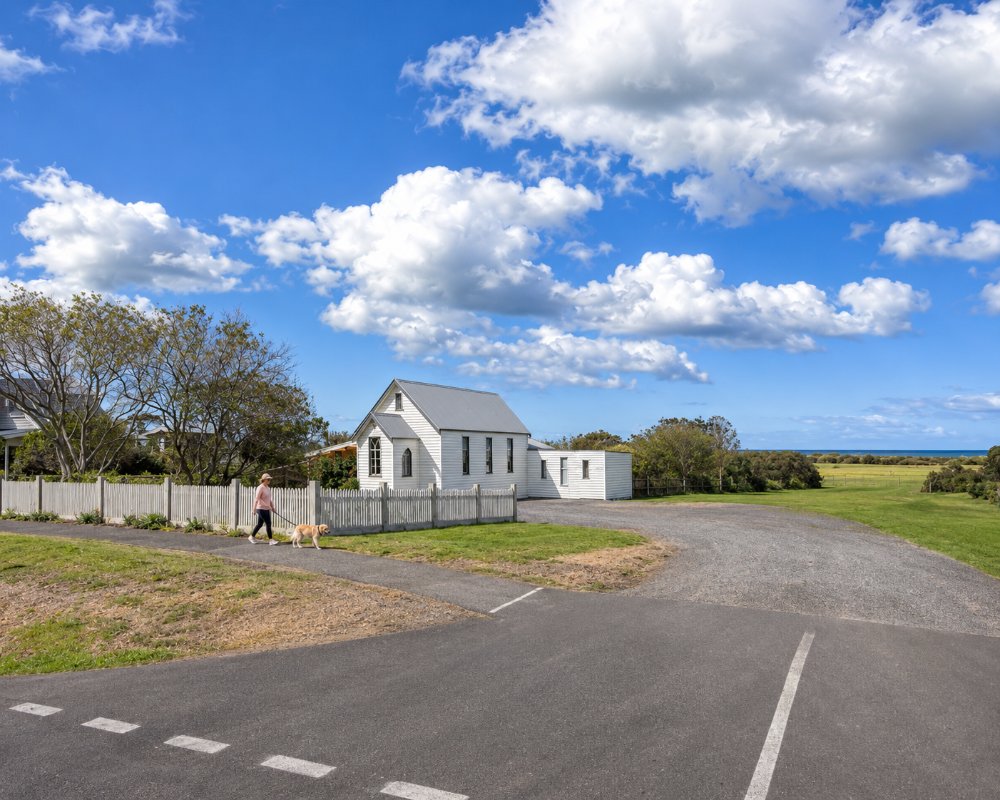
Things To Do in Narrawong
Narrawong Beach and the Surry River
Narrawong Beach is good for swimming, surfing and fishing, with snapper and salmon caught from the shore and boats. The Surry River is calm and lovely for kayaking, and the holiday park has a boat ramp and fish-cleaning bench.
Mount Clay
Mount Clay, 4 km north, was named by Major Thomas Mitchell in 1836. The Sawpit Picnic Area in the forest there has camping and mountain bike trails, and the Great South West Walk passes through the area.
Tyrendarra Indigenous Protected Area
About 10 km north-east, near Tyrendarra, the Indigenous Protected Area run by the Winda-Mara Aboriginal Corporation protects part of the Budj Bim lava flow, with a self-guided loop walk past stone eel traps and house sites. Budj Bim Tours, run by the Gunditjmara, offers guided cultural tours of the wider Budj Bim landscape, most starting at Tae Rak near Lake Condah.
Galleries and Lavender
The Bay of Whales Gallery and Coffee Shop on Liebelts Road shows the work of artist Brett Jarrett, with the gallery open late in the week and the coffee shop on Sundays, and the Narrawong Lavender Farm is nearby. The village’s Mouth to Mouth fun run is held each year.
Whalers Point Lookout and the Esplanade
From the Sawpit Picnic Area in Mount Clay State Forest, a loop track winds through the forest to Whalers Point Lookout, with views across Portland Bay. Back in the village, the Narrawong Esplanade path is an easy, flat foreshore walk for all ages.
Narrawong Cemetery
The small rural cemetery, established in 1878 according to its entrance sign, holds the grave of Captain William Dutton, a whaler who was one of the first Europeans to live at Portland Bay. Three of the six Portland men who drowned in 1863 trying to rescue the crew of the brig Julia, wrecked at the mouth of the Fitzroy River, are also buried here.
Where To Stay
BIG4 Narrawong Island Holiday Park, on Caravan Park Road, is surrounded on three sides by the Surry River, with 10 acres of Norfolk Island pines, powered and unpowered sites, huts and shacks, a store with a weekend coffee window and a boat ramp. Pets are not allowed. It is a good stop for caravans, with easy access from the highway.
Portland, 15 minutes west, has a wide choice of motels, caravan parks and dump points, and Port Fairy is about 45 minutes east. The Princes Highway is sealed and easy for towing.
The holiday park’s accommodation runs from basic shacks with a double bed and bunks, through family huts and a two-bedroom double hut, to beach huts whose decks look over the river to the sea. Some of the powered and unpowered sites sit right on the river’s edge. The park also takes school camps and group bookings, and has a camp kitchen, tennis courts, a playground and an onsite store, so book well ahead for the school holidays.
For a free bush camp, the Sawpit Picnic Area in Mount Clay State Forest, about five minutes north of the village up Boyers Road, has a flat camping area with toilets, barbecues and picnic tables. Sites are first come, first served, and there is no drinking water or rubbish collection, so bring water and take your rubbish with you. Holiday Lifestyle Henty Bay, on the beach on Dutton Way about 13 km west, and Portland Tourist Park and NRMA Portland Bay Holiday Park in Portland are the next nearest parks. Portland’s public dump point, with a water tap and toilets, is at Henty Park near the cable tram depot.
Eat & Drink
Narrawong has little in the way of food: the holiday park store sells basics and coffee on weekends, and the Bay of Whales Gallery serves coffee on Sundays. Portland, 15 minutes away, has the nearest restaurants, pubs and supermarkets.
Anglers can cook their own catch: bream and salmon come from the Surry River, and mulloway and snapper from the surf beach. For a meal out, Portland is the nearest choice. The Richmond Henty Hotel on Bentinck Street has a dining room and bars looking over Portland Bay, and the town centre around Bentinck and Percy streets has cafes, pubs, takeaways and seafood restaurants. Isabella’s Cafe at the Cape Nelson Lighthouse, about 30 km away by road, serves coffee, cakes and lunches daily in the old lighthouse stables and makes a good stop on a day out to the capes.
Port Fairy, about 45 minutes east along the Princes Highway, has a wider choice of cafes, pubs and restaurants. Narrawong has no supermarket, bottle shop or fuel, so stock up in Portland.
History
This is Gunditjmara Country, and the Convincing Ground massacre of the 1830s took place in this district. A school opened in 1857, and the Farmers’ Inn and post office followed in 1859. In 2007 building on more than 500 coastal blocks was halted because of erosion.
Getting to Narrawong
Narrawong is about 344 km from Melbourne on the Princes Highway, 18 km east of Portland. V/Line coaches between Warrnambool and Mount Gambier pass through the district.
Experiences
- Nature based
- Relaxation
- Self-Drive
Popular Activities
- Beach
- Caravan and Camping
- Cycling
- Fishing
- Kayaking
- Swimming
About Narrawong
- Locality: Rural locality
- Narrawong Postcode: 3285
- State: Victoria
- Region: Great Ocean Road
- Latitude: -38.2524
- Longitude: 141.7170
- Elevation: 14m
- Timezone: Australia/Melbourne
