
Derrinallum and Mount Elephant, VIC
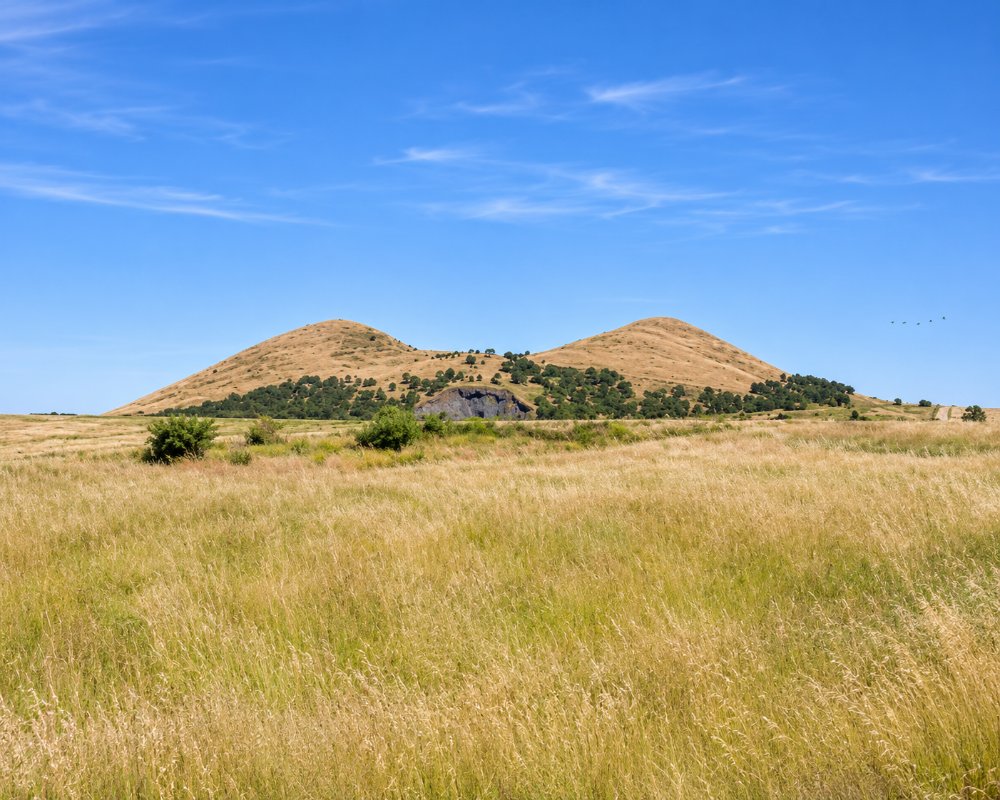
Derrinallum is a small farming town on the Hamilton Highway, about 176 km west of Melbourne and 12 km west of Lismore, sitting on flat basalt plains beneath Mount Elephant. The mountain, the largest scoria cone in Victoria, rises 240 m above the plains and can be seen for miles, which is why drovers once called it the Swagman’s Lighthouse.
In 2000 the local community bought the mountain to protect it, and today it is a reserve with walking tracks, a visitor centre and wide views. Nearby lakes offer fishing, boating and lakeside camping.
Known For
- Mount Elephant, Victoria’s largest scoria cone
- A community-owned volcano reserve
- Fishing and camping at Lake Tooliorook
Things To Do in Derrinallum and Mount Elephant
Climbing Mount Elephant
Mount Elephant erupted about 180,000 years ago, leaving a cone with a crater 90 m deep. The John and Millie Borbidge track climbs from the car park to the summit, about 2 km return and steep and uneven, and you can add a 3 km loop around the crater rim. A 4 km base track suits all abilities. The car gate and visitor centre open on Sunday afternoons, but the pedestrian gate is always open, and dogs on leads are welcome. The reserve closes on Total Fire Ban days.
The Community Purchase
In 2000 the community raised $100,000 in five months to buy the mountain, matched by Trust for Nature, and volunteers have since replanted native grasslands and built the tracks. A panel shows Eugene von Guerard’s 1856 painting of the mountain.
Lake Tooliorook and Deep Lake
Lake Tooliorook, near Lismore, is stocked with trout and redfin and is popular for boating. Deep Lake, about 5 km west of Derrinallum, is another fishing and boating lake, though its water level varies. Watch for blue-green algae warnings in summer.
Derrinallum Discovery Trail
Signs at Deep Lake, the recreation reserve and under the elms on the main street guide you around the town’s history. Stops include the 1932 war memorial in Harcourt granite topped with a white marble soldier, a 25-pounder field gun, a replica of the stone houses built by Scottish wallers for soldier settlers after the First World War (many were lost in the 1944 and 1977 fires), and the history rooms of the Derrinallum Lismore Community Association. The trail also explains how the village of Tooliorook, proclaimed in 1867, became Derrinallum in 1873.
Where To Stay
The Mount Elephant Hotel Motel on Main Street has about ten motel rooms.
For caravans and campers, Lake Tooliorook Recreation Reserve has shaded unpowered sites beside the lake, hot showers and a boat ramp; fees apply, booking is not usually needed and dogs on leads are allowed. Deep Lake Reserve takes caravans and has hot showers, and the Derrinallum Recreation Reserve also allows caravans. The Hamilton Highway is an easy tow, and Camperdown, about 40 km south, has larger holiday parks.
The Mt Elephant Hotel Motel has been fully refurbished, with a bar and bistro downstairs. For a powered site, the Lions Club caravan park at Browns Waterholes in Lismore’s Grimwade Park, 12 km east, sits beside the town pool and playground and takes caravans and camper trailers. Mortlake Caravan Park, about 35 km west on the Hamilton Highway, is a larger council park with more than 30 powered sites, cabins, a camp kitchen and a resident caretaker.
Lake Tooliorook suits big rigs outside busy summer weekends, but it has no power, so arrive with full water and empty tanks. Skipton Roadhouse Cabins, about 35 km north-east, has motel-style rooms. Derrinallum has a small service station on Main Street, but for a full fill and a supermarket, Camperdown is the nearest larger town.
Eat & Drink
The Mount Elephant Hotel Motel has a bar and restaurant, and the Foodworks and hardware store in town also does coffee. For a wider choice, Lismore has a pub and cafes, and Camperdown is about half an hour south.
The Mt Elephant Hotel at 1 Main Street is the town’s pub, with a bar and a bistro by an open fire serving lunch and dinner, with meals for children and for most dietary needs. Lismore, 12 km east, has three good stops: the Lismore Hotel, which has stood since 1911 and serves hearty bistro meals such as parmas and steaks seven days a week; Full On Food at 24 High Street, a country cafe known for generous roast lunches, paninis, spanakopita and pasties; and Fairway Coffee and Eatery at the golf club on High Street, under the dancing-brolga water tower mural, for cooked breakfasts, toasties, burgers, and Thai dishes and pizza at set times.
West along the highway, Mortlake has Clarke’s square pies and the Mount Shadwell Hotel for pub meals. For a big shop, Camperdown has supermarkets.
History
This is the Country of the Djargurd wurrung people of the Eastern Maar. The name is thought to mean sea swallow or tern. Early settlers knew the area as The Swamp, and it was surveyed in the 1860s as Tooliorook. Mount Elephant was quarried for scoria for decades before the community bought it in 2000; the reserve celebrated its 25th anniversary in November 2025.
Getting to Derrinallum and Mount Elephant
Derrinallum is about 176 km from Melbourne via Geelong on the Hamilton Highway, around two hours. Lismore is 12 km east and Camperdown about 40 km south. V/Line coaches between Ballarat and Warrnambool stop in the town.
Experiences
- Rural/Country
- Self-Drive
Popular Activities
- Bird Watching
- Bush Walking
- Caravan and Camping
- Driving
- Fishing
- Sightseeing
About Derrinallum and Mount Elephant
- Locality: Urban locality
- Derrinallum and Mount Elephant Postcode: 3325
- State: Victoria
- Region: Great Ocean Road
- Latitude: -37.9485
- Longitude: 143.2200
- Elevation: 181m
- Timezone: Australia/Melbourne
