
Rossarden, TAS
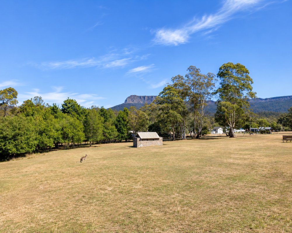
Rossarden is a small former mining town at an elevation of about 600 metres, tucked into a valley beneath the southern cliffs of Ben Lomond. It is 19 km north of Avoca by a winding sealed road, and about an hour and twenty minutes from Launceston.
Fewer than 50 people live here now. In its day it was the largest tin producer in Tasmania, and the rows of company houses and the quiet streets still tell that story.
Known For
- A company tin town of the 1930s
- Mountain scenery below Stacks Bluff
- The old mining village of Storys Creek
Things To Do in Rossarden
The Town
Rossarden was built almost overnight in 1933 to house workers at the Aberfoyle mine, with a hall, a post office and the first houses finished within months. The mine closed in 1982, and many of the houses remain.
Storys Creek
A few kilometres further up the valley, Storys Creek was another mining village, where tin and wolfram were mined from 1892 to 1982.
Stacks Bluff
From Storys Creek a rough track climbs through forest and across boulder scree to Stacks Bluff, at 1,527 metres the southern summit of Ben Lomond. It is a long, steep day walk for experienced walkers, and the start can be hard to find, so take a map.
Rossarden Park and the deer
Rossarden Park, in the middle of town, has toilets, barbecues and a playground, though no power, and makes a quiet lunch stop below the cliffs. Fallow deer are often seen in and around the streets, so drive slowly through town.
Where To Stay
There is very little accommodation in Rossarden.
There is no council campground, fuel or shop in the town. Cabins have been offered on the road in from Avoca; check that they are operating before you rely on them. Avoca has limited supplies, and Campbell Town and Fingal are the nearest towns with full shops, though the Avoca Roadhouse sells fuel and basic supplies.
The cabins on the road in are Craggy Peaks Wilderness Cabins, at 1410 Rossarden Road, about 14 km north of Avoca and a few kilometres short of town. They have self-contained cabins and studio cabins, as well as powered and unpowered sites with views of Stacks Bluff, so this is the one place in the valley where a caravan can plug in. The nearest shop is about 25 km away, so bring all your food, and phone ahead to check availability.
For caravans and motorhomes, Rossarden Road is sealed all the way from Avoca, but it climbs steadily to about 600 metres, so take it slowly with a heavy van, and pack warm bedding for nights in the hills. There is no fuel, shop or dump point in Rossarden. Fill up at the Avoca Roadhouse, 19 km south, and use the council dump points at the King Street Oval in Campbell Town or the Cressy Recreation Ground. Self-contained travellers can stay free for up to 48 hours, with a council permit, at Blackburn Park in Campbell Town. The track to Stacks Bluff is for walkers only.
Eat & Drink
Do not expect to find a meal in Rossarden. Bring food with you.
There is nowhere to buy food in Rossarden or at Storys Creek. The nearest is the Avoca Roadhouse at 25 Falmouth Street, Avoca, 19 km south, which has a convenience store, coffee and hot food as well as fuel. Campbell Town, on the Midland Highway beyond Avoca, has the Campbell Town Hotel with its attached JJ’s Bakery and Banjo’s Bakery Café for a proper meal.
History
This is the country of the Ben Lomond people. Tin was found at Storys Creek in the 1890s, and the Aberfoyle lode at Rossarden was discovered in 1916. Full production began in the early 1930s and by 1960 Aberfoyle was the largest tin producer in the state. The mine was sold in 1981 and closed the following year. Rossarden was formally named as a locality in 1973.
Getting to Rossarden
From the Esk Highway (A4) at Avoca, take Rossarden Road (B42) north for 19 km. The road is sealed but winds steadily uphill. It suits caravans driven with care, though there is little reason to take one in.
Experiences
- Historic/Heritage
- Remote
- Rural/Country
- Self-Drive
Popular Activities
- Bush Walking
- Caravan and Camping
- Driving
- Sightseeing
About Rossarden
- Locality: Rural locality
- Rossarden Postcode: 7213
- State: Tasmania
- Region: Launceston & North
- Latitude: -41.6690
- Longitude: 147.7465
- Elevation: 601m
- Timezone: Australia/Hobart
