
Mount William National Park, TAS
Mount William National Park fills the far north-east corner of Tasmania, a low country of heath, lagoons and long white beaches facing Bass Strait and the Tasman Sea. It is one of the best places in the state to see wildlife, and one of the quietest national parks.
The northern entrance is 17 km from Gladstone on gravel roads, and the southern end, at Eddystone Point, is reached from St Helens by way of Ansons Bay. The mountain itself is also known by its Aboriginal name, wukalina.
Known For
- Forester kangaroos and wombats at dusk
- Camping behind the beach at Stumpys Bay
- The granite lighthouse at Eddystone Point
Things To Do in the Park
Forester Kangaroo Drive
A signposted road through the northern part of the park passes open grassland where Forester kangaroos, the Tasmanian form of the eastern grey, graze in mobs. Wombats, wallabies, pademelons and echidnas are common too. Late afternoon is best, but drive slowly and avoid travelling after dark.
wukalina / Mount William
A well-made track climbs to the 216-metre summit in about 90 minutes return, with views along the coast and, on a clear day, to the Furneaux Islands.
Cobler Rocks
An easy two-hour return walk follows a fire trail to the coast and comes back along the beach.
Eddystone Point
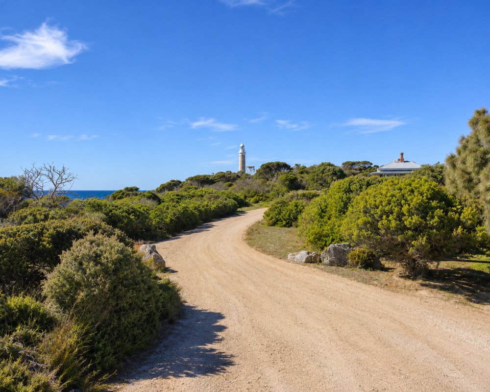
At the southern end of the park stands a lighthouse built in 1889 from granite quarried on the spot, with granite keepers’ cottages beside it. The point is known as larapuna and is leased to the Aboriginal community. The road to the lighthouse is open to walkers in daylight.
Where To Stay
All accommodation in the park is camping.
There are six campgrounds: Stumpys Bay 1, 2, 3 and 4 and Top Camp in the north, and Deep Creek in the south near Eddystone Point. Small and medium caravans and motorhomes fit in all of them except Stumpys Bay 2, which is for tents only; large rigs are not suited. Each has pit toilets. There is no drinking water, no power and no rubbish collection, though bore water for washing is available at Stumpys Bay 1 and 3 and at Deep Creek. Bring firewood and all your water.
From 3 November 2026 the fee is $18 a night for each site, for up to six people, on top of the parks pass, and sites can now be booked online through the Parks and Wildlife Service. The nearest fuel is at Gladstone, with 24-hour fuel and a dump point at St Helens.
Stumpys Bay 2 is a fuel-stove-only area, and elsewhere in the park fires may be lit only in the fireplaces provided, and not at all while the seasonal campfire ban that began on 26 October 2026 is in place. Stumpys Bay 1 and 2 are closed, including their beach access and toilets, from 10 am on Thursday 10 December to 2 pm on Tuesday 15 December 2026; Stumpys Bay 3 and 4 stay open. Top Camp is near Musselroe Bay at the northern end.
If the park camps are full, or you want something less remote, Policemans Point in the Bay of Fires Conservation Area, south of Ansons Bay, is free, takes no bookings and suits caravans, with a toilet; carry your own drinking water. Ansons Bay has holiday houses but no shop or fuel. The nearest caravan parks with powered sites and cabins are at St Helens: Tasman Holiday Parks St Helens on St Helens Point Road and BIG4 Tassie Getaway Parks St Helens on Penelope Street. The Gladstone general store sells petrol and diesel, but with gravel roads and long distances it is safest to fill up and carry spare water before leaving St Helens or Scottsdale.
Eat & Drink
There is nothing to eat or drink in the park. Stock up at St Helens, Bridport or Scottsdale on the way in.
There is no food for sale anywhere near the park, and the nearest fuel is at the Gladstone general store, 17 km from the northern entrance. Coming from the south, Priory Ridge Estate on Ansons Bay Road, just outside St Helens, opens its cellar door from Friday to Sunday, with cheese boards. St Helens itself has Sco & Co. and The Lifebuoy Cafe for breakfast, Easy Tiger for Thai food, burgers and house-brewed beer, and the Bayside Bistro for pub meals seven days.
History
The north-east coast was home to several Aboriginal family groups, and the middens along the beaches are protected. Eddystone Point lighthouse was built in 1889 after years of shipping losses on this coast. The national park was declared in 1973 and has been enlarged twice since. In 2006 the lighthouse reserve at larapuna was leased to the Aboriginal Land Council of Tasmania, and in 2016 the mountain was given the dual name wukalina / Mount William.
Getting to the Park
From Gladstone, follow the gravel road (C843, then C845) for 17 km to the northern entrance. For Deep Creek and Eddystone Point, take the gravel road from Ansons Bay or Gladstone (C843 and C846). All roads in and around the park are unsealed and can be corrugated; they suit ordinary cars and smaller vans in dry weather. A parks pass is required.
Experiences
- Caravan and Camping
- Eco Tourism
- Nature based
- Remote
- Self-Drive
Popular Activities
- Beach
- Bird Watching
- Bush Walking
- Caravan and Camping
- National Park
- Wildlife
About Mount William National Park
- Locality: Rural locality
- Mount William National Park Postcode: 7264
- State: Tasmania
- Region: East Coast
- Latitude: -40.9342
- Longitude: 148.2355
- Timezone: Australia/Hobart
