
Lipson, SA
Lipson is a near-deserted village 12 kilometres north-west of Tumby Bay, with a hall of 1910, an old church and the shell of a main street. Most visitors know the name from Lipson Cove, on the coast to the north-east.
Tumby Bay has the shops and services.
Known For
- Camping beside the beach at Lipson Cove
- Seabirds and penguins on Lipson Island
- A quiet old farming village
Things To Do in Lipson
Lipson Cove
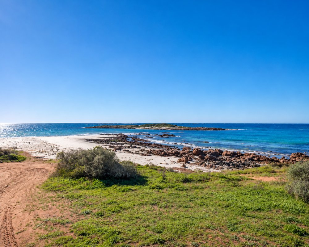
A gravel road leads 7.6 kilometres from the Lincoln Highway to a curving white beach with clear water. It is good for swimming, fishing and snorkelling.
Lipson Island
The rocky island 150 metres offshore is a conservation park, with nesting seabirds and a colony of little penguins. Some people walk out across the sand at low tide, but the rocks and currents around it can be dangerous, so it is safest to watch it from the shore and keep away from nesting birds.
The Village
The village dates from 1872 and was named after Captain Thomas Lipson, the colony’s first harbour master. Its show has been held for more than a century.
Wildlife at the Cove
Crested terns and little penguins breed on Lipson Island, and from the beach you may see Australian sea lions, long-nosed fur seals and bottlenose dolphins, with the odd southern right whale passing in winter. The island and the surrounding intertidal zone have been a conservation park since 1967. The penguins come and go after dark, so keep your distance and keep lights off the island.
Fishing
The cove is a popular spot for beach and rock fishing. Southern calamari (squid) has been closed to fishing in Spencer Gulf since May 2026, and snapper is closed until at least June 2027, so check the current rules before you go.
Where To Stay
There is nowhere to stay in the village.
The council campground at Lipson Cove has about 12 sites with drop toilets and bins, and suits caravans and large motorhomes. It costs about $10 a night and is booked online. There is no water. Tumby Bay has a caravan park and an RV park with a dump point.
Tumby Bay, 12 km south-east of the village, is the nearest town with beds. Its foreshore caravan park has powered and ensuite sites, cabins and a camp kitchen, and Tumby Villas and Motel, the Tumby Bay Motel and the town’s two hotels have rooms. The council’s RV park on Lipson Road in Tumby Bay takes self-contained vehicles for up to 14 nights, and there is a second public dump point opposite the cemetery on the same road.
The Lipson Cove campground has been upgraded as part of a regional program to improve coastal campgrounds, but sites are limited and fill quickly in summer and school holidays, so book ahead. Bring all your water in, and take the gravel road to the cove slowly with a van, as it can be corrugated.
Port Neill, about 30 km north of the cove, has a cabin and caravan park on the foreshore and glamping tents in the dunes, and Port Lincoln, about 60 km south, has the widest choice of holiday parks and motels.
Eat & Drink
There are no shops. Bring supplies from Tumby Bay.
There is nowhere to buy food or water at Lipson or the cove. Tumby Bay, 12 km south-east, has the nearest meals: the Seabreeze Hotel’s bistro looks over the bay and serves seafood, steaks and pub favourites, the Tumby Bay Hotel has a restaurant and beer garden, and the Tumby Bay Bakery is the stop for coffee, pies and pastries. Port Neill, about 30 km north, has a hotel looking over the beach and a kiosk at the caravan park. Stock up on groceries, ice and fuel in Tumby Bay.
History
Lipson lies on the country of the Barngarla people. Farmers took up the district for sheep and cereal crops from the 1870s, and the village grew to have a post office, a church, a shop and a school. The school opened in 1881 under the name Yaranyacka and closed in 1950. Talc from the mines near the cove was rated among the finest in the world, and after the mines closed the village slowly emptied; today only a handful of people live there. In 1963 the Lipson football club joined with Ungarra and Butler to form Eyre United, based at Ungarra. The Lipson Show marked its 100th year in 2004. Lipson Island, also known by its French name, Île d’Alembert, was proclaimed a conservation park in 1967.
Getting to Lipson
The Lipson Cove turn-off is 14 kilometres north of Tumby Bay on the Lincoln Highway. The village is reached by a separate road inland.
Experiences
- Caravan and Camping
- Nature based
- Relaxation
- Rural/Country
- Self-Drive
Popular Activities
- Beach
- Bird Watching
- Caravan and Camping
- Fishing
- Surfing
- Swimming
About Lipson
- Locality: Rural locality
- Lipson Postcode: 5607
- State: South Australia
- Region: Eyre Peninsula
- Latitude: -34.29836
- Longitude: 136.14573
- Elevation: 39m
- Timezone: Australia/Adelaide
