
Farrell Flat, SA
Farrell Flat is a town of about 200 people on the road between Clare, 20 kilometres west, and Burra, 22 kilometres north-east. It stands on open plains east of the Clare hills, beside a railway line that no longer carries trains.
With a pub that has rooms and a free camp beside the oval, it is a useful base for visiting both the Clare Valley wineries and Burra without paying for a caravan park.
Known For
- Silo art of the last train through town
- A free camp with a dump point beside the oval
- Midway between Clare and Burra
Things To Do in Farrell Flat
Silo Art
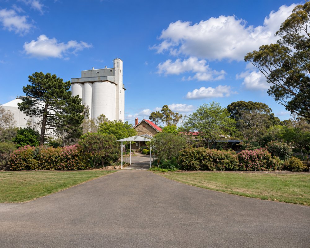
The silos on Patterson Terrace carry a 30 metre mural of the last train to pass through Farrell Flat, painted by Jarrod Soden and Matthew Knights in 2020.
Railway Precinct
The old station, the water tank and the institute are reminders of the town’s years as a wheat-loading point on the line from Adelaide to Peterborough. The last train ran in 2004.
Nearby
Mintaro is 20 minutes south-west by back roads, Burra 20 minutes north-east.
Clare and the Riesling Trail
Clare is 20 km west, and from there the Riesling Trail follows an old railway line south through Sevenhill and Watervale to Auburn, passing cellar doors along the way. The trail follows a gentle railway grade, so it suits families on bikes. Farrell Flat makes a cheap base for a day on the trail and a night back at the pub.
Where To Stay
The Farrell Flat Hotel has a few rooms and a bunk room, and points campers to the free camp at Duncan Park.
Duncan Park in Cameron Terrace, beside the oval, offers free camping (donations welcome), with toilets, water, a barbecue, a dog park and a dump point.
The Farrell Flat Hotel has three queen rooms and a four-bunk room, all with shared bathrooms, and a public and a lounge bar downstairs, which suits walkers, cyclists and anyone on a tight budget.
Duncan Park has a fenced playground and outdoor fitness equipment as well as the off-leash dog area, so it works well for families with pets. A donation to the park committee is appreciated.
For more choice, Burra is 22 km north-east, with the caravan park on Bridge Terrace (30 powered sites, a camp kitchen and a dump point), the Paxton Square miners’ cottages, the Burra Motor Inn and many heritage cottages. Clare, 20 km west, has caravan parks, motels and B&Bs among the vineyards, and Mintaro’s heritage cottages are about 20 minutes south-west.
Eat & Drink
The Farrell Flat Hotel, licensed since 1871, opens every day and serves meals. Clare and Burra have supermarkets and bakeries.
The Farrell Flat Hotel at 12 Patterson Terrace is an old-style country pub with a public bar and a lounge bar, and it is open every day from late morning into the evening for counter meals. Ring ahead if you are arriving late or in a group.
There is no shop or cafe in town. Burra, 22 km north-east, has the nearest bakery, Waters Burra Bakery in Commercial Street, plus Mog’s Cafe, St Just Cafe and four pubs. Clare, 20 km west, has the widest choice of cafes, restaurants and cellar doors. Supermarkets and fuel are in Burra and Clare.
History
The district is Ngadjuri country. The town was surveyed in 1870 as Hanson and officially renamed Farrell Flat in 1940, the name the railway station had long used, after James Farrell, an early Anglican dean of Adelaide.
Getting to Farrell Flat
Farrell Flat is on the sealed road between Clare and Burra, about two hours from Adelaide by either town.
Experiences
- Rural/Country
- Self-Drive
Popular Activities
- Caravan and Camping
- Cycling
- Driving
- Food and Wine
- Sightseeing
About Farrell Flat
- Locality: Rural locality
- Farrell Flat Postcode: 5416
- State: South Australia
- Region: Clare Valley
- Latitude: -33.82954
- Longitude: 138.79268
- Elevation: 429m
- Timezone: Australia/Adelaide
Accommodation In Farrell Flat
Discover some of the accommodation in and around Farrell Flat
