
Munmorah State Conservation Area, NSW
Munmorah State Conservation Area covers about 1,500 hectares of coast between Budgewoi and Catherine Hill Bay, at the northern limit of the Central Coast. It is run like a national park and feels like one: twelve kilometres of beaches, cliffs and headlands with no buildings on them, backed by heath, woodland and the shore of Lake Munmorah.
Known For
- Birdie, Frazer and Moonee beaches
- Clifftop lookouts at Wybung Head and Snapper Point
- Camping a few steps from the sand
Things To Do in Munmorah State Conservation Area
Beaches
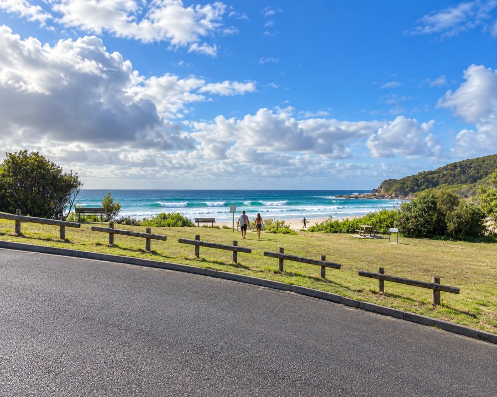
Birdie Beach, at the southern end, is a long open beach reached by a sealed road from near Budgewoi; a signed section at its northern end is set aside for nude bathing. Frazer Beach, in the middle of the park, is a small, pretty bay between rocky points, popular with surfers and families. Further north, Moonee Beach and Ghosties Beach are reached on foot. Only Frazer Beach is patrolled, and only in the Christmas and Easter school holidays; the surf can be rough.
Lookouts
A sealed road leads to Wybung Head, where a short path gives a sweeping view of the coast and a good chance of whales from June to November. Snapper Point, nearby, has a platform above a sea cave and a deep gutter in the cliffs. The rocks here are notorious: many rock fishers have been swept off them, so keep well back when there is any swell.
Walks
The Palms loop track is a short walk through a gully of cabbage tree palms. The Moonee Beach track crosses heath to the northern beaches, and the coastal track links the headlands. From late winter to spring the heath is thick with wildflowers, including flannel flowers and Christmas bells.
Fishing and Surfing
The beaches produce tailor, salmon, bream and whiting, and Frazer and Birdie both have surf breaks. Lake Munmorah, on the western side, is calm water for kayaks.
Tea Tree Picnic Area and Lookout
A short walk from Birdie Beach, this platform looks north along the beach, south to the Norah Head lighthouse and out to Bird Island, with barbecues, picnic tables, toilets and accessible parking. It is one of the easiest places in the reserve to watch for whales in winter.
Elizabeth Bay Picnic Area
On the western side of the reserve, off Elizabeth Bay Drive, this picnic area sits on the shore of Lake Munmorah, with picnic tables and the reserve’s only boat ramp. The flat water suits kayaks and small tinnies and is a quieter swimming spot for children than the surf beaches.
Pink Caves: Closed to Visitors
The “Pink Caves” near Moonee became famous on social media, but National Parks has closed them: there is no track, the rock shelf is slippery, the caves fill at high tide and rogue waves have swept people off. Walk the Moonee Beach trail or the Palms loop track instead.
Catherine Hill Bay
The old coal-mining village of Catherine Hill Bay, about 4 km north of the Blue Wren Drive entrance, has streets of miners’ cottages and the remains of the coal jetty beside a long beach, which is patrolled in the warmer months when Munmorah’s are not.
Where To Stay
There are two campgrounds. Frazer is a small site right behind Frazer Beach, and Freemans is a larger one among trees near Birdie Beach, suited to camper trailers and small caravans. Both have toilets and cold showers and must be booked online; they are in heavy demand in summer.
Freemans has 39 marked unpowered sites for tents, camper trailers and caravans, with drinking water and covered barbecues, while Frazer has six sites for tents or camping beside the car and no drinking water. Check-in is 2pm. The gates lock at 7pm in autumn and winter and 9pm in spring and summer, so late arrivals cannot get in, and there are no powered sites, no pets and no dump point.
Budgewoi and Toukley have holiday parks and motels.
The nearest caravan park and dump point is NRMA Budgewoi Holiday Park on Weemala Street, Budgewoi, on the shore of Lake Munmorah, with powered and unpowered sites, cabins and villas and the nearest dump point to the conservation area, about 5 km south of the Birdie Beach entrance, and Ingenia Holidays Lake Macquarie at Mannering Park, with lakefront cabins, a pool, kayak hire and its own boat ramp and jetty, about 15 km north-west.
Eat & Drink
There is nowhere to eat or buy supplies in the reserve, so bring food and water, especially to Frazer campground. The nearest supermarket is the Woolworths in the Lake Munmorah shopping centre on the Pacific Highway, about 5 km from either entrance, with a bakery, takeaways and fuel nearby, and Budgewoi has a small shopping strip. For a meal by the water, the Foreshore Bistro at Gwandalan Bowling Club is about 12 km north-west. The old Wallarah Hotel (the “Catho Pub”) at Catherine Hill Bay was up for sale in 2026, so check that it is trading before you plan a meal there.
After a day at Frazer Beach or Snapper Point, the Budgewoi Hotel and The Swordfish Co at Budgie Circle are the nearest places for a meal, and Dunes by Dish at Soldiers Beach, Norah Head, serves share plates and cocktails from Wednesday to Sunday.
Good To Know
A daily vehicle entry fee applies. The gates are open from early morning to evening, later in summer. Fires are often banned, and roads within the area close from time to time for repairs, so check the park alerts before you set out. Bring drinking water.
History
This coast is the country of the Awabakal and Darkinjung peoples. Coal has been mined under and around the reserve since the 1800s, and the village of Catherine Hill Bay, just north, is one of the oldest mining settlements in the state. The area was set aside for recreation in 1977.
The reserve was declared on 1 January 1977 as the Munmorah State Recreation Area and is now a state conservation area. National Parks says the Awabakal people gathered cabbage-palm hearts, lilly pillies, yams and shellfish here and paddled out to Moon Island for muttonbird eggs. The big sea cave at Snapper Point was dug out for its beach pebbles in 1975-76, just before the reserve was declared, so look down on it from the fenced lookout and don’t climb down.
Getting to Munmorah State Conservation Area
There are two entrances: Birdie Beach Drive, off Elizabeth Bay Drive north of Budgewoi, and Blue Wren Drive, off the Pacific Highway north of Lake Munmorah. Both are about 120 kilometres from Sydney by the M1 and the Doyalson exit.
Inside the reserve all the roads are sealed and suit 2WD in all weather. Newcastle is about 40 km north by the highway, and the nearest stations on the Central Coast & Newcastle Line are Wyee and Warnervale, about 15 to 20 km west; there is no public transport into the reserve.
Experiences
- Active
- Caravan and Camping
- Eco Tourism
- Nature based
Popular Activities
- Beach
- Bush Walking
- Caravan and Camping
- Fishing - Beach
- National Park
- Surfing
- Swimming
- Wildlife
About Munmorah State Conservation Area
- Locality: National Park
- Munmorah State Conservation Area Postcode: 2259
- State: New South Wales
- Region: Central Coast
- Latitude: -33.18669
- Longitude: 151.62114
- Timezone: Australia/Sydney
