
Queen Mary Falls, QLD
Queen Mary Falls is the best-known waterfall in southern inland Queensland. Spring Creek, a headwater of the Condamine River, runs across a plateau of farmland and then drops 40 metres over a basalt cliff into a gorge filled with rainforest. The falls lie in a small section of Main Range National Park, ten kilometres east of Killarney and about 45 kilometres from Warwick, and they are the highlight of the scenic drive along the range.
Known For
- A 40-metre waterfall in World Heritage rainforest
- An easy cliff-top lookout and a circuit to the base
- King parrots, rosellas and lyrebirds
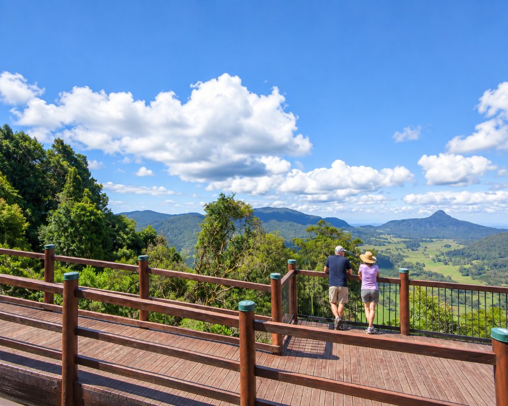
The falls flow all year but are at their best after summer rain. The gorge faces east, so morning light is best for photographs, and a rainbow often forms in the spray.
The surrounding park is part of the Gondwana Rainforests of Australia World Heritage Area, recognised for plant and animal groups that date back to the ancient supercontinent.
Things To Do at Queen Mary Falls
Cliff circuit
A level path of about 400 metres leads from the picnic ground to a fenced lookout directly opposite the top of the falls. It is suitable for prams and takes ten minutes.
Queen Mary Falls circuit
The full circuit, two kilometres, continues down through open forest into the rainforest of the gorge, crosses the creek on a footbridge at the base of the falls and climbs back up the other side. Allow 40 minutes to an hour. The track is well made but has many steps, and the rocks near the base are slippery.
Birdlife
Crimson rosellas and king parrots crowd the picnic area, and satin bowerbirds, whipbirds and brush turkeys are common. Albert’s lyrebird, a shy bird found only in this part of Australia, can sometimes be heard in the gorge in winter.
The Falls Drive
On the way from Killarney, stop at Browns Falls, reached by a 600-metre scramble along a creek bed, and at the roadside lookout over Daggs Falls. Past Queen Mary Falls the road climbs to Carrs Lookout, with a view over the headwaters of the Condamine, and continues down the range towards Boonah.
Daggs Falls and Carrs Lookout
Daggs Falls, 1 km past Browns Falls, drops 39 metres and is seen from a lookout right beside the road, so it suits anyone who cannot manage steps. Carrs Lookout, 8 km beyond Queen Mary Falls, looks over the Head valley to Mount Superbus, the Scenic Rim and Tamborine Mountain, and its signs name the peaks and tell the story of a 1955 plane crash on Mount Superbus.
Moss Gardens
Three kilometres past Carrs Lookout, cool temperate rainforest crowds the roadside, its trunks and rocks thick with moss and lichen. A 25-metre walk along a century-old rabbit-proof fence passes hoop pine, kurrajong and silky oak, and an undeveloped 300-metre track continues to a view of Wilsons Peak and White Swamp. The road narrows from here, so leave caravans behind.
Where To Stay
A privately run caravan park with cabins and camping lies directly opposite the picnic area. Guesthouses, cottages and farm stays are found along the road in both directions.
There is no camping in this section of the national park. Killarney has a motel, hotel and caravan park.
Queen Mary Falls Caravan Park has powered sites in park-like grounds, unpowered sites and cabins, with hot showers, a laundry and a camp kitchen with a wood heater, fridge and barbecue. Campfires are allowed in set spots and firewood is sold on site. Pets are welcome on a lead but not in the cabins or in the national park across the road. There is no dump point, so empty cassettes before you arrive, and mobile and internet coverage is patchy. Killarney View Cabins and Caravan Park in Killarney, 10 km west, has cabins, a cottage and level powered sites, and Adjinbilly Rainforest Retreat offers off-grid cabins reached by 4WD through Cambanoora Gorge.
Spring Creek Road from Killarney is sealed, but the climb to the falls is steep and winding, so take it slowly with a van. East of Carrs Lookout the road narrows for 6 km and heavy vehicles are banned, so caravans should come and go through Killarney. The nearest council dump point is at Morgan Park in Warwick, about 45 km west.
Eat & Drink
The cafe at the caravan park serves meals, coffee and scones and sells seed for the birds. A cafe at Carrs Lookout has one of the best views in the district. The picnic ground has tables and barbecues.
Queen Mary Falls Cafe, across the road from the picnic ground, serves gourmet burgers, Devonshire teas, ice creams and coffee, with seats inside and out, and the king parrots and rosellas gather for a feed. The kitchen closes early in the afternoon and the cafe is not open every day, so check before you go. The picnic ground has covered tables and gas barbecues. The Killarney Hotel, 10 km west, serves lunch and dinner daily.
History
The falls are in the country of the Githabul people. The area was reserved in the early 20th century, and the falls were named after Queen Mary, the wife of King George V. The reserve later became part of Main Range National Park.
Getting to Queen Mary Falls
From Warwick, drive to Killarney and follow Spring Creek Road east for ten kilometres. From Brisbane, the direct route is by Boonah and the range road known as The Head, which is narrow, steep and not suitable for caravans; allow two and a half hours.
Experiences
- Eco Tourism
- Mountain
- Nature based
- Self-Drive
Popular Activities
- Bird Watching
- Bush Walking
- Caravan and Camping
- National Park
- Rainforest
- Sightseeing
- World Heritage
About Queen Mary Falls
- Locality: Rural locality
- Queen Mary Falls Postcode: 4373
- State: Queensland
- Region: Southern Queensland Country
- Latitude: -28.3390
- Longitude: 152.3710
- Elevation: 800m
- Timezone: Australia/Brisbane
