
Paluma and Paluma Range National Park, QLD
Paluma is a tiny village in the clouds, almost 900 metres up on the crest of the Paluma Range about 85 kilometres north-west of Townsville. It marks the southern end of the Wet Tropics World Heritage Area, and the change from the dry coastal plain is startling: within half an hour the road climbs from brown grass and gum trees into dripping rainforest, tree ferns and mist. On a summer day it can be ten degrees cooler than the city, which has made it a retreat for Townsville people for generations.
Known For
- The southern gateway to the Wet Tropics rainforest
- Little Crystal Creek and its stone arch bridge
- Cool mountain air, lookouts and rainforest birds
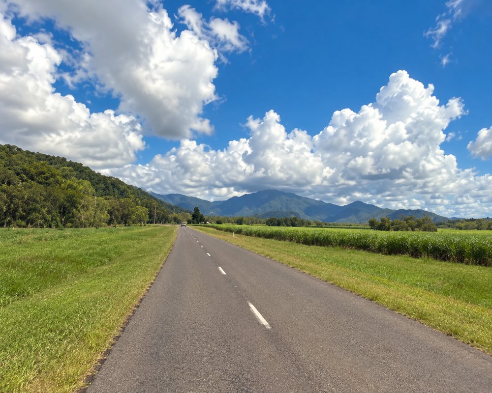
The surrounding Paluma Range National Park has two main visitor areas. The Mount Spec section takes in the mountain road, the village walks and the country beyond. Big Crystal Creek, also part of the Mount Spec section, lies at the foot of the range, reached by a separate road from the highway.
The village itself has only a few dozen residents, a scatter of cottages and guesthouses, an environmental education centre and a community hall.
Things To Do at Paluma
Mount Spec Road
The 18-kilometre road from the Bruce Highway to the village was built by hand as a relief project during the Depression of the 1930s and is heritage listed. It is narrow and winding, with stone culverts and lookouts, and is not suitable for caravans or large motorhomes. The road was badly damaged by landslips in the floods of early 2025; the permit system was dropped on 31 March 2026, but repairs continue until about mid-2027, with escorted traffic in daytime and vehicle length limits; check road conditions before you go, especially after rain.
Little Crystal Creek
Seven kilometres up the range, the road crosses a graceful stone arch bridge built in 1932. Below it the creek tumbles over granite into a series of clear pools, with a picnic area beside them. It is one of the most popular swimming spots in the region, but the day-use area has been closed since the February 2025 floods and is not due to reopen before mid-2027, and take care on the slippery rocks.
Village walks
McClelland’s Lookout, a short stroll from the car park at the edge of the village, looks over Halifax Bay and the Palm Islands. From there, tracks continue to Witts Lookout and Cloudy Creek, between one and four kilometres return, and a short rainforest circuit starts in the village. Watch for Victoria’s riflebird and listen for the calls of catbirds and whipbirds; the golden bowerbird lives in the higher forest.
Lake Paluma and Birthday Creek Falls
Beyond the village the road turns to gravel. Birthday Creek Falls is a short walk from a car park about ten kilometres on, and Lake Paluma, a water-supply dam ringed by forest, has a picnic area and a camping ground that must be booked through the city council.
Big Crystal Creek
At the base of the range, signposted from the highway north of the Paluma turn-off, Paradise Waterhole is a large, deep pool with a sandy edge, and the Rockslides, a short walk upstream, are natural water slides over smooth granite. There is a national park camping area with showers.
Driving the range road in 2026
Mount Spec Road is open to everyone again, but repairs at dozens of landslip sites will continue until about mid-2027. Traffic is escorted through the work zones in daytime (roughly 6 am to 6 pm), so expect waits of up to an hour, and vehicles longer than a four-wheel drive with a box trailer need prior approval from Transport and Main Roads, which rules out caravans and big motorhomes. In heavy rain the road can close at short notice; check QLDTraffic before setting out. Part of the McClellands Lookout car park is a works depot until June 2027, but the lookout and its track stay open, with overflow parking at the end of Loop Road.
Where To Stay
Paluma has a small number of cottages, cabins and guesthouses, some with fireplaces for the cool nights.
Campers can choose between Big Crystal Creek, booked through Queensland national parks, and Lake Paluma. Otherwise the nearest motels are in Townsville and Ingham.
Campers have two booked options. Lake Paluma, run by Townsville City Council, is one of the council’s free campsites and must be booked online; it is reached by the gravel road past the village, so check that road after rain. The Big Crystal Creek camping area at the foot of the range has 2WD access and suits tents beside the car, small caravans, camper trailers and small motorhomes, with flush toilets, cold showers, gas barbecues, campfires where permitted and good mobile coverage; book with Queensland national parks (closed 9 to 13 November 2026 for roadworks).
Beyond Paluma, Hidden Valley Cabins is an off-grid, solar-powered eco-retreat with cabins, a restaurant and bar, guided tours and Advanced Ecotourism certification; while the range road is under repair it suggests coming via Hervey Range Road from Townsville. Caravanners should leave the van on the coast, at Big Crystal Creek, the Rollingstone holiday park or the council camps at Balgal Beach and Rollingstone, and drive up in the tow vehicle alone.
Eat & Drink
Facilities in the village are very limited and opening hours are irregular; a tearoom or cafe is usually open on weekends, and there may be a pottery or gallery to visit. There is no fuel and no general store, so bring what you need. The roadhouse at Rollingstone and a well-known roadside stall selling tropical fruit ice cream on the highway are the nearest stops.
Food in the village itself is very limited at present. Its small tea house and inn have opened irregularly since the 2025 road closures, so check the Paluma community association’s website (paluma.org) or ring ahead before driving up for lunch, and carry a picnic as back-up. Hidden Valley Cabins, beyond the village, has a licensed restaurant serving home-style meals, mainly for its guests and tour groups, so book. At the bottom of the range, Frosty Mango on the highway at Mutarnee, a few kilometres north of the Paluma turn-off, is open every day for tropical fruit ice cream, sorbets, pancakes and sandwiches.
The Rollingstone Hotel, about 10 km south of the turn-off, serves pub meals, and Fisherman’s Landing Kiosk at Balgal Beach does fish and chips later in the week. There is no fuel or general store in Paluma; the nearest fuel is at Rollingstone.
History
The range is the country of the Nywaigi people. Tin miners worked the creeks from the 1870s, and the settlement was at first called Cloudy Clearing. It was renamed after the survey ship Paluma. During the Second World War, American and Australian forces ran a radar station here, and the village was a rest camp for servicemen.
Getting to Paluma
From Townsville, drive 61 kilometres north on the Bruce Highway and turn left onto Mount Spec Road for the 18-kilometre climb. Allow an hour and a half. There is no public transport.
Experiences
- Eco Tourism
- Mountain
- Nature based
- Rural/Country
- Self-Drive
Popular Activities
- Bird Watching
- Bush Walking
- Caravan and Camping
- Driving
- National Park
- Rainforest
- Swimming
- World Heritage
About Paluma and Paluma Range National Park
- Locality: Rural locality
- Paluma and Paluma Range National Park Postcode: 4816
- State: Queensland
- Region: Townsville
- Latitude: -19.00886
- Longitude: 146.20978
- Elevation: 897m
- Timezone: Australia/Brisbane
